|
|
 |
|
|
|
|
|
![[IMG_0169_1.jpg]](../pct-2018/d71/thumbs/IMG_0169_1.jpg) |
|
![[IMG_0169_3.jpg]](../pct-2018/d71/thumbs/IMG_0169_3.jpg) |
|
![[IMG_0169_5.jpg]](../pct-2018/d71/thumbs/IMG_0169_5.jpg) |
|
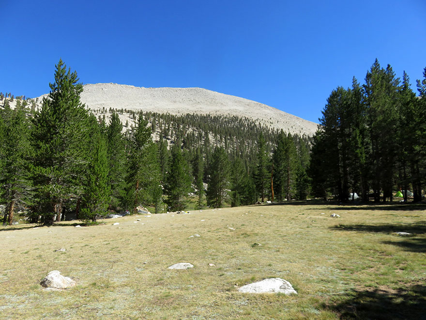
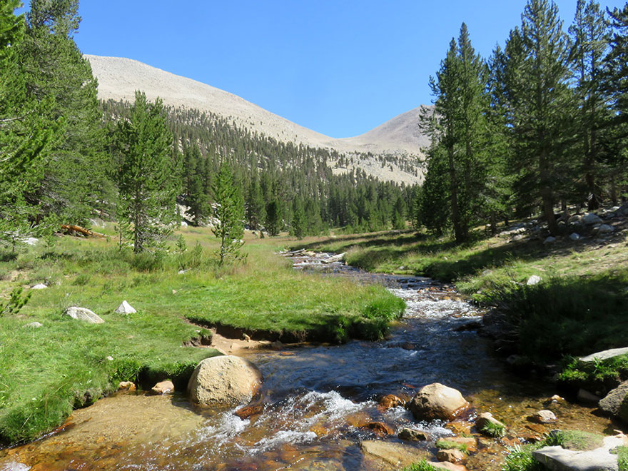
| Whitney Crest |
|
Mount Whitney Summit Shelter |
|
|
|
![[IMG_0169_6.jpg]](../pct-2018/d71/thumbs/IMG_0169_6.jpg) |
|
![[IMG_0169_7.jpg]](../pct-2018/d71/thumbs/IMG_0169_7.jpg) |
|
![[IMG_0169_9.jpg]](../pct-2018/d71/thumbs/IMG_0169_9.jpg) |
|
|
Mount Russell |
|
Lone Pine Peak |
|
|
![[IMG_2556+.jpg]](../pct-2018/d71/thumbs/IMG_2556+.jpg) |
|
![[IMG_2557.jpg]](../pct-2018/d71/thumbs/IMG_2557.jpg) |
|
![[IMG_2558+.jpg]](../pct-2018/d71/thumbs/IMG_2558+.jpg) |
|
| viewing southeast / Lone Pine Peak |
|
viewing north |
|
Mount Russell |
|
|
![[IMG_2557+58.jpg]](../pct-2018/d71/thumbs/IMG_2557+58.jpg) |
|
![[IMG_2560+.jpg]](../pct-2018/d71/thumbs/IMG_2560+.jpg) |
|
![[IMG_2559.jpg]](../pct-2018/d71/thumbs/IMG_2559.jpg) |
|
| viewing north / Mt. Williamson, Trojan Peak, Mt. Barnard, Mt. Hale and Mt. Russell |
|
viewing south |
|
viewing west |
|
|
|
|
|
|
|
|
|
|
![[IMG_2566.jpg]](../pct-2018/d71/thumbs/IMG_2566.jpg) |
|
![[IMG_2566+.jpg]](../pct-2018/d71/thumbs/IMG_2566+.jpg) |
|
| Mount Whitney Summit Shelter |
|
"Extreme Danger from Lightning" |
|
|
![[IMG_2565.jpg]](../pct-2018/d71/thumbs/IMG_2565.jpg) |
|
![[IMG_2567.jpg]](../pct-2018/d71/thumbs/IMG_2567.jpg) |
|
![[IMG_2568.jpg]](../pct-2018/d71/thumbs/IMG_2568.jpg) |
|
![[tweet.png]](../images/tweet.png) |
|
| Mount Whitney Summit Shelter |
|
Whitney Crest |
|
|
|
![[IMG_2569.jpg]](../pct-2018/d71/thumbs/IMG_2569.jpg) |
|
![[IMG_2570.jpg]](../pct-2018/d71/thumbs/IMG_2570.jpg) |
|
![[IMG_2571.jpg]](../pct-2018/d71/thumbs/IMG_2571.jpg) |
|
|
Mount Hale, Wales Lake and Mount Barnard |
|
Wales Lake |
|
|
|
|
| Whitney Crest |
![[maps.google.com.jpg]](../../../infos/icons/maps.google.com.jpg) |
|
![[IMG_2572+73.jpg]](../pct-2018/d71/thumbs/IMG_2572+73.jpg) |
|
![[IMG_2573+.jpg]](../pct-2018/d71/thumbs/IMG_2573+.jpg) |
|
|
|
| Whitney Crest / Keeler Needle, Day Needle and Mt. Muir |
|
|
|
![[IMG_2574.jpg]](../pct-2018/d71/thumbs/IMG_2574.jpg) |
|
![[IMG_2575.jpg]](../pct-2018/d71/thumbs/IMG_2575.jpg) |
|
![[IMG_2576.jpg]](../pct-2018/d71/thumbs/IMG_2576.jpg) |
|
![[IMG_2577.jpg]](../pct-2018/d71/thumbs/IMG_2577.jpg) |
|
| Keeler Needle and Day Needle (Crooks Peak) |
|
Mt. Whitney Summit |
|
|
![[IMG_2578.jpg]](../pct-2018/d71/thumbs/IMG_2578.jpg) |
|
![[IMG_2579.jpg]](../pct-2018/d71/thumbs/IMG_2579.jpg) |
|
![[IMG_2580+.jpg]](../pct-2018/d71/thumbs/IMG_2580+.jpg) |
|
|
Keeler Needle |
|
Mount Hitchcock and Hitchcock Lakes |
|
|
![[IMG_2581.jpg]](../pct-2018/d71/thumbs/IMG_2581.jpg) |
|
![[IMG_2582+.jpg]](../pct-2018/d71/thumbs/IMG_2582+.jpg) |
|
![[IMG_2583.jpg]](../pct-2018/d71/thumbs/IMG_2583.jpg) |
|
| Keeler Needle and Day Needle |
|
Mount Hitchcock and Hitchcock Lakes |
|
Mt. Whitney summit, Keeler Needle and Day Needle |
|
|
![[IMG_2584.jpg]](../pct-2018/d71/thumbs/IMG_2584.jpg) |
|
![[IMG_2585.jpg]](../pct-2018/d71/thumbs/IMG_2585.jpg) |
|
![[IMG_2586+.jpg]](../pct-2018/d71/thumbs/IMG_2586+.jpg) |
|
![[IMG_2587.jpg]](../pct-2018/d71/thumbs/IMG_2587.jpg) |
|
|
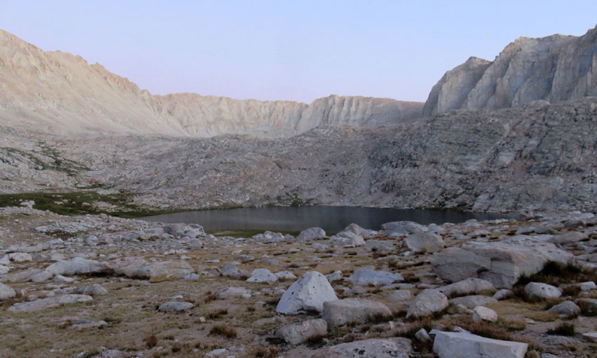
Lower Hitchcock Lake and Guitar Lake |
|
|
|
|
|
|
|
|
|
|
|
|
|
|
|
|
|
![[IMG_2598.jpg]](../pct-2018/d71/thumbs/IMG_2598.jpg) |
|
![[IMG_2599.jpg]](../pct-2018/d71/thumbs/IMG_2599.jpg) |
|
![[IMG_2600+.jpg]](../pct-2018/d71/thumbs/IMG_2600+.jpg) |
|
|
Lower Hitchcock Lake and Guitar Lake |
|
|
|
|
|
![[IMG_2604.jpg]](../pct-2018/d71/thumbs/IMG_2604.jpg) |
|
![[IMG_2604+.jpg]](../pct-2018/d71/thumbs/IMG_2604+.jpg) |
|
![[IMG_2605+.jpg]](../pct-2018/d71/thumbs/IMG_2605+.jpg) |
|
| Mount Young and Guitar Lake |
|
|
|
![[IMG_2606.jpg]](../pct-2018/d71/thumbs/IMG_2606.jpg) |
|
![[IMG_2607.jpg]](../pct-2018/d71/thumbs/IMG_2607.jpg) |
|
![[IMG_2608.jpg]](../pct-2018/d71/thumbs/IMG_2608.jpg) |
|
| Mount Newcomb and Lower Hitchcock Lake |
|
|
|
![[IMG_2609.jpg]](../pct-2018/d71/thumbs/IMG_2609.jpg) |
|
![[IMG_2610.jpg]](../pct-2018/d71/thumbs/IMG_2610.jpg) |
|
![[IMG_2611+.jpg]](../pct-2018/d71/thumbs/IMG_2611+.jpg) |
|
| Mt. Whitney Trail Junction seen |
|
Mount Hitchcock and Hitchcock Lakes |
|
|
![[IMG_2612.jpg]](../pct-2018/d71/thumbs/IMG_2612.jpg) |
|
![[IMG_2613.jpg]](../pct-2018/d71/thumbs/IMG_2613.jpg) |
|
![[IMG_2613+.jpg]](../pct-2018/d71/thumbs/IMG_2613+.jpg) |
|
|
Mt. Whitney Trail Junction |
|
|
|
![[IMG_2614.jpg]](../pct-2018/d71/thumbs/IMG_2614.jpg) |
|
![[IMG_2615+.jpg]](../pct-2018/d71/thumbs/IMG_2615+.jpg) |
|
| approaching Mt. Whitney Trail Junction |
|
|
|
|
| Junction - Mount Whitney Trail |
|
|
![[IMG_2616.jpg]](../pct-2018/d71/thumbs/IMG_2616.jpg) |
|
![[IMG_2617.jpg]](../pct-2018/d71/thumbs/IMG_2617.jpg) |
|
|
|
"Whitney Portal 8.7"
"Crabtree Ranger Station 5.5" |
|
"Mt. Whitney 1.9" |
|
|
|
![[IMG_2618.jpg]](../pct-2018/d71/thumbs/IMG_2618.jpg) |
|
![[IMG_2618++.jpg]](../pct-2018/d71/thumbs/IMG_2618++.jpg) |
|
![[IMG_2619.jpg]](../pct-2018/d71/thumbs/IMG_2619.jpg) |
|
![[IMG_2619++.jpg]](../pct-2018/d71/thumbs/IMG_2619++.jpg) |
|
"Whitney Portal 8.7"
"Crabtree Ranger Station 5.5" |
|
"Mt. Whitney 1.9"
"Whitney Portal Parking Lot Station 8.7" |
|
|
![[IMG_2620.jpg]](../pct-2018/d71/thumbs/IMG_2620.jpg) |
|
![[IMG_2621.jpg]](../pct-2018/d71/thumbs/IMG_2621.jpg) |
|
![[IMG_2622+.jpg]](../pct-2018/d71/thumbs/IMG_2622+.jpg) |
|
| Mount Whitney Trail to Whitney Portal |
|
John Muir Trail to Crabtree Meadow |
|
|
|
|
|
|
|
|
|
|
|
![[IMG_2627+.jpg]](../pct-2018/d71/thumbs/IMG_2627+.jpg) |
|
![[IMG_2628+.jpg]](../pct-2018/d71/thumbs/IMG_2628+.jpg) |
|
![[IMG_2629.jpg]](../pct-2018/d71/thumbs/IMG_2629.jpg) |
|
|
Lower Hitchcock Lake and Guitar Lake |
|
|
|
|
|
|
|
|
|
|
|
![[IMG_2634+.jpg]](../pct-2018/d71/thumbs/IMG_2634+.jpg) |
|
![[IMG_2635.jpg]](../pct-2018/d71/thumbs/IMG_2635.jpg) |
|
 |
|
|
Mount Hitchcock |
|
Guitar Lake |
|
|
|
|
|
|
|
|
|
|
|
|
|
|
|
|
|
|
|
|
 |
|
![[IMG_2644.jpg]](../pct-2018/d72/thumbs/IMG_2644.jpg) |
|
![[IMG_2644+.jpg]](../pct-2018/d72/thumbs/IMG_2644+.jpg) |
|
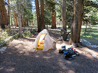
| Campsite |
|
"Wallace Creek 4.3" |
|
|
|
 |
|
![[IMG_2646.jpg]](../pct-2018/d72/thumbs/IMG_2646.jpg) |
|
![[IMG_2647.jpg]](../pct-2018/d72/thumbs/IMG_2647.jpg) |
|
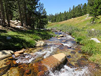
| Whitney Creek |
|
Mount Young from Crabtree Meadows Trail |
|
|
|
|
|
|
|
|
|
|
|
|
|
|
|
|
|
![[IMG_2574.jpg]](../pct-2018/d71/IMG_2574.jpg)
![[IMG_2614.jpg]](../pct-2018/d71/IMG_2614.jpg)
![[IMG_2634+.jpg]](../pct-2018/d71/IMG_2634+.jpg)
![[IMG_2404.jpg]](../pct-2018/d71/IMG_2404.jpg)
![[IMG_2460+.jpg]](../pct-2018/d71/IMG_2460+.jpg)
![[IMG_2506.jpg]](../pct-2018/d71/IMG_2506.jpg)
![[IMG_0167+.jpg]](../pct-2018/d71/IMG_0167+.jpg)
![[IMG_0168+.jpg]](../pct-2018/d71/IMG_0168+.jpg)
![[IMG_0169_1.jpg]](../pct-2018/d71/IMG_0169_1.jpg)
![[IMG_0169_3.jpg]](../pct-2018/d71/IMG_0169_3.jpg)
![[IMG_0169_5.jpg]](../pct-2018/d71/IMG_0169_5.jpg)
![[IMG_0169_6.jpg]](../pct-2018/d71/IMG_0169_6.jpg)
![[IMG_0169_7.jpg]](../pct-2018/d71/IMG_0169_7.jpg)
![[IMG_0169_9.jpg]](../pct-2018/d71/IMG_0169_9.jpg)
![[IMG_2556+.jpg]](../pct-2018/d71/IMG_2556+.jpg)
![[IMG_2557.jpg]](../pct-2018/d71/IMG_2557.jpg)
![[IMG_2558+.jpg]](../pct-2018/d71/IMG_2558+.jpg)
![[IMG_2557+58.jpg]](../pct-2018/d71/IMG_2557+58.jpg)
![[IMG_2560+.jpg]](../pct-2018/d71/IMG_2560+.jpg)
![[IMG_2559.jpg]](../pct-2018/d71/IMG_2559.jpg)
![[IMG_2561.jpg]](../pct-2018/d71/IMG_2561.jpg)
![[IMG_2562.jpg]](../pct-2018/d71/IMG_2562.jpg)
![[IMG_2563+.jpg]](../pct-2018/d71/IMG_2563+.jpg)
![[IMG_2564+.jpg]](../pct-2018/d71/IMG_2564+.jpg)
![[IMG_2566.jpg]](../pct-2018/d71/IMG_2566.jpg)
![[IMG_2566+.jpg]](../pct-2018/d71/IMG_2566+.jpg)
![[IMG_2565.jpg]](../pct-2018/d71/IMG_2565.jpg)
![[IMG_2567.jpg]](../pct-2018/d71/IMG_2567.jpg)
![[IMG_2568.jpg]](../pct-2018/d71/IMG_2568.jpg)
![[IMG_2569.jpg]](../pct-2018/d71/IMG_2569.jpg)
![[IMG_2570.jpg]](../pct-2018/d71/IMG_2570.jpg)
![[IMG_2571.jpg]](../pct-2018/d71/IMG_2571.jpg)
![[IMG_2572+73.jpg]](../pct-2018/d71/IMG_2572+73.jpg)
![[IMG_2573+.jpg]](../pct-2018/d71/IMG_2573+.jpg)
![[IMG_2575.jpg]](../pct-2018/d71/IMG_2575.jpg)
![[IMG_2576.jpg]](../pct-2018/d71/IMG_2576.jpg)
![[IMG_2577.jpg]](../pct-2018/d71/IMG_2577.jpg)
![[IMG_2578.jpg]](../pct-2018/d71/IMG_2578.jpg)
![[IMG_2579.jpg]](../pct-2018/d71/IMG_2579.jpg)
![[IMG_2580+.jpg]](../pct-2018/d71/IMG_2580+.jpg)
![[IMG_2581.jpg]](../pct-2018/d71/IMG_2581.jpg)
![[IMG_2582+.jpg]](../pct-2018/d71/IMG_2582+.jpg)
![[IMG_2583.jpg]](../pct-2018/d71/IMG_2583.jpg)
![[IMG_2584.jpg]](../pct-2018/d71/IMG_2584.jpg)
![[IMG_2585.jpg]](../pct-2018/d71/IMG_2585.jpg)
![[IMG_2586+.jpg]](../pct-2018/d71/IMG_2586+.jpg)
![[IMG_2587.jpg]](../pct-2018/d71/IMG_2587.jpg)
![[IMG_2588.jpg]](../pct-2018/d71/IMG_2588.jpg)
![[IMG_2589.jpg]](../pct-2018/d71/IMG_2589.jpg)
![[IMG_2590.jpg]](../pct-2018/d71/IMG_2590.jpg)
![[IMG_2591+.jpg]](../pct-2018/d71/IMG_2591+.jpg)
![[IMG_2592.jpg]](../pct-2018/d71/IMG_2592.jpg)
![[IMG_2593.jpg]](../pct-2018/d71/IMG_2593.jpg)
![[IMG_2594+.jpg]](../pct-2018/d71/IMG_2594+.jpg)
![[IMG_2595.jpg]](../pct-2018/d71/IMG_2595.jpg)
![[IMG_2596.jpg]](../pct-2018/d71/IMG_2596.jpg)
![[IMG_2596+.jpg]](../pct-2018/d71/IMG_2596+.jpg)
![[IMG_2597.jpg]](../pct-2018/d71/IMG_2597.jpg)
![[IMG_2598.jpg]](../pct-2018/d71/IMG_2598.jpg)
![[IMG_2599.jpg]](../pct-2018/d71/IMG_2599.jpg)
![[IMG_2600+.jpg]](../pct-2018/d71/IMG_2600+.jpg)
![[IMG_2601.jpg]](../pct-2018/d71/IMG_2601.jpg)
![[IMG_2602.jpg]](../pct-2018/d71/IMG_2602.jpg)
![[IMG_2603.jpg]](../pct-2018/d71/IMG_2603.jpg)
![[IMG_2604.jpg]](../pct-2018/d71/IMG_2604.jpg)
![[IMG_2604+.jpg]](../pct-2018/d71/IMG_2604+.jpg)
![[IMG_2605+.jpg]](../pct-2018/d71/IMG_2605+.jpg)
![[IMG_2606.jpg]](../pct-2018/d71/IMG_2606.jpg)
![[IMG_2607.jpg]](../pct-2018/d71/IMG_2607.jpg)
![[IMG_2608.jpg]](../pct-2018/d71/IMG_2608.jpg)
![[IMG_2609.jpg]](../pct-2018/d71/IMG_2609.jpg)
![[IMG_2610.jpg]](../pct-2018/d71/IMG_2610.jpg)
![[IMG_2611+.jpg]](../pct-2018/d71/IMG_2611+.jpg)
![[IMG_2612.jpg]](../pct-2018/d71/IMG_2612.jpg)
![[IMG_2613.jpg]](../pct-2018/d71/IMG_2613.jpg)
![[IMG_2613+.jpg]](../pct-2018/d71/IMG_2613+.jpg)
![[IMG_2615+.jpg]](../pct-2018/d71/IMG_2615+.jpg)
![[IMG_2616.jpg]](../pct-2018/d71/IMG_2616.jpg)
![[IMG_2617.jpg]](../pct-2018/d71/IMG_2617.jpg)
![[IMG_2618.jpg]](../pct-2018/d71/IMG_2618.jpg)
![[IMG_2618++.jpg]](../pct-2018/d71/IMG_2618++.jpg)
![[IMG_2619.jpg]](../pct-2018/d71/IMG_2619.jpg)
![[IMG_2619++.jpg]](../pct-2018/d71/IMG_2619++.jpg)
![[IMG_2620.jpg]](../pct-2018/d71/IMG_2620.jpg)
![[IMG_2621.jpg]](../pct-2018/d71/IMG_2621.jpg)
![[IMG_2622+.jpg]](../pct-2018/d71/IMG_2622+.jpg)
![[IMG_2623.jpg]](../pct-2018/d71/IMG_2623.jpg)
![[IMG_2624+.jpg]](../pct-2018/d71/IMG_2624+.jpg)
![[IMG_2625.jpg]](../pct-2018/d71/IMG_2625.jpg)
![[IMG_2626.jpg]](../pct-2018/d71/IMG_2626.jpg)
![[IMG_2627+.jpg]](../pct-2018/d71/IMG_2627+.jpg)
![[IMG_2628+.jpg]](../pct-2018/d71/IMG_2628+.jpg)
![[IMG_2629.jpg]](../pct-2018/d71/IMG_2629.jpg)
![[IMG_2630+.jpg]](../pct-2018/d71/IMG_2630+.jpg)
![[IMG_2631.jpg]](../pct-2018/d71/IMG_2631.jpg)
![[IMG_2631+.jpg]](../pct-2018/d71/IMG_2631+.jpg)
![[IMG_2632+.jpg]](../pct-2018/d71/IMG_2632+.jpg)
![[IMG_2633++.jpg]](../pct-2018/d71/IMG_2633++.jpg)
![[IMG_2635.jpg]](../pct-2018/d71/IMG_2635.jpg)


![[IMG_2638.jpg]](../pct-2018/d71/IMG_2638.jpg)


![[IMG_2644.jpg]](../pct-2018/d72/IMG_2644.jpg)
![[IMG_2644+.jpg]](../pct-2018/d72/IMG_2644+.jpg)
![[IMG_2646.jpg]](../pct-2018/d72/IMG_2646.jpg)
![[IMG_2647.jpg]](../pct-2018/d72/IMG_2647.jpg)
![[IMG_2648+.jpg]](../pct-2018/d72/IMG_2648+.jpg)
![[IMG_2648++.jpg]](../pct-2018/d72/IMG_2648++.jpg)
![[IMG_2649.jpg]](../pct-2018/d72/IMG_2649.jpg)
![[IMG_2650+.jpg]](../pct-2018/d72/IMG_2650+.jpg)
![[IMG_2651.jpg]](../pct-2018/d72/IMG_2651.jpg)
![[IMG_2652.jpg]](../pct-2018/d72/IMG_2652.jpg)
![[IMG_2652+.jpg]](../pct-2018/d72/IMG_2652+.jpg)