 |
 |
| Gaps & Passes of Sierra Nevada |
 |
| List of major mountain Gaps and Passes, accessible by Roads and Trails, of Sierra Nevada Mountains (Sierra Nevada Range) and subranges (California and Nevada States, USA). |
 |
| # |
Gap |
| |
 |
 |
 |
Elevation |
 |
 |
 |
Trail/Road |
 |
 |
| (ft) |
(m) |
 |
| 1 |
Yuba Pass |
|
|
 |
 |
|
|
|
|
|
CA State Route 49 |
 |
 |
| 2 |
Henness Pass |
|
|
 |
 |
|
|
|
|
|
Henness Pass Road |
|
 |
 |
| 3 |
Euer Saddle
(Donner Summit) |
|
|
 |
|
|
|
|
|
|
Interstate 80 |
 |
 |
| 4 |
Donner Pass |
|
|
 |
 |
7,085 |
2,160 |
 |
|
|
Donner Pass Road
(Old Highway 40) |
|
 |
 |
| 5 |
Mount Rose
Summit |
E |
|
 |
|
|
|
|
|
|
NV State Route 431 |
|
|
| 6 |
Spooner Summit |
E |
|
 |
|
|
|
|
|
|
U.S. Route 50 |
 |
 |
| 7 |
Daggett Pass |
E |
|
 |
|
|
|
|
|
|
NV State Route 207 |
 |
|
| 8 |
Armstrong Pass |
E |
|
 |
 |
|
|
|
 |
|
Armstrong Pass Trail |
|
|
| 9 |
Luther Pass |
E |
|
 |
 |
7,740 |
2,359 |
 |
|
|
CA State Route 89 |
 |
 |
 |
| 10 |
Barker Pass |
|
|
 |
 |
|
|
|
|
|
Barker Pass Road |
|
 |
| 11 |
Rockbound Pass |
W |
|
 |
 |
|
|
|
|
|
Rockbound Pass Trail |
|
|
| 12 |
Echo Summit |
|
|
 |
 |
7,382 |
2,249 |
|
|
|
U.S. Route 50 |
 |
 |
 |
| 13 |
Monitor Pass |
E |
|
 |
 |
8,314 |
2,534 |
 |
|
|
CA State Route 89 |
 |
 |
| 14 |
Carson Pass |
|
|
 |
 |
8,573 |
2,613 |
 |
|
|
CA State Route 88 |
 |
 |
| 15 |
Ebbetts Pass |
|
|
 |
 |
8,730 |
2,661 |
 |
 |
|
CA State Route 4 |
 |
 |
| 16 |
Wolf Creek Pass |
|
|
 |
 |
|
|
|
|
|
Pacific Crest Trail |
 |
 |
| 17 |
Saint Marys Pass |
W |
|
 |
 |
|
|
|
 |
|
Saint Marys Pass Trail |
|
|
| 18 |
Sonora Pass |
|
|
 |
|
9,628 |
2,935 |
 |
 |
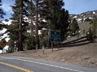 |
CA State Route 108
(Sonora Pass Highway) |
 |
 |
 |
| 19 |
Leavitt Pass |
|
|
 |
|
|
|
|
|
|
Leavitt Lake Trail
(Leavitt Lake Road) |
|
 |
| 20 |
Brown Bear Pass |
W |
|
 |
 |
|
|
|
|
|
Emigrant Pass Trail |
|
|
| 21 |
Emigrant Pass |
|
|
 |
 |
|
|
|
|
|
| 22 |
Bond Pass |
W |
Y |
 |
 |
|
|
|
|
|
Bond Pass Trail |
|
|
| 23 |
Dorothy Lake Pass |
|
Y |
 |
 |
|
|
 |
 |
|
Dorothy Lake Trail |
|
|
 |
| 24 |
Buckeye Pass |
|
Y |
 |
 |
9,572 |
2,917 |
 |
 |
|
Buckeye Pass Trail |
|
|
| 25 |
Peeler Lake |
|
Y |
 |
 |
9,489 |
2,892 |
|
|
|
Peeler Lake Trail |
|
 |
| 26 |
Rock Island Pass |
|
Y |
 |
 |
|
|
 |
|
|
Rock Island Pass Trail |
|
|
| 27 |
Mule Pass |
|
Y |
 |
 |
|
|
|
|
|
Burro Pass Trail |
|
|
| 28 |
Ice Lake Pass |
|
Y |
 |
|
10,000+ |
|
|
|
|
|
|
|
| 29 |
Burro Pass |
W |
Y |
 |
 |
|
|
|
|
|
Burro Pass Trail |
|
|
| 30 |
Horse Creek Pass |
|
Y |
 |
|
10,640+ |
|
|
|
|
|
|
|
| 31 |
Virginia Pass |
|
Y |
 |
 |
10,480+ |
|
|
|
|
|
|
|
| 32 |
Summit Lake |
|
Y |
 |
 |
10,183 |
3,104 |
|
|
|
Summit Lake Trail |
|
|
 |
| 33 |
McCabe Pass |
|
Y |
 |
|
11,200+ |
|
|
|
|
|
|
|
| 34 |
Lundy Pass |
E |
|
 |
 |
|
|
 |
 |
|
Lundy Pass Trail |
|
|
| 35 |
Dore Pass |
E |
|
 |
 |
|
|
|
|
|
|
|
|
| 36 |
Conness Pass |
|
Y |
 |
|
11,280+ |
|
|
|
|
|
|
|
| 37 |
Tioga Pass |
|
Y |
 |
 |
9,945 |
3,031 |
 |
 |
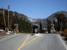 |
CA State Route 120
(Tioga Pass Road) |
 |
 |
 |
| 38 |
Mono Pass |
|
Y |
 |
 |
10,604 |
3,232 |
 |
|
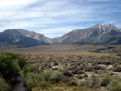 |
Mono Pass Trail |
|
 |
| 39 |
Parker Pass |
|
Y |
 |
 |
|
|
|
|
Parker Pass Trail |
|
|
| 40 |
Koip Peak Pass |
E |
|
 |
 |
|
|
|
|
|
| 41 |
Gem Pass |
E |
|
 |
 |
|
|
|
|
|
Gem Pass Trail |
|
|
| 42 |
Donohue Pass |
|
Y |
 |
 |
|
|
 |
 |
|
John Muir Trail |
 |
|
 |
| 43 |
Tuolumne Pass |
W |
Y |
 |
 |
9,992 |
3,046 |
|
|
|
Evelyn Lake Trail |
|
|
 |
Rafferty Creek Trail |
|
|
| 44 |
Cathedral Pass |
W |
Y |
 |
 |
|
|
|
|
|
John Muir Trail |
 |
|
| 45 |
Red Peak Pass |
W |
Y |
 |
 |
|
|
|
|
|
Red Peak Pass Trail |
|
|
 |
| 46 |
Island Pass |
|
|
 |
 |
|
|
|
|
|
John Muir Trail |
 |
|
| 47 |
Ritter Pass |
|
|
 |
|
11,120+ |
3,380+ |
|
|
|
|
|
|
| 48 |
Agnew Pass |
|
|
 |
 |
|
|
 |
 |
|
Agnew Pass Trail |
|
|
| 49 |
Deadman Pass |
|
|
 |
 |
|
|
 |
|
|
|
|
|
| 50 |
Minaret Summit |
|
|
 |
 |
9,175 |
2,796 |
|
 |
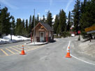 |
CA State Route 203
(Minaret Road) |
 |
 |
 |
| 51 |
Mammoth Pass |
|
|
 |
 |
|
|
|
|
|
Mammoth Pass Trail |
|
|
 |
| 52 |
Mammoth Crest Pass |
|
|
 |
|
|
|
|
|
|
Deer Lakes Trail |
|
|
| 53 |
Duck Pass |
|
|
 |
|
|
3,291 |
|
|
|
Duck Pass Trail |
|
|
 |
| 54 |
McGee Pass |
|
|
 |
 |
11,900 |
|
 |
|
|
McGee Pass Trail |
|
|
| 55 |
Silver Pass |
W |
|
 |
 |
|
|
|
|
|
John Muir Trail |
 |
|
| 56 |
Goodale Pass |
W |
|
 |
 |
10,997 |
3,352 |
|
|
|
Goodale Pass Trail |
|
|
| 57 |
Hopkins Pass |
|
|
 |
 |
11,360+ |
|
|
|
|
|
|
|
| 58 |
Mono Pass |
|
|
 |
 |
12,000 |
|
|
|
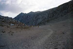 |
Mono Pass Trail |
|
|
| 59 |
Gabbot Pass |
W |
|
 |
 |
12,240+ |
|
|
|
|
|
|
|
| 60 |
Morgan Pass |
E |
|
 |
 |
|
|
|
|
|
Morgan Pass Trail |
|
|
| 61 |
Italy Pass |
|
|
 |
 |
12,230 |
|
|
|
|
Italy Pass Trail |
|
|
| 62 |
Pine Creek Pass |
|
|
 |
 |
11,000 |
|
|
|
|
Pine Creek Pass Trail |
|
|
 |
| 63 |
Piute Pass |
|
|
 |
 |
11,423 |
3,482 |
|
|
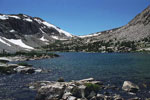 |
Piute Pass Trail |
|
|
| 64 |
The Keyhole |
W |
K |
 |
|
12,560+ |
|
|
|
|
|
|
|
| 65 |
Alpine Col |
W |
K |
 |
 |
12,320+ |
|
|
|
|
|
|
|
| 66 |
Lamarck Col |
|
K |
 |
 |
12,880+ |
|
|
 |
|
|
|
|
| 67 |
Hell for Sure Pass |
W |
K |
 |
 |
11,297 |
3,443 |
|
|
|
Hell for Sure Pass Trail |
|
|
| 68 |
Muir Pass |
W |
K |
 |
 |
11,955 |
3,644 |
|
|
|
John Muir Trail |
 |
|
| 69 |
Treasure Col |
|
K |
 |
|
11,760+ |
|
|
|
|
|
|
|
| 70 |
Bishop Pass |
|
K |
 |
 |
11,972 |
3,649 |
|
 |
|
Bishop Pass Trail |
|
|
| 71 |
Jigsaw Pass |
E |
|
 |
 |
12,720+ |
|
|
|
|
|
|
|
| 72 |
Agassiz Col |
|
K |
 |
 |
13,040+ |
|
|
|
|
|
|
|
| 73 |
Thunderbolt Pass |
W |
K |
 |
|
12,320+ |
|
|
|
|
|
|
|
| 74 |
Knapsack Pass |
W |
K |
 |
 |
11,673 |
3,558+ |
|
|
|
|
|
|
| 75 |
Contact Pass |
E |
|
 |
 |
11,760+ |
3,580+ |
|
 |
|
|
|
|
| 76 |
Southfork Pass |
|
K |
 |
 |
12,560+ |
3,800+ |
|
 |
|
|
|
|
| 77 |
Mather Pass |
W |
K |
 |
 |
12,100 |
3,688 |
|
|
|
John Muir Trail |
 |
|
| 78 |
Red Lake Pass |
|
K |
 |
|
12,960+ |
3,940+ |
|
|
|
|
|
|
 |
| 79 |
Mosquito Pass |
W |
|
 |
 |
|
|
|
|
|
|
|
|
 |
| 80 |
Granite Pass |
W |
K |
 |
 |
10,673 |
3,253 |
|
|
|
Granite Pass Trail |
|
|
| 81 |
Kennedy Pass |
W |
K |
 |
 |
10,900 |
3,322 |
|
|
|
Kennedy Pass Trail |
|
|
 |
| 82 |
Taboose Pass |
|
K |
 |
 |
11,400 |
3,475 |
|
|
|
Taboose Pass Trail |
|
|
| 83 |
Pinchot Pass |
W |
K |
 |
 |
12,050 |
3,673 |
|
|
|
John Muir Trail |
 |
|
| 84 |
Armstrong Col |
|
K |
 |
|
12,000+ |
3,660+ |
|
|
|
|
|
|
| 85 |
Sawmill Pass |
|
K |
 |
 |
11,347 |
3,459 |
|
|
|
Sawmill Pass Trail |
|
|
| 86 |
Baxter Pass |
|
K |
 |
 |
12,051 |
3,673 |
|
|
|
Baxter Pass Trail |
|
|
| 87 |
North Dragon
Pass |
|
K |
 |
|
11,920+ |
3,640+ |
|
|
|
|
|
|
| 88 |
Gould Pass
(Dragon Pass) |
|
K |
 |
|
12,800+ |
3,820+ |
|
|
|
|
|
|
| 89 |
Glen Pass |
W |
K |
 |
 |
11,978 |
3,651 |
|
|
|
John Muir Trail |
 |
|
| 90 |
Kearsarge Pass |
|
K |
 |
 |
11,823 |
3,604 |
|
|
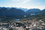 |
Kearsarge Pass Trail |
|
|
| 91 |
University Pass |
|
K |
 |
|
12,640+ |
3,840+ |
|
|
|
|
|
|
| 92 |
Junction Pass |
|
K |
 |
 |
13,200+ |
4,020+ |
|
|
|
|
|
|
 |
| 93 |
Forester Pass |
W |
K
S |
 |
 |
13,160 |
4,011 |
|
|
|
John Muir Trail |
 |
|
| 94 |
Colby Pass |
W |
K
S |
 |
 |
12,000 |
3,658 |
|
|
|
Colby Pass Trail |
|
|
| 95 |
Triple Divide Pass |
W |
K
S |
 |
 |
12,160+ |
|
|
|
|
|
|
|
| 96 |
Elizabeth Pass |
W |
K |
 |
 |
|
|
|
|
|
Elizabeth Pass Trail |
|
|
| 97 |
Kaweah Gap |
W |
S |
 |
 |
10,700 |
3,261 |
|
|
|
High Sierra Trail |
 |
|
| 98 |
Black Rock Pass |
W |
S |
 |
 |
11,600 |
3,536 |
|
|
|
Black Rock Pass Trail |
|
|
| 99 |
Timber Gap |
W |
S |
 |
 |
|
|
|
|
|
Timber Gap Trail |
|
|
| 100 |
Sawtooth Pass |
W |
S |
 |
 |
11,700 |
3,566 |
|
|
|
Sawtooth Pass Trail |
|
|
| 101 |
Franklin Pass |
W |
S |
 |
 |
11,800 |
3,597 |
|
|
|
Franklin Pass Trail |
|
|
| 102 |
Farewell Gap |
W |
S |
 |
 |
10,587 |
3,227 |
|
|
|
Farewell Gap Trail |
|
|
| 103 |
Shotgun Pass |
W |
S |
 |
 |
|
|
|
|
|
Shotgun Pass Trail |
|
|
| 104 |
Coyote Pass |
W |
S |
 |
 |
10,160 |
3,097 |
|
|
|
Coyote Pass Trail |
|
|
 |
| 105 |
Shepherd Pass |
|
S |
 |
 |
12,018 |
3,663 |
|
|
|
Shepherd Pass Trail |
|
|
| 106 |
Tyndall Col |
|
S |
 |
|
12,960+ |
3,980+ |
|
|
|
|
|
|
| 107 |
Vacation Pass |
|
S |
 |
 |
12,640+ |
3,860+ |
|
|
|
|
|
|
| 108 |
Cleaver Col |
|
S |
 |
|
12,560+ |
3,960+ |
|
|
|
|
|
|
| 109 |
Russell-Carillon
Pass |
|
S |
 |
|
13,280+ |
4,040+ |
|
|
|
|
|
|
| 110 |
Whitney-Russell
Pass |
|
S |
 |
|
13,040+ |
3,980+ |
|
|
|
|
|
|
| 111 |
Trail Crest |
|
S |
 |
 |
13,680 |
4,170 |
|
|
|
Mount Whitney Trail |
 |
 |
| 112 |
Discovery Pass |
|
S |
 |
|
13,400+ |
4,160+ |
|
|
|
|
|
|
| 113 |
Whitney Pass |
|
S |
 |
 |
13,280+ |
4,040+ |
|
|
|
|
|
|
| 114 |
Crabtree Pass |
W |
S |
 |
 |
12,560+ |
3,820+ |
|
|
|
|
|
|
| 115 |
Arc Pass |
|
S |
 |
 |
12,880+ |
3,920+ |
|
|
|
|
|
|
| 116 |
Tuttle Pass |
|
S |
 |
|
12,880+ |
3,900+ |
|
|
|
|
|
|
| 117 |
Diaz Pass |
|
S |
 |
|
13,280+ |
4,040+ |
|
|
|
|
|
|
| 118 |
Army Pass |
|
S |
 |
 |
|
|
|
|
|
|
|
|
| 119 |
New Army Pass |
|
S |
 |
 |
11,475 |
3,498 |
|
|
|
New Army Pass Trail |
|
|
| 120 |
Siberian Pass |
W |
S |
 |
 |
10,950 |
3,338 |
|
|
|
Siberian Pass Trail |
|
|
| 121 |
Cottonwood Pass |
|
|
 |
 |
11,200 |
3,414 |
|
|
|
Cottonwood Pass Trail |
|
|
Pacific Crest Trail |
 |
 |
| 122 |
Trail Pass |
|
|
 |
 |
|
|
|
|
|
Trail Pass Trail |
|
|
| 123 |
Mulkey Pass |
|
|
 |
 |
|
|
|
|
|
Mulkey Pass Trail |
|
|
Pacific Crest Trail |
 |
 |
 |
| 124 |
Olancha Pass |
|
|
 |
 |
|
|
|
|
|
Olancha Pass Trail |
|
|
| 125 |
Haiwee Pass |
|
|
 |
 |
|
|
|
|
|
Haiwee Pass Trail |
|
|
| 126 |
Little Lake Canyon Pass |
|
|
 |
|
|
|
|
|
|
Little Lake Canyon Trail
(Little Lake Canyon Road) |
|
|
 |
| 127 |
Ninemile Canyon Pass |
|
|
 |
|
|
|
|
|
|
Ninemile Canyon Road |
|
 |
| 128 |
Walker Pass |
|
|
 |
 |
5,246 |
1,600 |
 |
 |
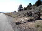 |
CA State Route 178
(Isabella Walker Pass Road) |
 |
 |
 |
| 129 |
Tehachapi Pass |
|
|
 |
 |
3,793 |
1,156 |
 |
|
|
CA State Route 58 |
 |
 |
|
 |
 |
 |
Gap names on topo maps. |
 |
 |
|
Gap names Not on topo maps. |
 |
 |
|
Road passes. |
 |
| E |
|
Gaps located at East of Sierra Crest. |
 |
| W |
|
Gaps located at West of Sierra Crest. |
 |
| Y |
 |
Gaps located in Yosemite National Park. |
 |
| K |
 |
Gaps located in Kings Canyon National Park. |
 |
| S |
|
Gaps located in Sequoia National Park. |
|
 |
|