| ソノラ・パス |
 |
| (ソノラ峠、Sonora Pass) |
 |
| Bookmark collection of resources regarding Sonora Pass, a pass/gap located on the boundary of Stanislaus National Forest and Toiyabe National Forest (Humboldt-Toiyabe National Forest) (Alpine, Tuolumne and Mono Counties, California, USA). |
 |
| Sonora Pass is: |
 |
| - a mountain gap/pass in Sierra Nevada Mountains (The Sierra, Sierra Nevada, High Sierra), on the crest/divide (Sierra Crest, Sierra Nevada Divide), |
 |
| - a road/highway pass on Sonora Pass Highway (Sonora Pass Road) and Highway 108 (California State Route 108, CA 108), |
 |
| - the second highest road summit (9,643 feet, 2,939 meters) in Sierra Nevada, |
 |
| - a tralhead for Pacific Crest Trail (Pacific Crest National Scenic Trail) and Tahoe-Yosemite Trail, |
 |
| and is a scenic viewpoint/roadstop for viewing Sonora Peak and Pacific Crest Peak (Peak 11,245). |
|
 |
| Articles (日本語) |
|
| トラベル・ガイド |
|
| アドベンチャー・ガイド |
|
| 写真 |
 |
 |
 |
 |
|
| サーチ |
 |
 |
|
|
 |
| Articles/Directories |
 |
 |
 |
 |
 |
 |
 |
 |
 |
 |
|
 |
 |
 |
 |
 |
 |
 |
 |
 |
 |
 |
|
| Outdoor & Adventure |
 |
 |
 |
 |
 |
 |
 |
 |
|
 |
 |
 |
|
| Maps |
 |
 |
 |
 |
 |
 |
 |
 |
 |
 |
 |
 |
 |
 |
 |
 |
 |
 |
|
|
| Photo Galleries |
 |
 |
 |
 |
 |
 |
 |
|
| Photos |
 |
 |
 |
 |
 |
 |
 |
 |
 |
 |
 |
|
|
| Searches |
 |
 |
 |
 |
 |
 |
 |
|
|
 |
 |
 |
 |
 |
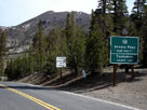
Sonora Peak and
Highway 108 (west)
from Sonora Pass |
|
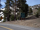
Sonora Pass and
Highway 108 (east) |
|
 |
|
|
 |
|
|
 |
 |
 |
 |
 |
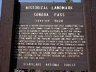
Sonora Pass
Historical Landmark |
|
|
 |
|
|
 |
|
|
 |
 |
 |
 |
 |
 |
 |
|
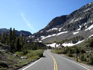
Highway 108 (east)
toward Sonora Pass |
|
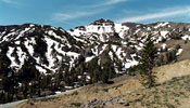
Pacific Crest Peak
and Highway 108 |
|
 |
|
|
 |
|
|
 |
 |
 |
 |
 |
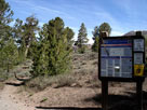
Pacific Crest Trail (north)
at Sonora Pass |
|
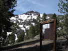
Pacific Crest Peak and
Pacific Crest Trail (south) |
|
 |
|
|
 |
|
|
 |
 |
 |
 |
 |
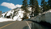
Sonora Pass and
Highway 108 (east) |
|
|
 |
|
|
 |
|
|
 |
 |
 |
 |
 |
Peak 11,220 and
Emigrant Wilderness
from Highway 108 |
|
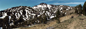
Pacific Crest Peak (Peak 11,245) and Hoover
Wilderness from above Sonora Pass |
|
 |
|
|
 |
|
|
 |
 |
 |
 |
 |
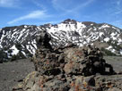
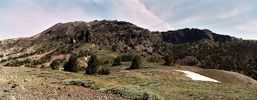
Unnamed summit above
Sonora Pass with
Pacific Crest Peak |
|
Sonora Peak from above Sonora Pass |
|
 |
|
|
 |
|
|
 |
 |
 |
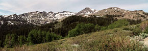
Latopie Peak, Pacific Crest Peak and Peak 10,990+
from Highway 108 (below Sonora Pass) |
|
 |
|
|
 |
|
|
 |
|
|
 |
|
|
 |
|
|
 |
 |
 |
 |
 |
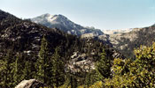
Night Cap Peak
from Highway 108 |
|
|
 |
|
|
 |
|
|
 |
|
|
 |
|
|
 |
|
|
 |
|
|
 |
 |
 |
 |
 |
 |
 |
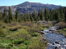
Sonora Peak and
Deadman Creek |
|
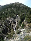
Leavitt Falls (Leavitt
Creek) from Leavitt
Falls Vista |
|
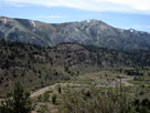
West Walker River and
Leavitt Meadow from
Leavitt Falls Vista |
|
 |
|
|
 |
|
|
 |
|
|
 |
|
|
 |
|
|
 |
|
|
 |
 |
 |
 |
 |
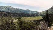
West Walker River and
Leavitt Meadow from
Leavitt Falls Vista |
|
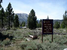
Pickel Meadow Wildlife
Area from Highway 108 |
|
 |
|
|
 |
|
|
 |
|
|
 |
 |
 |
 |
 |
 |
 |
Kennedy Meadows
Trailhead |
|
Saint Mary's Pass
Trailhead |
|
Leavitt Meadows
Trailhead |
|
 |
|
|
 |
|
|
 |
|
|
 |
 |
 |
 |
 |
 |
 |
| Baker Campground |
|
Deadman Campground |
|
Dardanelle Campground |
|
 |
 |
 |
 |
 |
 |
 |
Leavitt Meadows
Campground |
|
Sonora Bridge
Campground |
|
Little Walker Road to
Obsidian Campground |
|
 |
|
|
 |
|
|
 |
|
|
 |
 |
 |
 |
 |
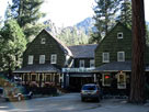
Kennedy Meadows
Resort ('07) |
|
Bridgeport |
|
 |
|
|
 |
 |
Alpine County, California |
 |
 |
 |
 |
 |
 |
 |
 |
 |
| Tuolumne County, California |
 |
 |
 |
 |
 |
 |
 |
 |
|
|
 |
|
|