 |
| Death Valley National Park |
|
| Albums of photos from trips visiting Death Valley National Park located in Mojave Desert. |
|
|
|
|
|
|
|
|
| Darwin Falls [March 2019] |
|
| ... |
|
|
|
|
|
|
|
|
|
| Scenic Drive & Camping [October 2015] |
|
| ... |
|
|
|
|
| Scenic Drives [September 2014] |
|
| ... |
|
|
|
|
| Scenic Drive [February 2014] |
|
| ... |
|
|
|
|
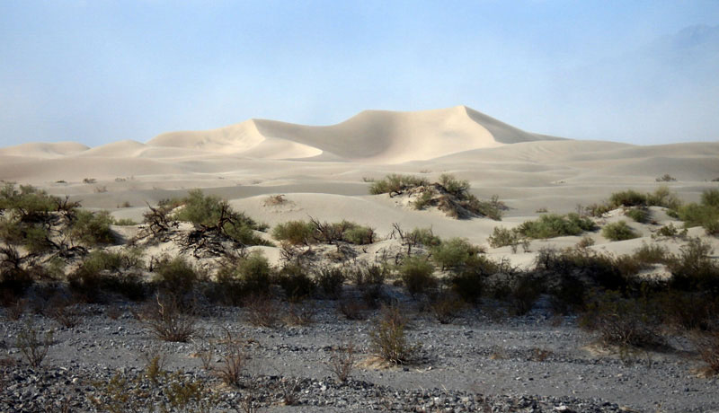
| Mesquite Flat Sand Dunes [February 2013] |
|
| ... |
|
|
|
|
| Titus Canyon Road [April 2012] |
|
| ... |
|
|
|
|
| The Racetrack & Hunter Mountain Road [December 2010] |
|
 |
|
 |
|
 |
|
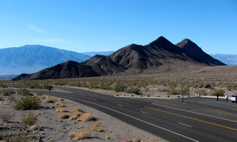
Death Valley Buttes, Hells
Gate and Daylight Pass Road |
|
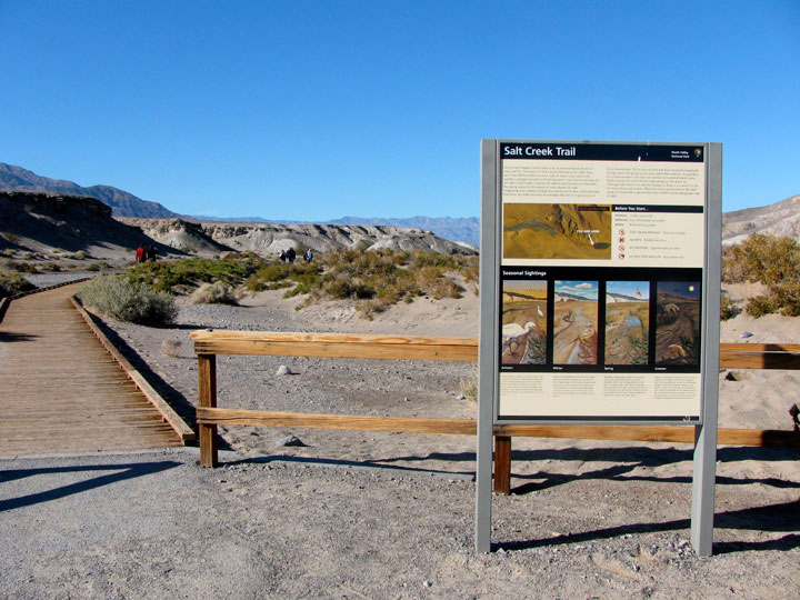
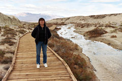
Salt Creek Trailhead |
|
Scotty's Castle |
|
|
 |
|
 |
|
 |
|
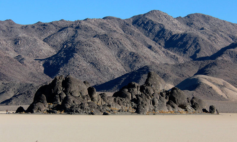
The Grandstand in The
Racetrack (Racetrack Playa) |
|
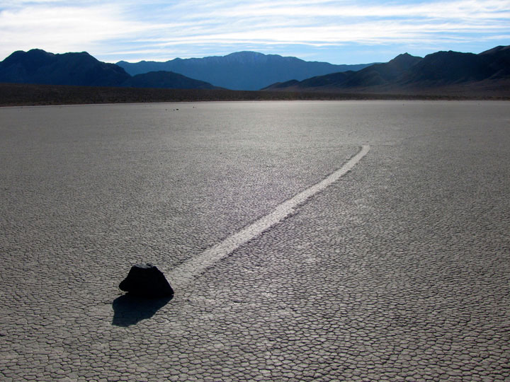
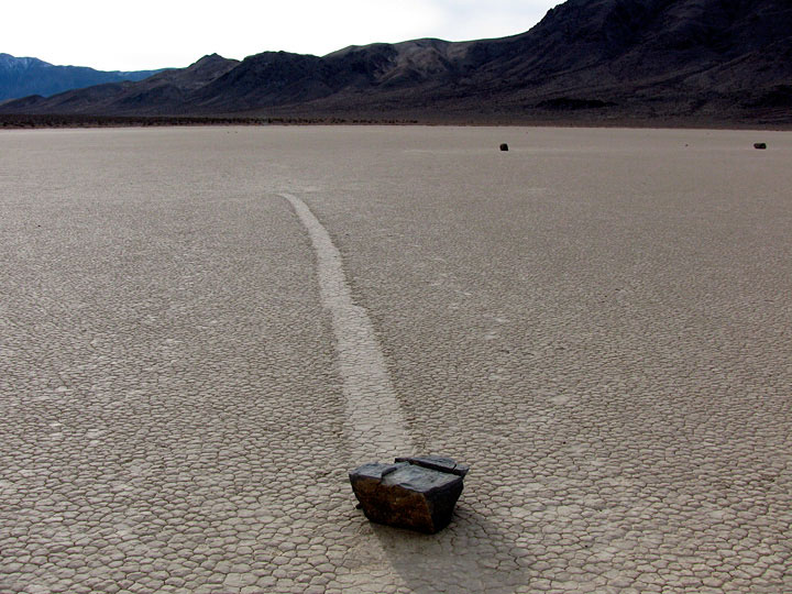
Moving Rocks
in The Racetrack |
|
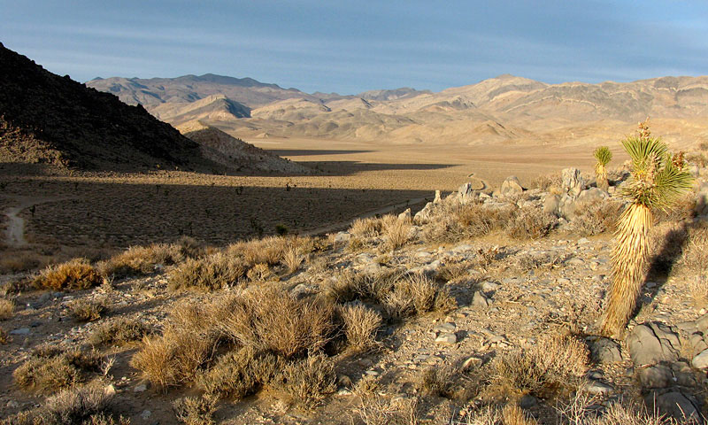
Hunter Mountain Road
in Cottonwood Mountains |
|
|
|
|
|
| Eureka Sand Dunes & The Racetrack [December 2009] |
|
 |
|
 |
|
 |
|
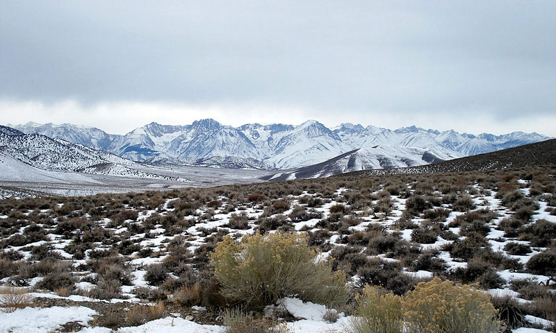
Sierra Nevada Mountains
from Death Valley Road |
|
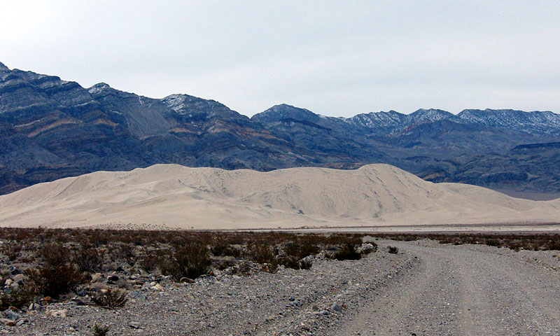
Eureka Sand Dunes
(Eureka Dunes) |
|
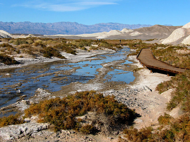
Salt Creek and
Salt Creek Trail |
|
|
 |
|
 |
|
 |
|
Moving Rocks
in The Racetrack
(Racetrack Playa) |
|
Hidden Valley and
Hidden Valley Road |
|
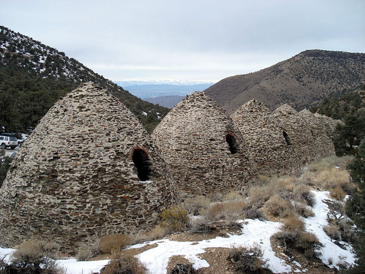
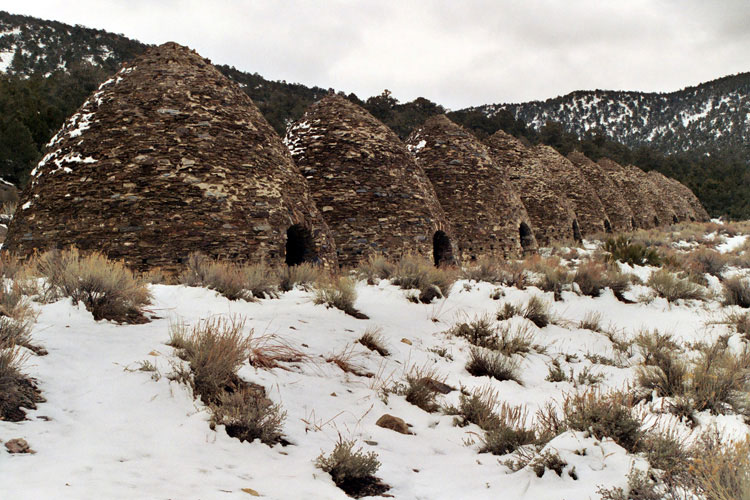
Charcoal Kilns |
|
|
|
|
|
| Death Valley in Summer [August 2008] |
|
 |
|
 |
|
 |
|
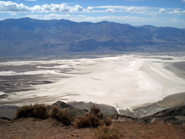
Panamint Range and Death
Valley from Dante's View |
|
Mesquite Flat Sand Dunes
from Highway 190 |
|
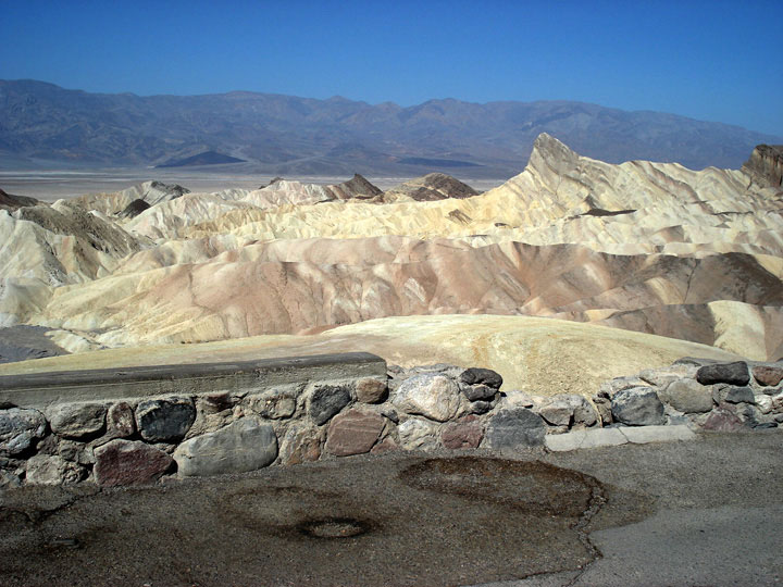
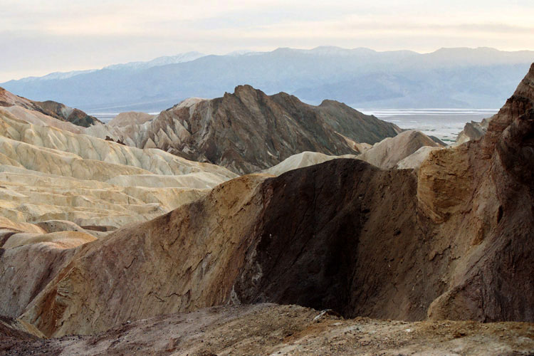
Zabriskie Point |
|
|
 |
|
 |
|
 |
|
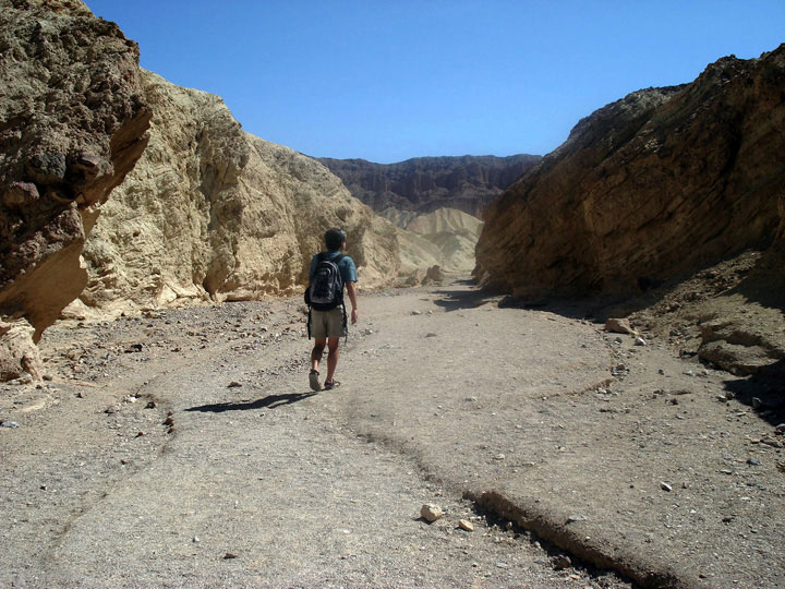
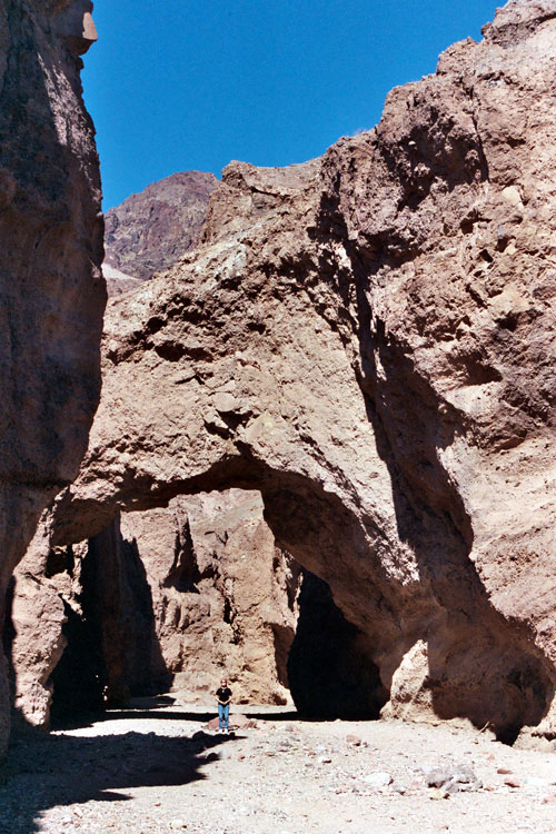
Golden Canyon
(Golden Canyon Trail) |
|
Black Mountains and
Highway 190 (west) |
|
Mosaic Canyon |
|
|
|
|
|
| Charcoal Kilns, Natural Bridge & Golden Canyon [March 2006] |
|
 |
|
 |
|
 |
|
| Charcoal Kilns |
|
Salt Creek Trail
and Salt Creek |
|
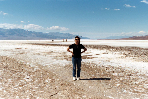
Badwater Basin |
|
|
 |
|
 |
|
 |
|
 |
|
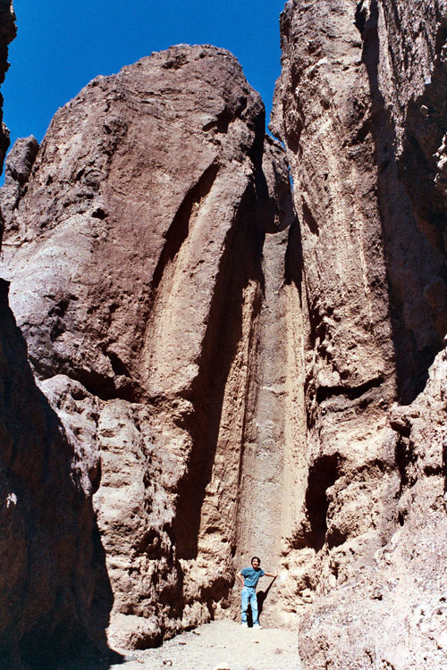
Natural Bridge
(Natural Bridge
Canyon) |
|
Natural Bridge
Canyon above
Natural Bridge |
|
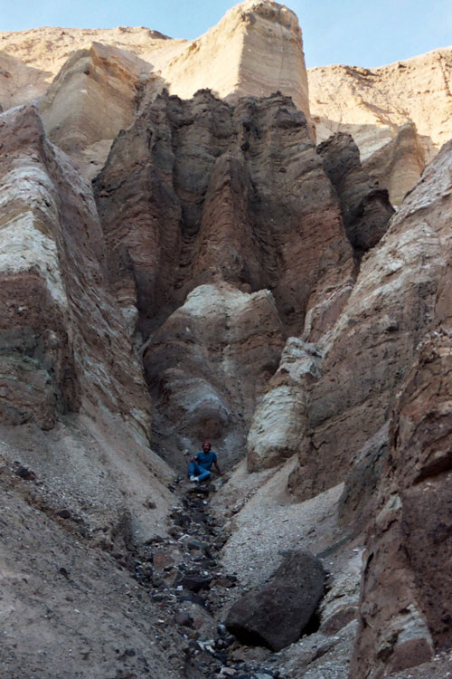
A side canyon of
Golden Canyon |
|
Death Valley and Golden
Canyon from Golden Canyon
Trailend below Red Cathedral |
|
|
|
|
|
| Mesquite Flat Sand Dunes [June 1992] |
|
| ... |
|
|
|
|
![[albums]](./images/albums.jpg)
![[itoda.com]](./images/itoda.com.jpg)
![[geonames.usgs.gov]](./images/geonames.usgs.gov.png)
![[nps.gov]](./images/nps.gov.png)
![[nationalparks.org]](./images/nationalparks.org.png)
![[wikipedia.org]](./images/wikipedia.org.png)
![[wikivoyage.org]](./images/wikivoyage.org.png)
![[wikitravel.org]](./images/wikitravel.org.png)
![[commons.wikimedia.org]](./images/commons.wikimedia.org.png)
![[bing.com]](./images/bing.com.png)
![[google.com]](./images/maps.google.com.png)
![[IMG_4903.jpg]](./death-valley-np-%2717/IMG_4903.jpg)
![[IMG_4910.jpg]](./death-valley-np-%2717/IMG_4910.jpg)
![[IMG_4918.jpg]](./death-valley-np-%2717/IMG_4918.jpg)
![[IMG_4929.jpg]](./death-valley-np-%2717/IMG_4929.jpg)
![[IMG_4931.jpg]](./death-valley-np-%2717/IMG_4931.jpg)
![[IMG_4932.jpg]](./death-valley-np-%2717/IMG_4932.jpg)
![[IMG_4933.jpg]](./death-valley-np-%2717/IMG_4933.jpg)
![[ja]](./images/japanese_white.gif)
![[en]](./images/english_black.gif)