| Death Valley National Park |
 |
|
|
|
|
|
| Mountain Ranges |
|
 |
|
 |
|
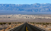
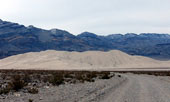
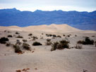
Panamint Range and
Mesquite Flat Sand Dunes
from Daylight Pass Road |
|
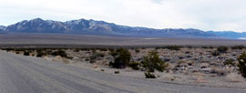
Last Chance Range and Eureka Valley
from Big Pine Road (Death Valley Road) |
|
|
 |
|
 |
|
 |
|
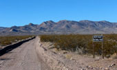
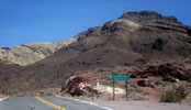
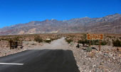
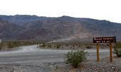
Grapevine Mountains and
Titus Canyon Road entering
Death Valley National Park |
|
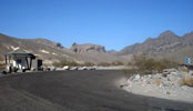
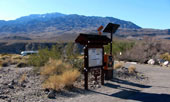
Funeral Mountains from
Information Kiosk off Highway 190 |
|
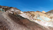
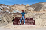
Black Mountains
from Artists Drive |
|
|
|
|
| Peaks & Subpeaks |
|
 |
|
 |
|
 |
|
Death Valley Buttes, Hells
Gate and Daylight Pass Road |
|
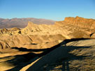
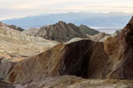
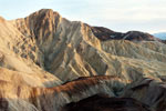
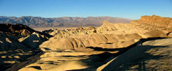
Manly Beacon and
Red Cathedral from
Zabriskie Point |
|
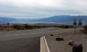
Telescope Peak, Panamint
Valley and Highway 190
from Father Crowley Vista |
|
|
 |
|
 |
|
 |
|
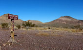
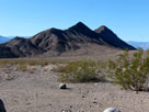
Peak 5,086 and Peak 4,957
from Daylight Pass |
|
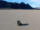
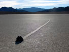
The Grandstand
in The Racetrack |
|
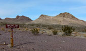
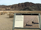
Ubehebe Peak and Moving
Rocks (The Racetrack) |
|
|
|
|
| Sand Dunes |
|
 |
|
 |
|
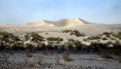
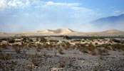
Mesquite Flat Sand Dunes
(Mesquite Flat Dunes)
from Highway 190 |
|
Eureka Sand Dunes (Eureka
Dunes) and South Eureka Road |
|
|
|
|
| Passes & Gaps |
|
 |
|
 |
|
 |
|
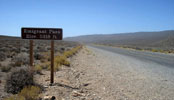
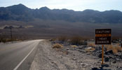
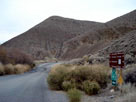
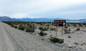
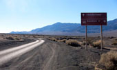
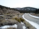
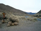
Emigrant Pass and Emigrant
Canyon Road (Wildrose Road) |
|
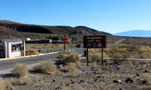
Daylight Pass off
Daylight Pass Road |
|
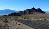
Salsberry Pass and
Jubilee Pass Road |
|
|
|
|
| Springs |
|
 |
|
|
|
Scottys Castle Road near
Mesquite Road (Mesquite Springs
Campground Road) junction |
|
|
|
|
|
| Streams (Rivers, Creeks & Washes) |
|
 |
|
 |
|
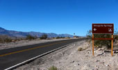
Salt Creek Road (Salt
Creek Trailhead entrance)
from Highway 190 |
|
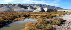
Salt Creek from Salt Creek Trail |
|
|
 |
|
 |
|
Big Pine Road (Death Valley
Road) crossing Death Valley
Wash near Crankshaft Junction |
|
Black Mountains and Highway
190 (west) near Furnace Creek
Wash Road junction |
|
|
|
|
| Canyons & Gorges |
|
 |
|
 |
|
 |
|
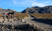
Golden Canyon from
Golden Canyon Trailend
below Red Cathedral |
|
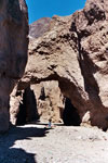
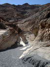
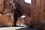
Natural Bridge
Canyon |
|
Twenty Mule Team Canyon |
|
|
 |
|
 |
|
 |
|
Grapevine Mountains and
Titus Canyon Road |
|
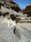
Mosaic Canyon |
|
Emigrant Canyon Road
(Wildrose Road)
in Wildrose Canyon |
|
|
|
|
| Valleys & Basins |
|
 |
|
 |
|
 |
|
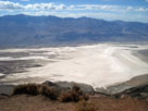
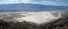
Panamint Range and
Death Valley (Badwater
Basin) from Dante's View |
|
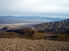
Death Valley and
Panamint Range (Telescope
Peak) from Hells Gate |
|
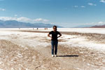
Badwater Basin |
|
|
 |
|
 |
|
Last Chance Range and
Big Pine Road (Death Valley
Road) in Eureka Valley |
|
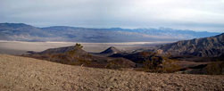
Panamint Range, Panamint
Valley and CA 190 (east) |
|
|
 |
|
 |
|
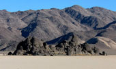
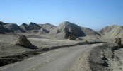
The Racetrack and
Racetrack Valley from
Racetrack Valley Road |
|
Hidden Valley Road
in Hidden Valley |
|
|
|
|
| Flats & Plains |
|
 |
|
 |
|
 |
|
Mesquite Flat Sand Dunes in
Mesquite Flat from Highway 190 |
|
Devil's Corn Field
and Highway 190 (west) |
|
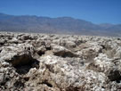
Devil's Golf Course |
|
|
 |
|
 |
|
 |
|
The Racetrack (Racetrack
Playa) in Racetrack Valley |
|
Moving Rocks
in The Racetrack |
|
Ulida Flat and
Hidden Valley Road |
|
|
|
|
| Trails & Trailheads |
|
 |
|
 |
|
 |
|
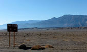
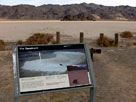
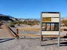
| Salt Creek Trailhead |
|
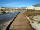
Salt Creek and Salt
Creek Trail (Salt Creek
Interpretive Trail) |
|
Zabriskie Point from Zabriskie
Point Trailhead off Highway 190 |
|
|
 |
|
 |
|
 |
|
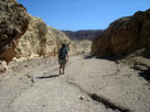
Golden Canyon Trail
(Golden Canyon Interpretive
Trail) into Golden Canyon |
|
Manly Beacon (?) from
Golden Canyon Trail
below Red Cathedral |
|
Black Mountains and Artist's
Palette (Artists Palette Trail) |
|
|
 |
|
 |
|
 |
|
Natural Bridge in
Natural Bridge Canyon |
|
Mosaic Canyon Trail |
|
Grapevine Mountains and
Mesquite Flat Sand Dunes
from Mesquite Flat Sand
Dunes Trailhead |
|
|
 |
|
 |
|
 |
|
Death Valley Buttes
from Hells Gate (Death
Valley Buttes Trailhead) |
|
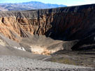
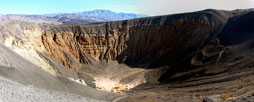
Ubehebe Crater from
Ubehebe Crater Overlook
(Ubehebe Crater Trailhead) |
|
The Racetrack from
Moving Rocks Trailhead |
|
|
|
|
| Roads & Highways |
|
 |
|
 |
|
 |
|
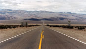
Highway 190 (west) near
Scottys Castle Road junction |
|
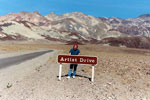
Black Mountains and
Artists Drive (Artist Drive)
off Badwater Road |
|
Twenty Mule Team Road
(20 Mule Team Road) in
Twenty Mule Team Canyon |
|
|
 |
|
 |
|
Scottys Castle Road near
Ubehebe Crater Road junction |
|
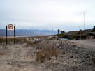
Daylight Pass Road entering
Death Valley National Park |
|
|
 |
|
 |
|
 |
|
Ubehebe Crater Road near
Racetrack Road junction |
|
Hidden Valley Road
from Teakettle Junction |
|
Hunter Mountain Road
in Cottonwood Mountains |
|
|
 |
|
|
|
 |
|
Mosaic Canyon Road and
Highway 190 near Stovepipe Wells |
|
Emigrant Canyon Road
(Wildrose Road) from
Charcoal Kilns Road |
|
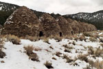
Charcoal Kilns and
Charcoal Kilns Road
(Mahogany Flat Road) |
|
|
|
|
| Vista Points |
|
 |
|
 |
|
Panamint Range and Death Valley (Badwater
Basin) from Dante's View |
|
Panamint Range, Death Valley, Golden
Canyon, Manly Beacon and Red
Cathedral from Zabriskie Point |
|
|
 |
|
 |
|
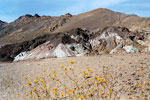
Artist's Palette (Artists
Palette) off Artists Drive |
|
Black Mountains, Death Valley and Panamint
Range (Telescope Peak) from Hells Gate |
|
|
 |
|
 |
|
Ubehebe Crater from
Ubehebe Crater Overlook |
|
Panamint Range and Panamint Valley from
Father Crowley Vista (Father Crowley Viewpoint) |
|
|
|
|
| Historic Sites |
|
 |
|
 |
|
 |
|
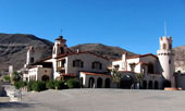
Scotty's Castle (Scottys Castle)
off Scottys Castle Road |
|
Panamint Range and
Mesquite Flat from
Old Stovepipe Wells
(Historic Stovepipe Wells) |
|
Charcoal Kilns (Wildrose
Charcoal Kilns) from
Charcoal Kilns Road |
|
|
|
|
| Campgrounds |
|
 |
|
 |
|
 |
|
Tin Mountain from
Mesquite Spring Campground
(Mesquite Springs Campground) |
|
Stovepipe Wells
Campground and
Highway 190 |
|
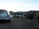
Wildrose Campground
and Charcoal Kilns Road |
|
|
|
|
| Villages & Populated Places |
|
 |
|
 |
|
 |
|
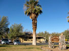
Furnace Creek Ranch
from CA 190 |
|
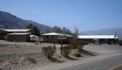
Stovepipe Wells Village
and CA 190 |
|
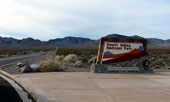
Panamint Springs Resort
and CA 190 |
|
|
 |
|
 |
|
 |
|
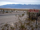
Grapevine Ranger Station and
Scottys Castle Road (south) |
|
Stovepipe Wells Village
and CA 190 |
|
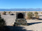
Sea level sign
from Badwater
off Badwater Road |
|
|
|
|
| Death Valley National Park Photos on Web |
|
|
|
|