| Yosemite National Park |
 |
|
|
|
|
|
| Park Entrances |
|
 |
|
 |
|
 |
|
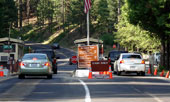
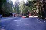
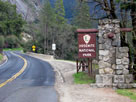
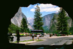
Arch Rock Entrance
and Highway 140 |
|
Big Oak Flat Entrance
and Highway 120 |
|
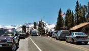
South Entrance
and Highway 41 |
|
|
 |
|
 |
|
 |
|
| Tioga Pass Entrance (East Entrance) and Highway 120 |
|
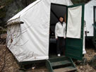
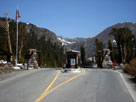
Hetch Hetchy Entrance |
|
|
|
|
|
|
|
 |
|
 |
|
 |
|
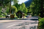
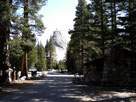
| Wawona |
|
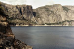
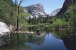
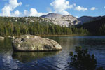
Hetch Hetchy Valley
(Hetch Hetchy Reservoir) |
|
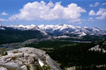
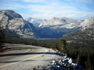
Olmsted Point |
|
|
 |
|
 |
|
 |
|
| Tuolumne Meadows |
|
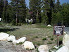
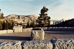
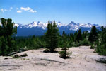
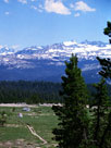
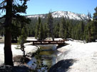
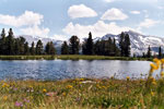
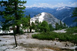
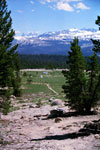
Dana Meadows |
|
Tioga Pass |
|
|
|
|
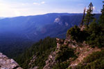
| Ranges & Ridges |
|
 |
|
 |
|
 |
|
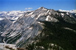
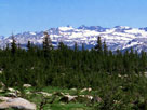
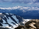
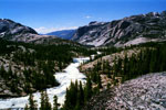
Sawtooth Ridge (Sierra
Crest) from Burro Pass Trail |
|
Cathedral Range from
Young Lakes Trail |
|
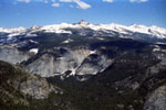
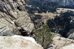
Mt. Clark and Clark Range
from Half Dome summit |
|
|
|
|
| Peaks & Subpeaks |
|
 |
|
 |
|
 |
|
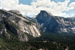
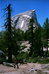
Half Dome from
Half Dome Trail |
|
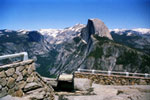
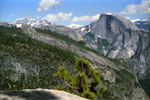
Clouds Rest from
Half Dome summit |
|
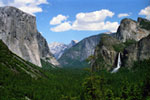
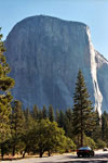
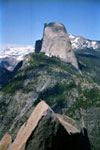
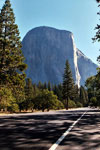
El Capitan from
Southside Drive
(Yosemite Valley) |
|
|
 |
|
 |
|
 |
|
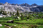
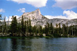
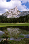
Cathedral Peak and
Upper Cathedral Lake |
|
Mount Conness from
Lower Young Lake |
|
Matterhorn Peak
from Burro Pass
Trail |
|
|
|
|
| Passes & Gaps |
|
 |
|
 |
|
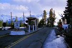
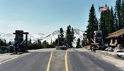
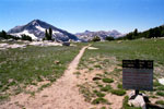
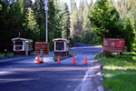
Tioga Pass Entrance
Station and Tioga Road |
|
Tioga Pass Entrance and
Tioga Pass Road (Highway 120) |
|
|
|
|
| High Passes |
|
 |
|
 |
|
 |
|
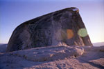
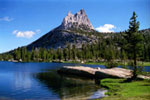
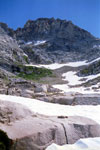
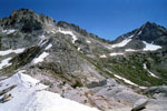
Rock Island Pass Trail
into Yosemite Nationa Park
(Rock Island Pass) |
|
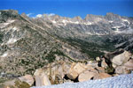
Sawtooth Ridge and
Matterhorn Peak
from Mule Pass |
|
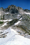
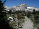
Matterhorn Peak
and Burro Pass |
|
|
|
|
| Viewpoints |
|
 |
|
 |
|
 |
|
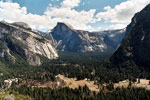
North Dome, Half Dome
and Yosemite Valley
from Columbia Point |
|
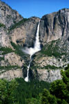
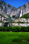
Yosemite Valley and
Upper Yosemite Fall
(Yosemite Falls Overlook) |
|
Clouds Rest, North Dome
and Half Dome
from Yosemite Point |
|
|
|
|
| Glaciers |
|
 |
|
 |
|
 |
|
Mount Lyell and Lyell Glacier
from Young Lakes Trail |
|
Lyell Glacier and
Maclure Glacier from
Mount Conness summit |
|
|
|
|
| Streams (Rivers & Creeks) |
|
 |
|
 |
|
 |
|
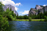
El Capitan, Bridalveil
Fall and Merced River
from Valley View |
|
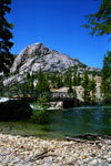
Cathedral Peak and
Lower Cathedral Lake outlet
(Tenaya Creek) |
|
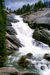
Yosemite Creek
above Yosemite Falls |
|
|
 |
|
 |
|
 |
|
Wildcat Point, Peak 8,886
and Tuolumne River
from Glen Aulin Trail |
|
Lyell Fork and
Pacific Crest Trail |
|
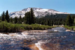
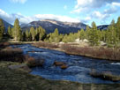
Mount Gibbs
and Dana Fork |
|
|
|
|
| Falls (Waterfalls) |
|
 |
|
 |
|
 |
|
 |
|
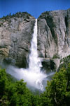
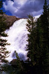
Yosemite Falls from
Four Mile Trail |
|
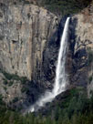
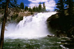
Upper Yosemite Fall
from Yosemite
Falls Trail |
|
Bridalveil Fall
from Tunnel View |
|
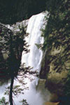
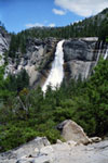
Vernal Fall
from Mist Trail |
|
|
 |
|
 |
|
 |
|
 |
|
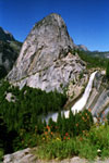
Liberty Cap and
Nevada Fall from
John Muir Trail |
|
Upper Chilnualna
Fall (Chilnualna
Falls) |
|
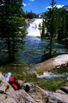
Tuolumne Falls from
Glen Aulin Trail |
|
White Cascade from
Glen Aulin Trail |
|
|
|
|
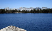
| Lakes |
|
 |
|
 |
|
|
|
Mount Watkins
and Mirror Lake |
|
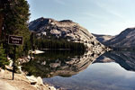
Polly Dome and Tenaya Lake
from Tioga Road |
|
Wapama Falls, Hetch
Hetchy Dome and
Hetch Hetchy Reservoir |
|
|
|
|
| High Lakes |
|
 |
|
 |
|
 |
|
Cathedral Range (Cathedral Peak
to Tenaya Peak) and May Lake |
|
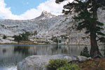
Cathedral Peak and
Lower Cathedral Lake
(Cathedral Lakes) |
|
Cockscomb and Budd Lake |
|
|
 |
|
 |
|
 |
|
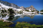
Johnson Peak
and Elizabeth Lake |
|
Cathedral Range and
Gaylor Lakes from
Gaylor Peak summit |
|
Ragged Peak and Upper
Young Lake (Young Lakes) |
|
|
|
|
| Canyons & Gorges |
|
 |
|
 |
|
 |
|
Mt. Watkins, Tenaya Canyon
and Half Dome summit |
|
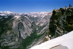
Grand Canyon of the
Tuolumne from Peak 8,886
near Glen Aulin |
|
Matterhorn Canyon
from Burro Pass |
|
|
|
|
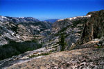
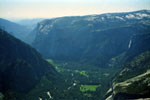
| Valleys & Basins |
|
 |
|
 |
|
 |
|
El Capitan, Yosemite Falls
and Yosemite Valley from
Half Dome summit |
|
John Muir Trail into Little
Yosemite Valley along Merced
River (top of Nevada Fall) |
|
Peak 8,886,
Tuolumne River
and trail/bridge
to Glen Aulin |
|
|
|
|
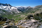
| Meadows & Flats |
|
 |
|
 |
|
 |
|
Tuolumne Peak and
Tuolumne Meadows from
Lembert Dome summit |
|
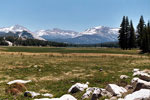
Mount Dana and Dana
Fork (Dana Meadows) |
|
Kuna Crest and Mammoth
Peak from
near Tioga Pass
(Upper Dana Meadow) |
|
|
|
|
| Trails |
|
 |
|
 |
|
 |
|
 |
|
Nevada Fall
from Clark Point
(John Muir Trail) |
|
Half Dome from
Half Dome Trail |
|
Half Dome from
Panorama Trail |
|
North Dome from
North Dome Trail |
|
|
 |
|
 |
|
 |
|
 |
|
Cathedral Peak
from Cathedral
Lakes Trail |
|
White Cascade and
Glen Aulin Trail
(under water) |
|
Mount Ritter, Mount
Lyell and Young
Lakes Trail |
|
Matterhorn Peak, Whorl
Mountain, Burro Pass
and Burro Pass Trail |
|
|
|
|
| Roads & Highways |
|
 |
|
 |
|
 |
|
 |
|
El Portal Road (Highway
140) into Yosemite Valley |
|
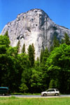
El Capitan and
Southside Drive |
|
Yosemite Falls from
Sentinel Drive |
|
El Capitan and
Northside Drive |
|
|
 |
|
 |
|
 |
|
Wawona Tunnel and Tunnel
View from Wawona
Road (Highway 41) |
|
Big Oak Flat Entrance
and Big Oak Flat Road
(Highway 120) |
|
Mt. Conness, Medlicott
Dome, Tenaya Lake
and Tioga Road |
|
|
|
|
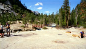
| Campgrounds |
|
 |
|
 |
|
 |
|
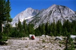
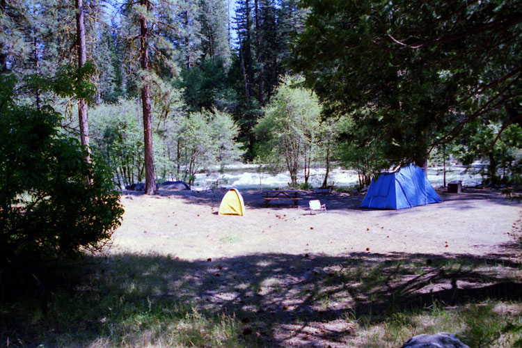
Upper Pines Campground
in Yosemite Valley |
|
South Fork Merced River
and Wawona Campground |
|
Lembert Dome and
Tuolumne Meadows
Camground Office |
|
|
|
|
|
|
|
|
|
| "East of Yosemite" |
|
 |
|
 |
|
 |
|
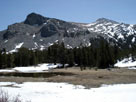
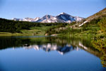
Mammoth Peak, Tioga Pass
and Tioga Lake |
|
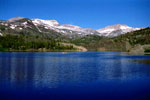
White Mountain, Mount
Conness (southeast peak)
and Ellery Lake |
|
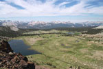
North Peak and
20 Lakes Basin Trail
(Hoover Wilderness) |
|
|
|
|
| See also |
|
|
|
|