| ヨセミテ |
 |
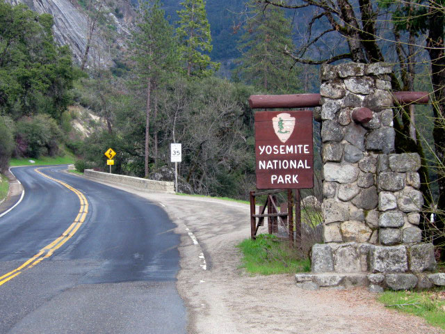
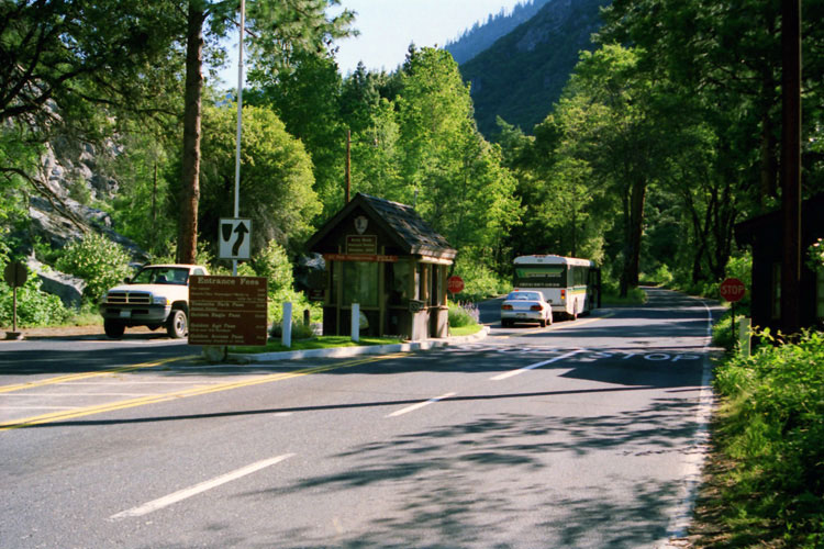
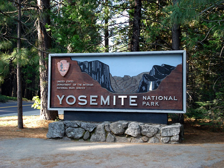
| (Yosemite National Park) |
|
|
|
|
|
|
|
|
|
|
|
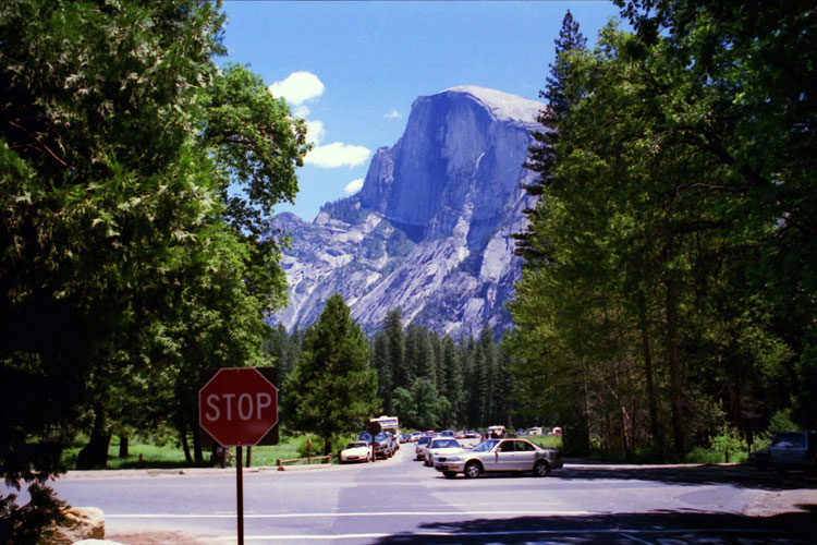
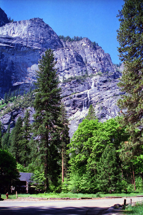
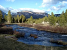
| ヨセミテ・バレー (Yosemite Valley) |
|
 |
|
 |
|
 |
|
 |
|
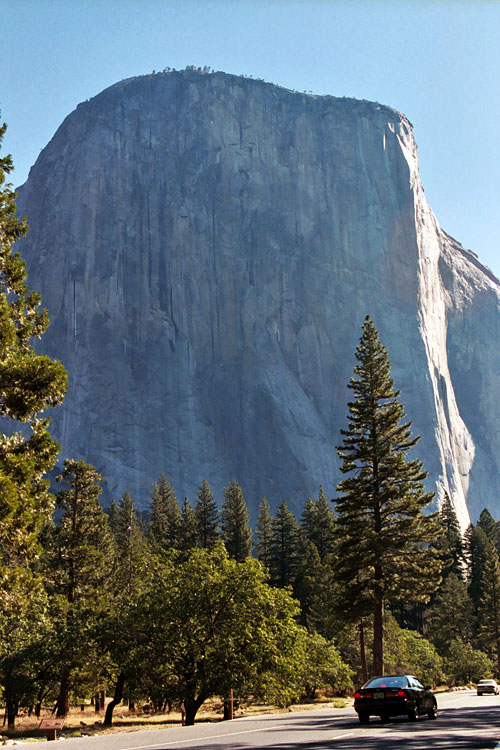
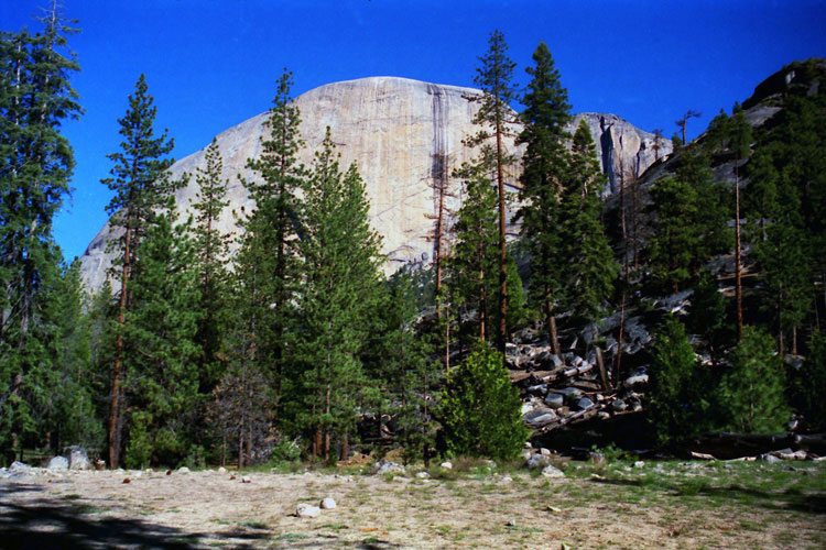
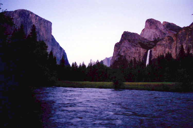
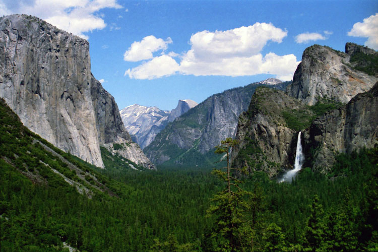
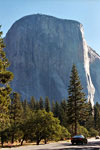
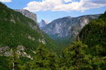
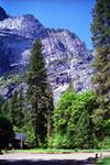
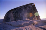
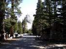
El Capitan and
Southside Drive |
|
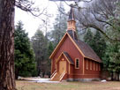
Yosemite Chapel |
|
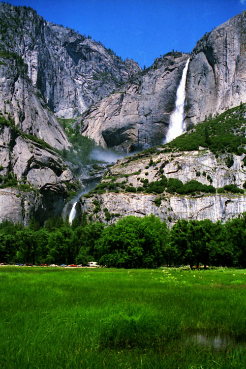
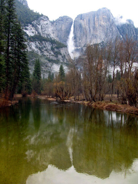
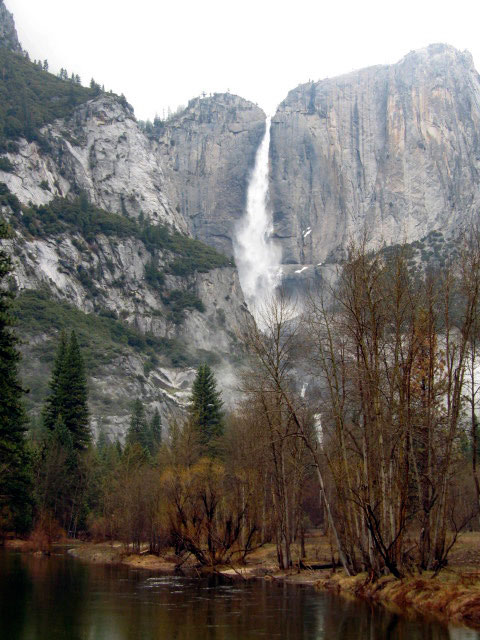
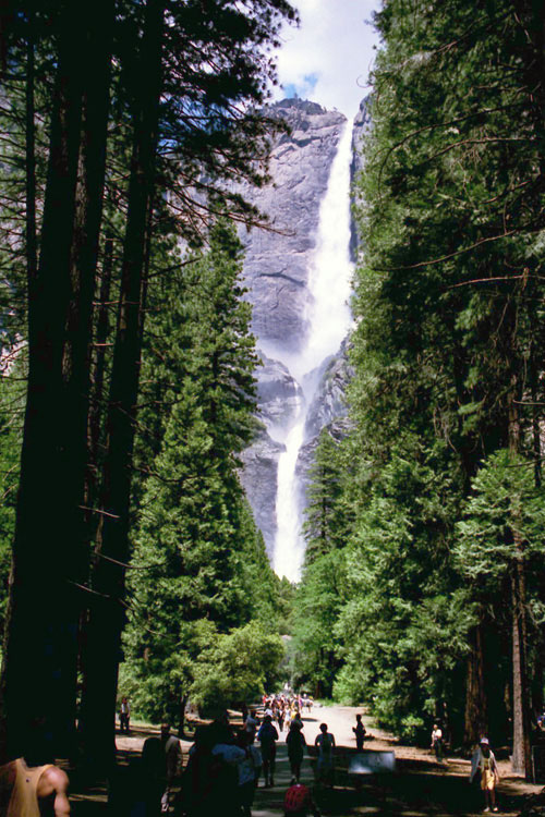
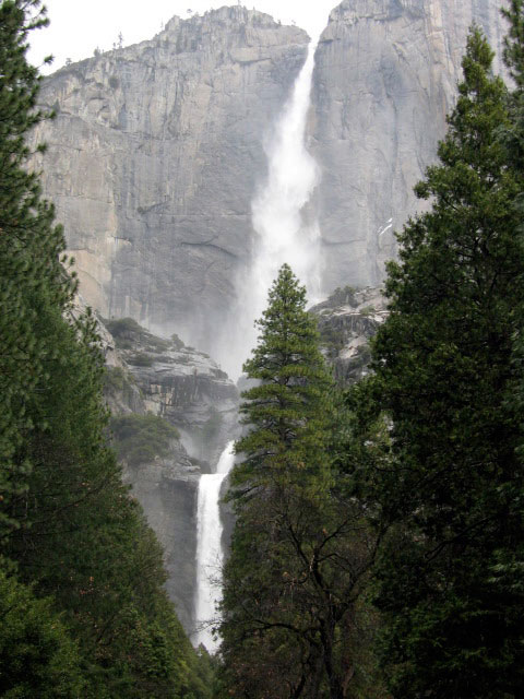
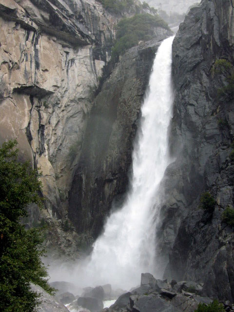
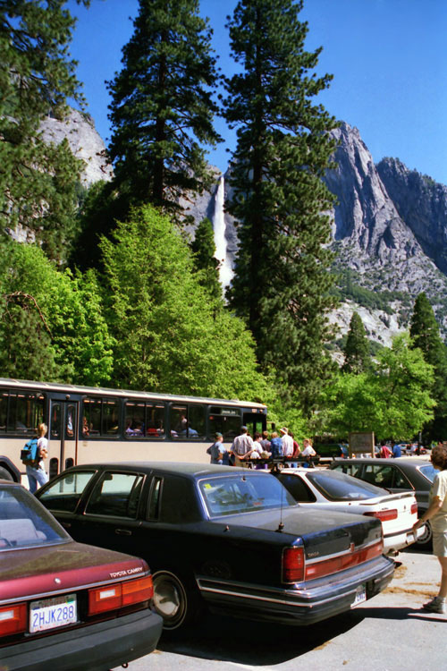
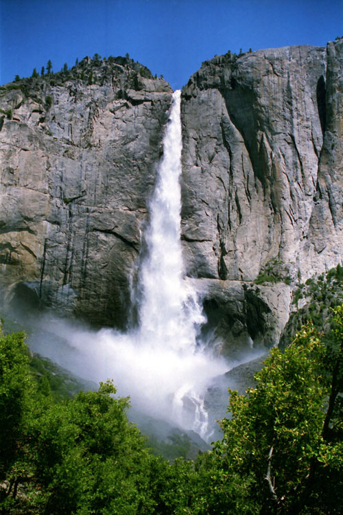
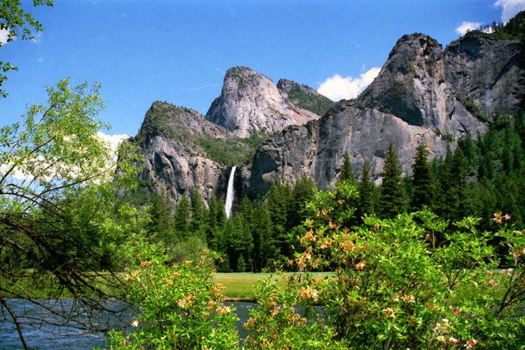
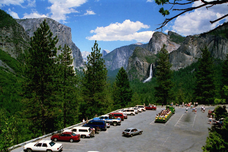
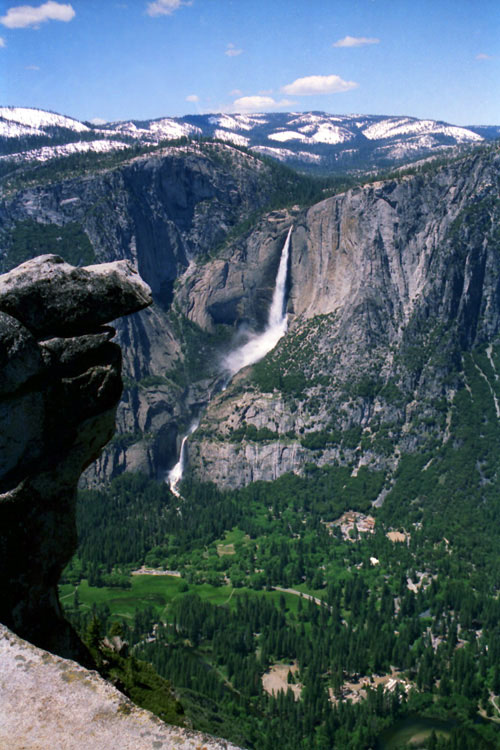
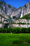
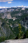
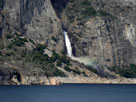
Yosemite Falls from
Sentinel Drive |
|
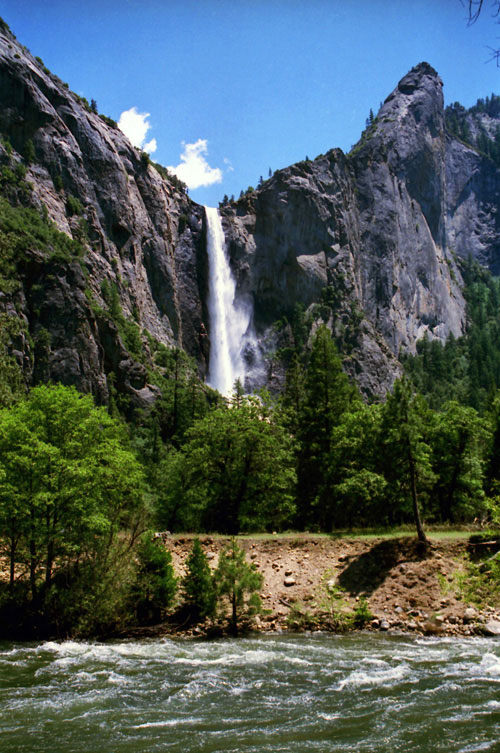
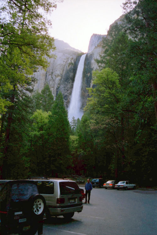
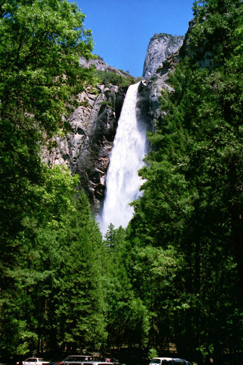
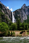
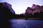
Bridalveil Fall and
Merced River from
Northside Drive |
|
|
 |
|
 |
|
 |
|
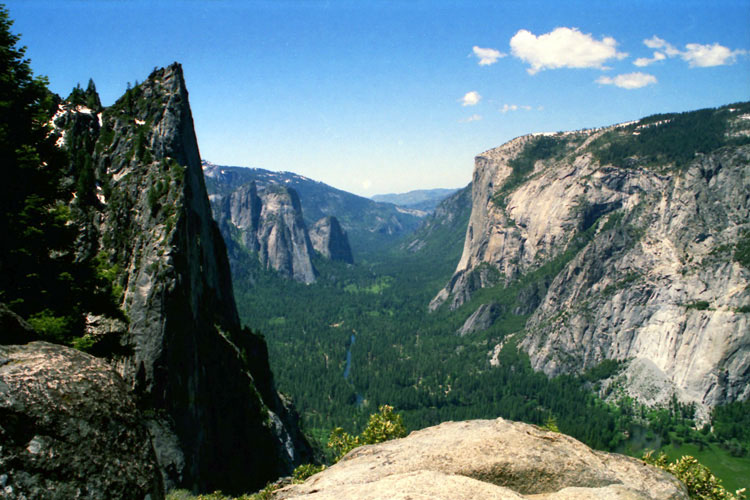
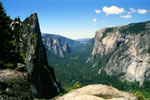
Sentinel Rock, Cathedral
Rocks, El Capitan
and Yosemite Valley
from Four Mile Trail |
|
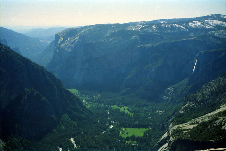
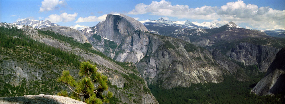
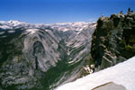
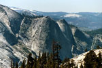
El Capitan, Yosemite Falls
and Yosemite Valley from
Half Dome summit |
|
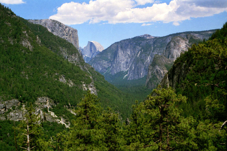
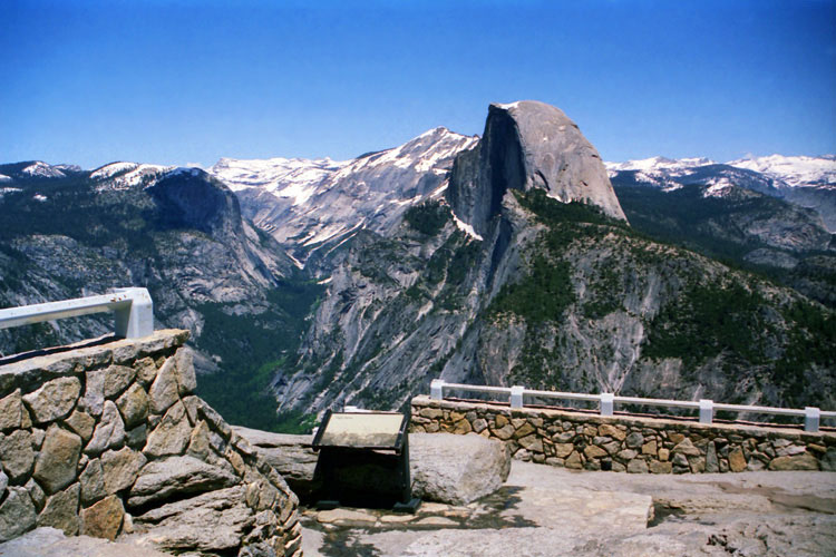
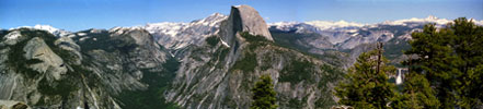
El Capitan, Half Dome,
Sentinel Dome
and Yosemite Valley
from Wawona Road |
|
|
|
|
|
|
|
|
|
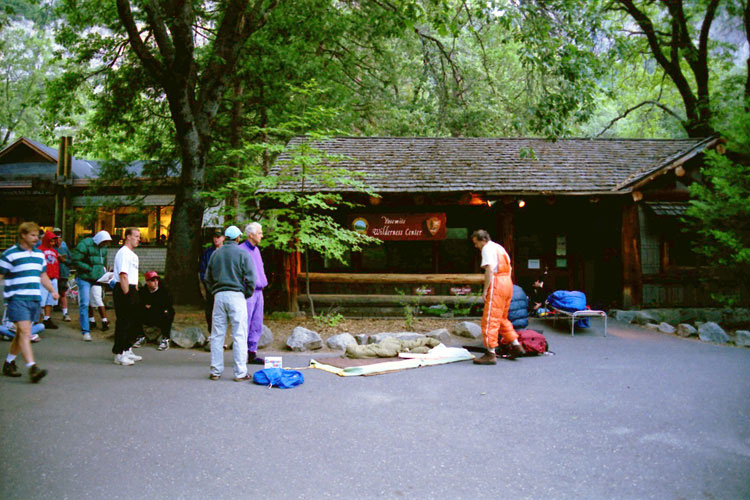
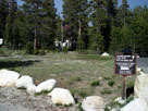
| カリー・ビレッジ (Curry Village) |
|
 |
|
 |
|
 |
|
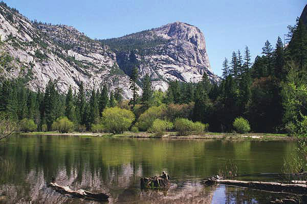
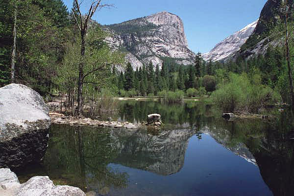
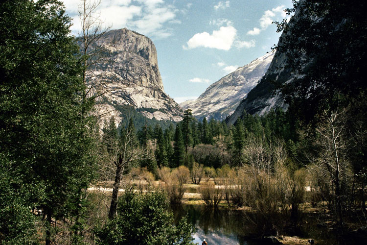
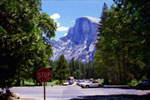
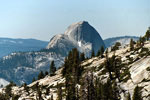
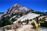
Half Dome from Southside
Drive near Curry Villlage |
|
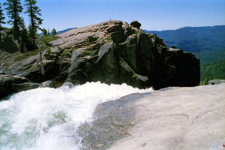
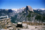
Glacier Point and
Staricase Falls
from Curry Village |
|
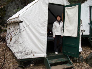
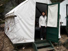
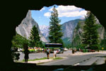
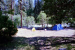
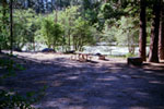
Tent Cabin, Curry Village |
|
|
|
|
|
|
|
|
|
|
|
|
|
|
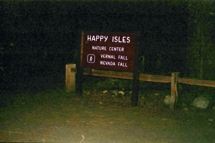
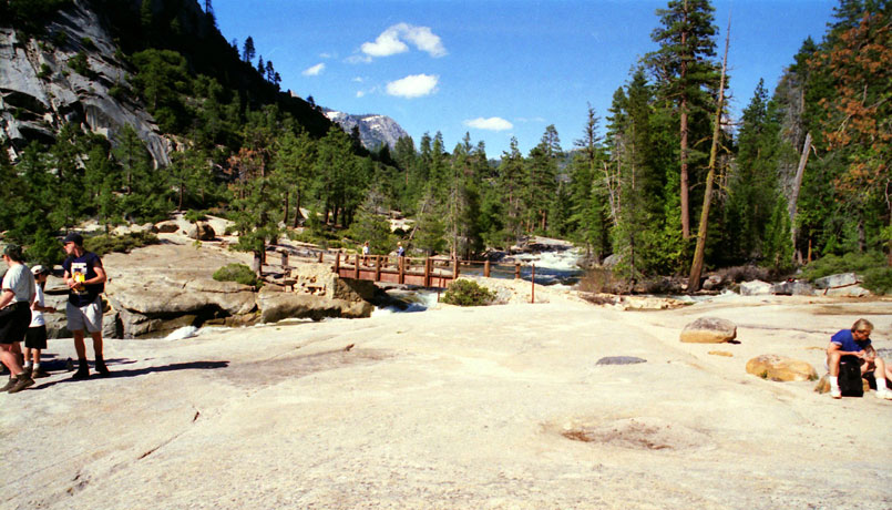
| バーナル・フォール (Vernal Fall) - ミスト・トレイル |
|
 |
|
 |
|
 |
|
|
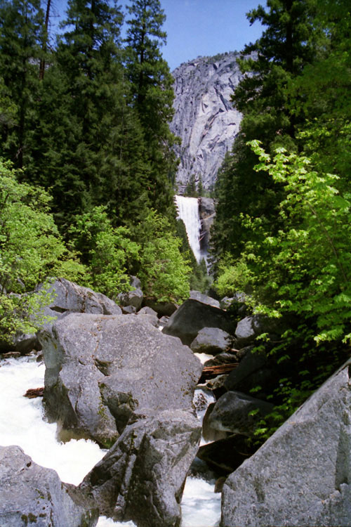
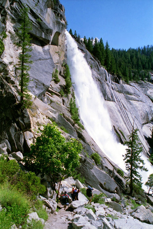
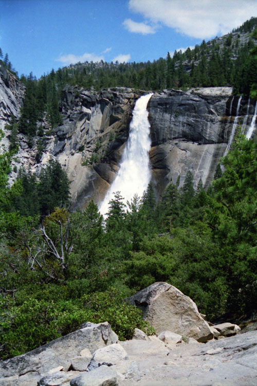
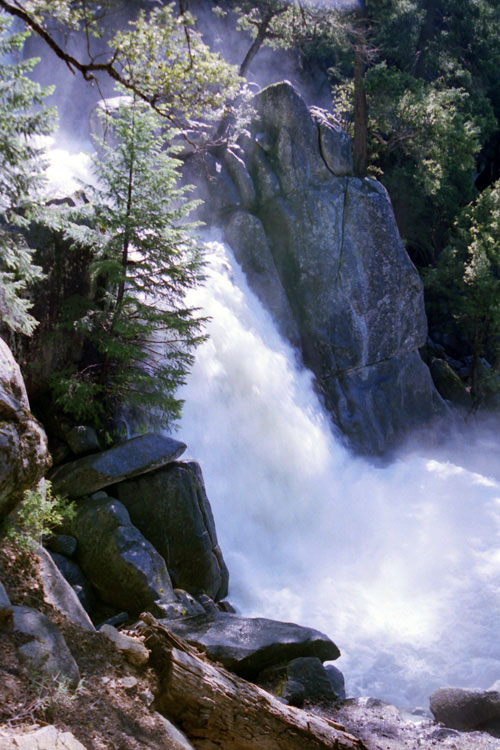
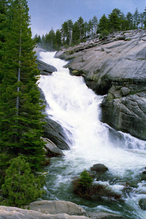
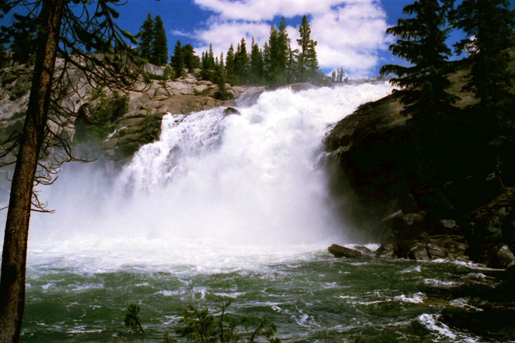
Vernal Fall from
John Muir Trail |
|
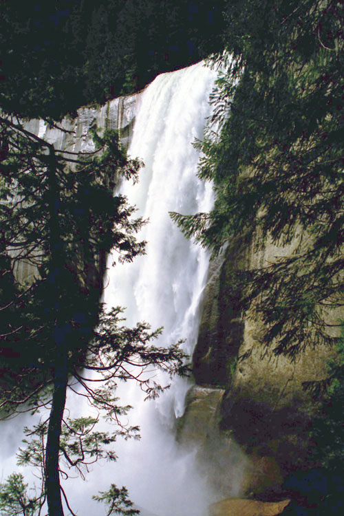
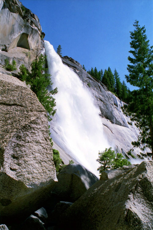
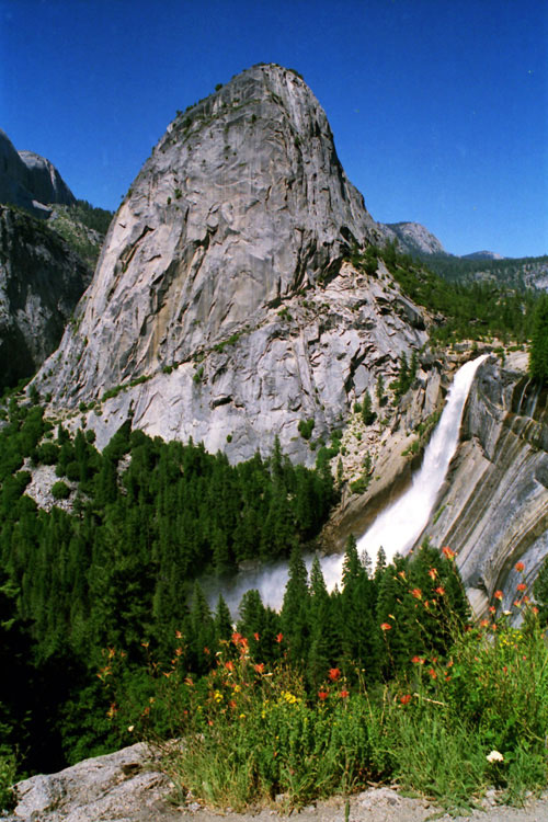
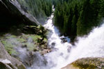
Vernal Fall
from Mist Trail |
|
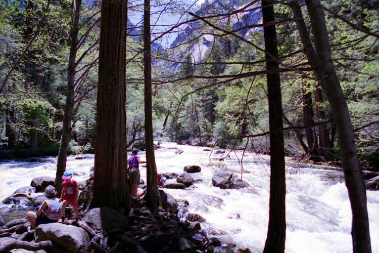
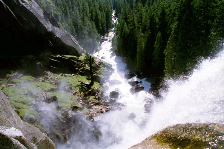
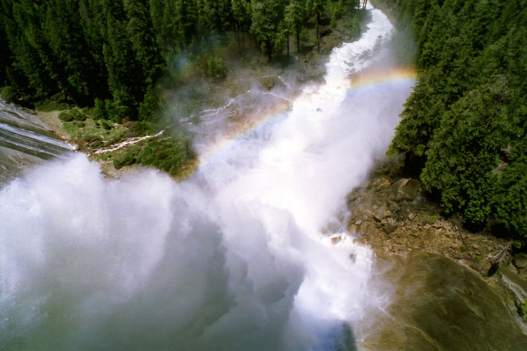
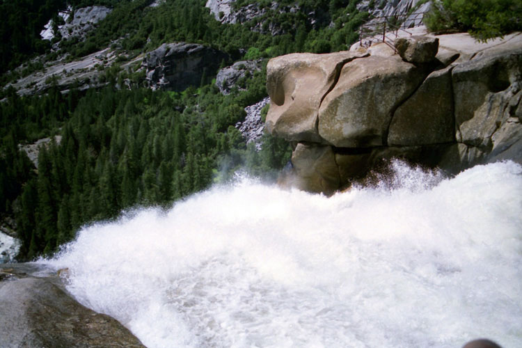
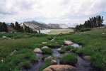
Merced River and Mist Trail
from top of Vernal Fall |
|
|
|
|
|
|
|
|
|
|
|
|
|
|
|
|
|
|
|
|
| ハーフ・ドーム (Half Dome) - ハーフ・ドーム・トレイル |
|
 |
|
 |
|
 |
|
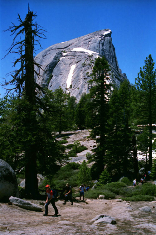
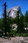
Half Dome and
Half Dome Trail |
|
Half Dome summit and
Half Dome Cables |
|
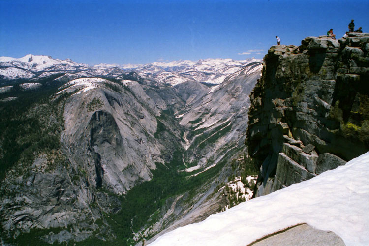
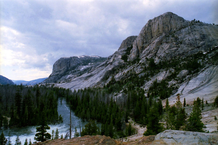
Mt. Watkins, Tenaya Canyon
and Half Dome summit |
|
|
|
|
|
|
|
|
|
|
|
|
|
|
|
|
|
|
|
|
|
|
|
|
|
|
|
|
|
|
|
|
|
|
| バレー・ビュー (Valley View) |
|
 |
|
 |
|
 |
|
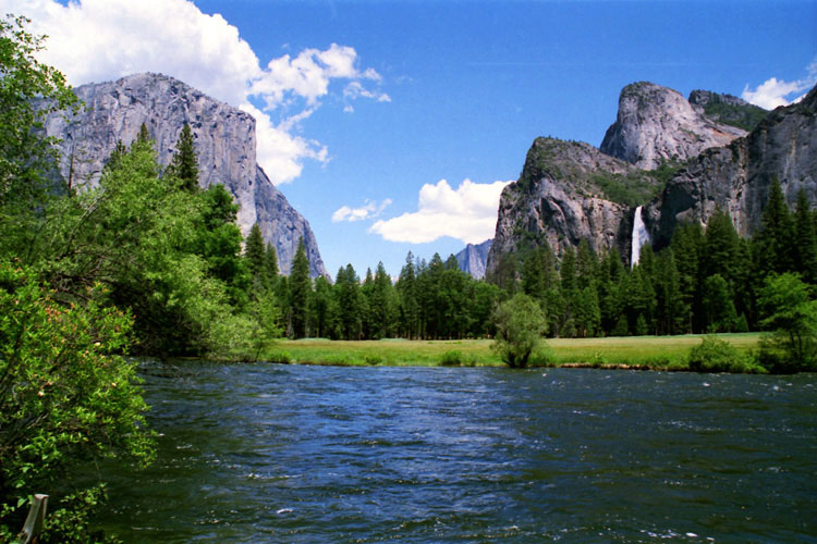
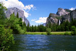
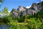
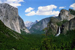
El Capitan, Cathedral Rocks, Bridalveil Fall
and Merced River from Valley View |
|
|
|
|
|
|
|
|
|
|
| トンネル・ビュー (Tunnel View) |
|
 |
|
 |
|
 |
|
El Capitan, Clouds Rest, Half Dome, Sentinel Dome,
Cathedral Rocks, Bridalveil Fall and Yosemite Valley
from Tunnel View |
|
Wawona Tunnel and Wawona
Road (Highway 41) |
|
|
|
|
|
|
|
|
|
|
|
|
|
|
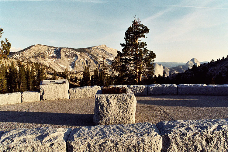
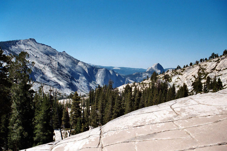
| グレイシャー・ポイント (Glacier Point) |
|
 |
|
 |
|
 |
|
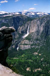
Yosemite Falls and
Yosemite Valley |
|
Tenaya Canyon and Half
Dome from Glacier Point |
|
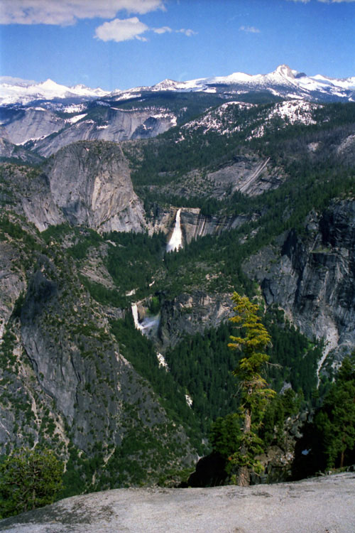
Nevada Fall
and Vernal Fall |
|
|
 |
|
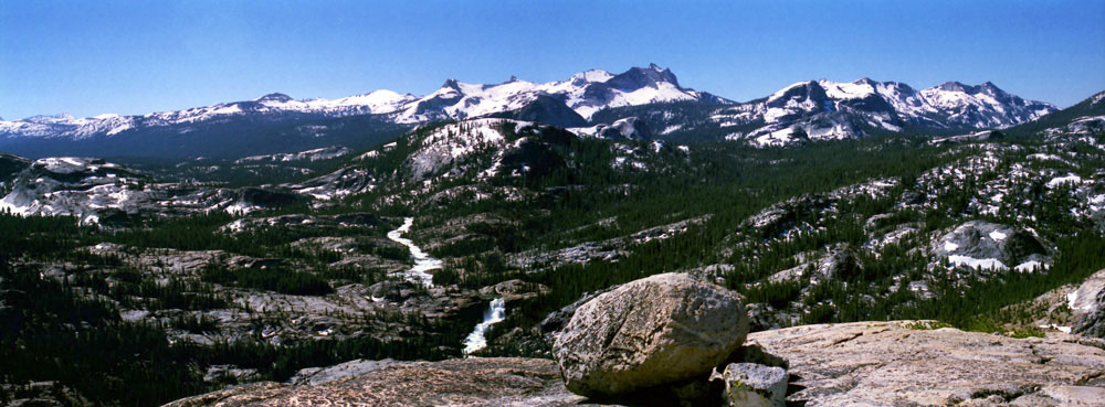
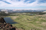
North Dome, Basket Dome, Mount Hoffmann, Mount Watkins, Tenaya Canyon,
Clouds Rest, Half Dome, Cathedral Range, Mount Clark and Nevada Fall
from Glacier Point |
|
|
|
|
|
|
|
|
|
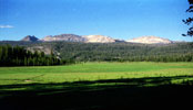
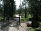
| ワオナ (Wawona) |
|
 |
|
 |
|
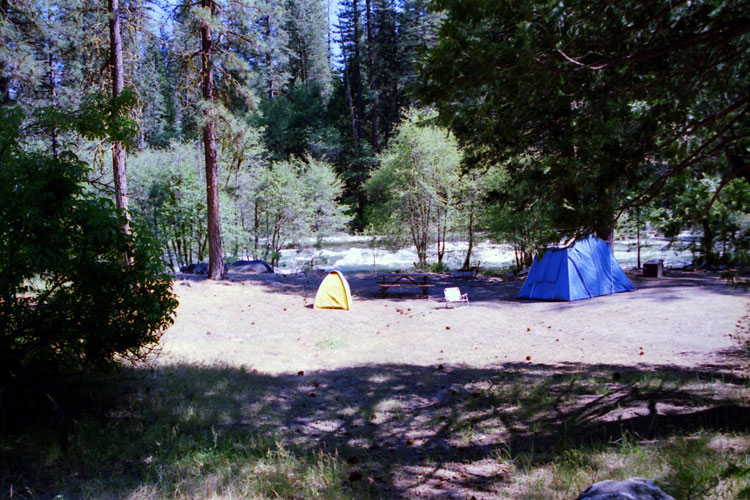
| South Fork Merced River and Wawona Campground |
|
|
|
|
|
|
|
|
|
|
|
|
|
|
|
|
|
|
|
|
|
|
|
|
| ヘッチ・ヘッチー湖 (Hetch Hetchy Reservoir) |
|
 |
|
 |
|
 |
|
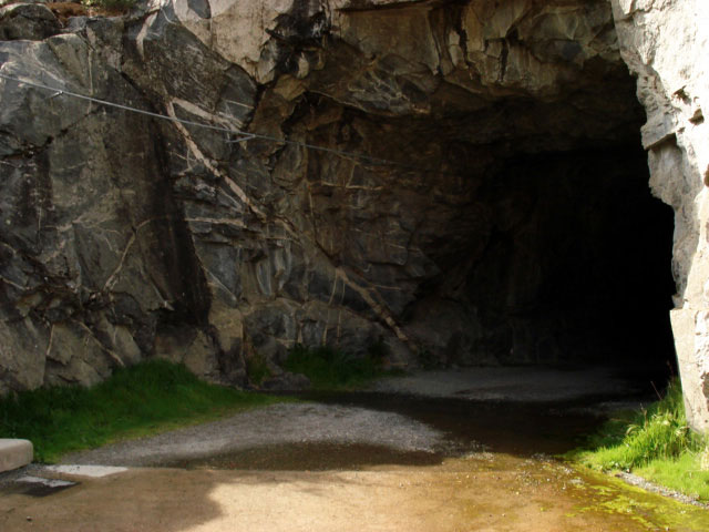
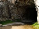
Tunnel of O'Shaughnessy
Dam (Wapama Falls Trail) |
|
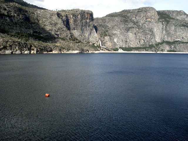
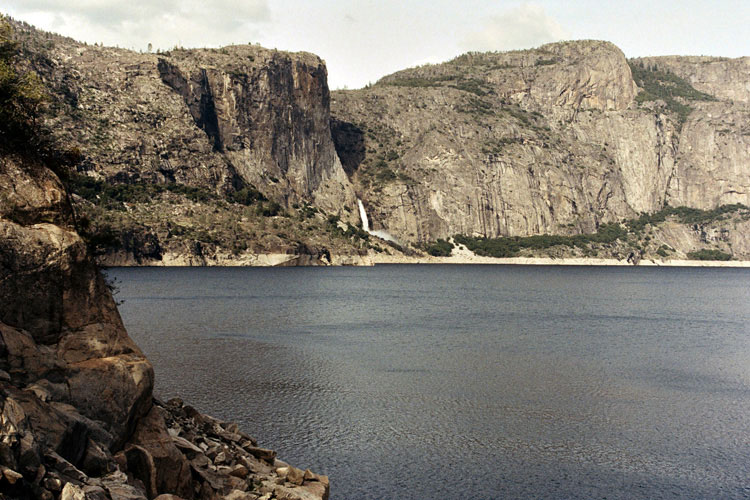
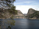
Wapama Falls and
Hetch Hetchy Reservoir |
|
Hetch Hetchy Reservoir
and Kolana Rock |
|
|
|
|
|
|
|
|
|
|
|
|
|
|
|
|
|
|
|
|
|
|
|
|
|
|
|
|
|
|
|
|
|
|
|
|
|
 |
|
 |
|
 |
|
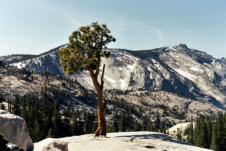
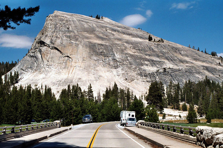
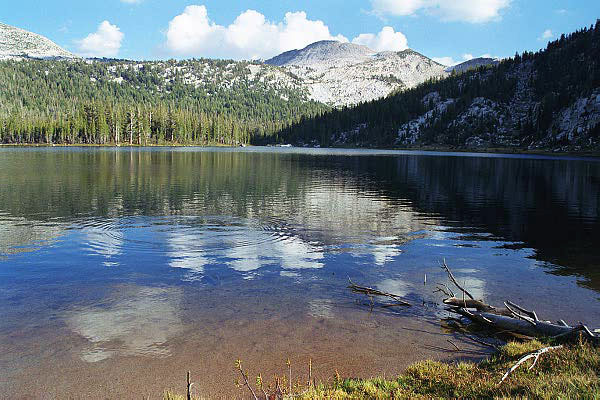
Quarter Domes
from Olmsted Point |
|
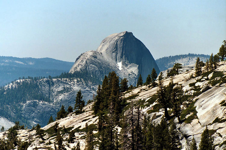
Half Dome |
|
Mt. Conness, Medlicott Dome,
Pywiack Dome and Tenaya
Lake from Olmsted Point |
|
|
|
|
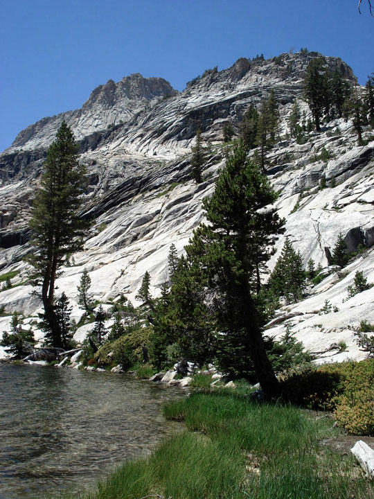
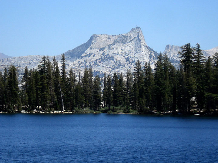
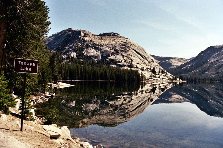
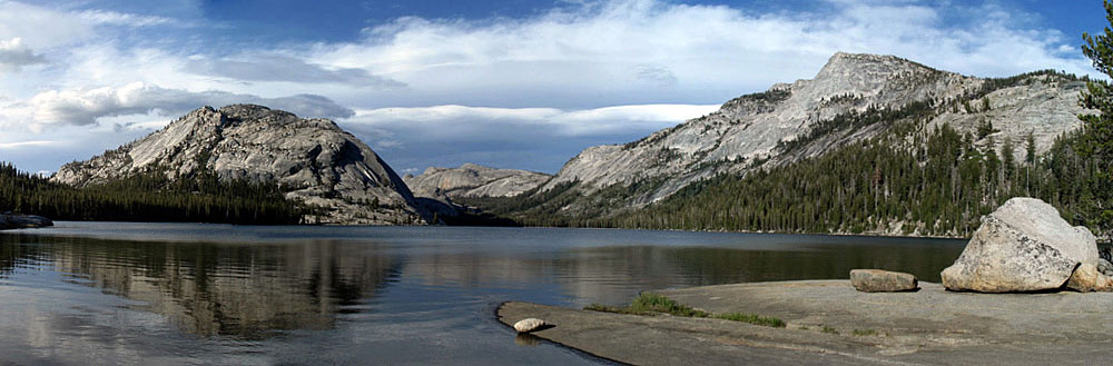
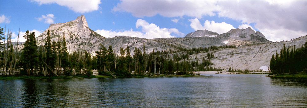
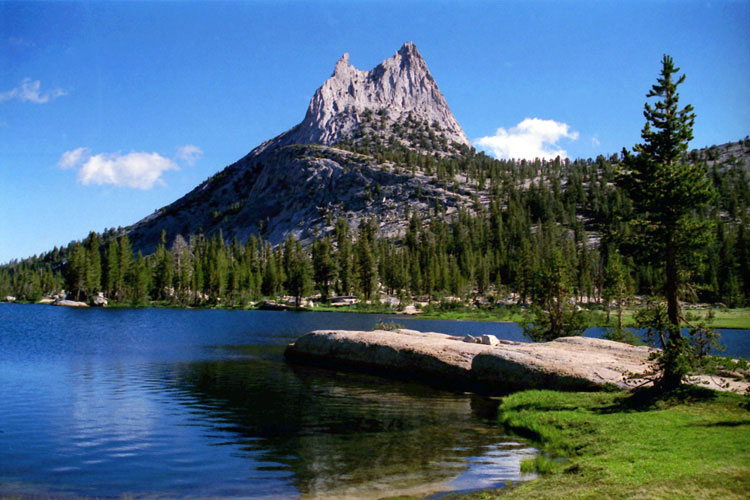
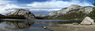
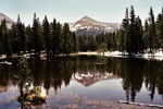
| テナヤ・レイク (Tenaya Lake) |
|
 |
|
 |
|
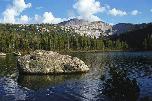
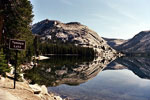
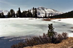
Polly Dome and Tenaya Lake
from Tioga Road |
|
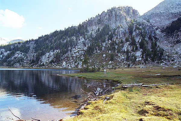
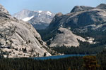
Polly Dome, Medlicott Dome, Tenaya Peak
and Tenaya Lake |
|
|
|
|
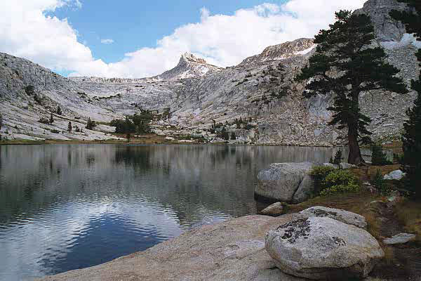
| トゥオルム・メドウズ (Tuolumne Meadows) |
|
 |
|
 |
|
 |
|
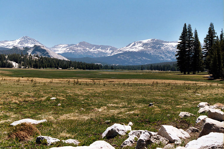
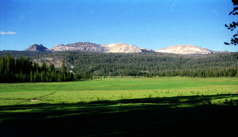
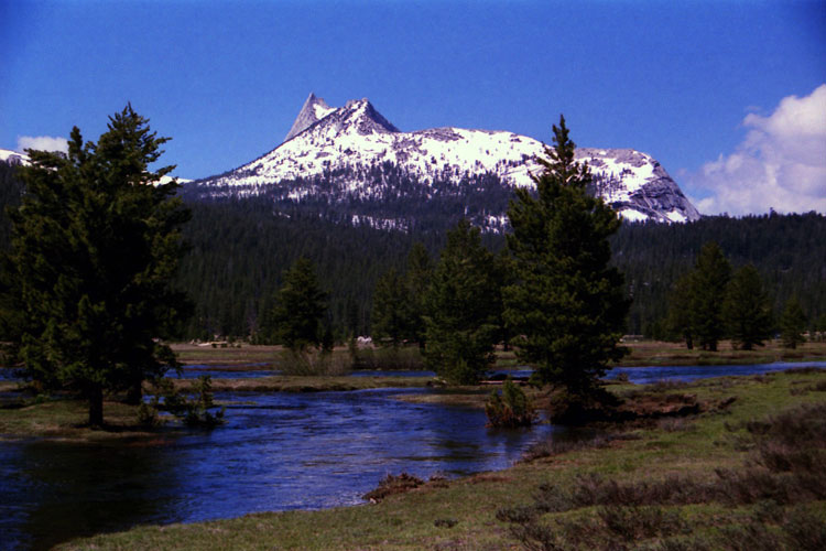
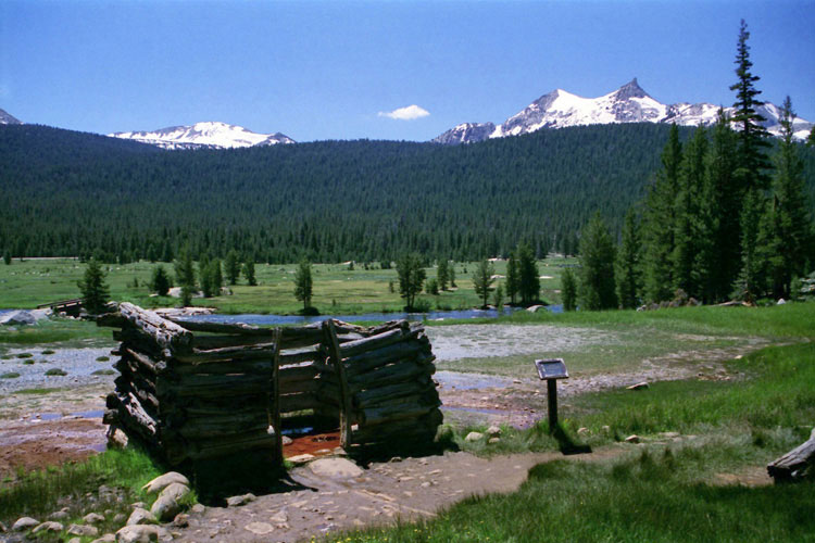
Mount Dana, Mount Gibbs, Mammoth Peak
and Lembert Dome from Tuolumne Meadows |
|
Ragged Peak, Mount Conness
and White Mountain
from Tuolumne Meadows |
|
|
 |
|
 |
|
 |
|
Lembert Dome,
Tuolumne Meadows Bridge
and Tioga Road |
|
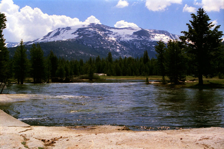
Mammoth Peak
and Tuolumne River |
|
Cathedral Peak
and Tuolumne River |
|
|
|
|
| トゥオルム・メドウズ (Tuolumne Meadows) [続き] |
|
 |
|
 |
|
 |
|
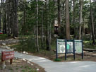
Tuolumne Meadows
Visitor Center |
|
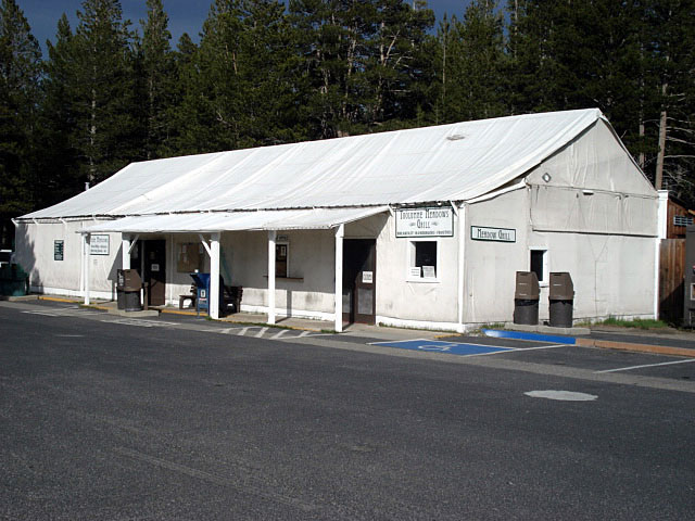
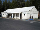
Tuolumne Meadows
Store and Grill |
|
Lembert Dome and
Tuolumne Meadows
Camground Office |
|
|
 |
|
 |
|
 |
|
| Tuolumne Meadows Lodge |
|
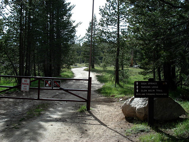
Glen Aulin Trail
(Pacific Crest Trail) |
|
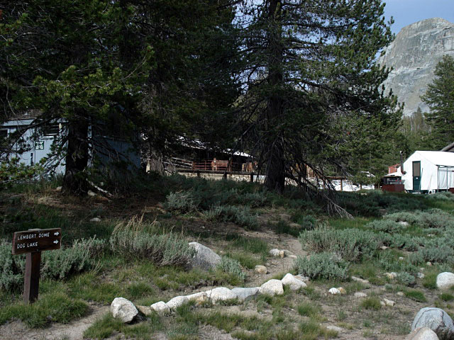
Stables |
|
|
|
|
|
|
|
|
|
|
|
|
|
|
|
|
|
|
|
|
|
|
|
|
|
|
|
|
|
|
|
|
 |
|
 |
|
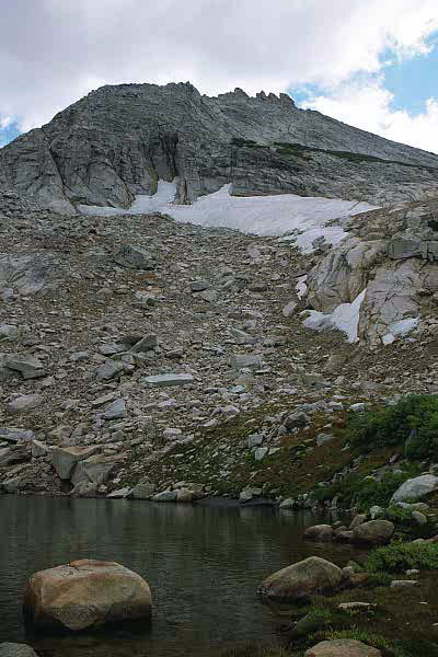
| Peak 8,886 near Glen Aulin |
|
Cathedral Range and Tuolumne River
from Peak 8,886 summit |
|
|
|
|
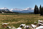
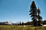
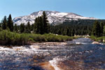
| デイナ・メドウズ (Dana Meadows) |
|
 |
|
 |
|
 |
|
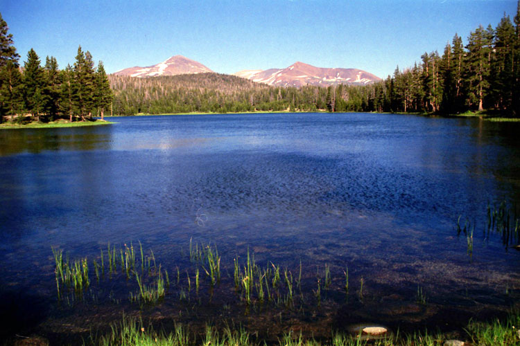
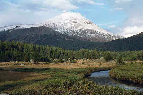
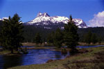
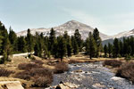
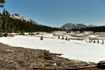
Mount Dana and Dana
Fork (Dana Meadows) |
|
Mount Gibbs
and Dana Fork |
|
Mammoth Peak
and Dana Fork |
|
|
 |
|
 |
|
 |
|
Cathedral Range
from Dana Meadows |
|
Mount Dana
and Dana Fork |
|
Mount Gibbs
from Dana Meadows |
|
|
|
|
| アッパー・デイナ・メドウ (Upper Dana Meadow) |
|
 |
|
 |
|
 |
|
Gaylor Peak, Tioga Peak,
Tioga Pass and Tioga Road
from Upper Dana Meadow |
|
Mount Dana and unnamed
lake near Tioga Pass |
|
Mammoth Peak and unnamed
lake near Tioga Pass |
|
|
|
|
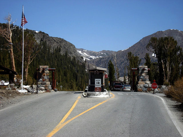
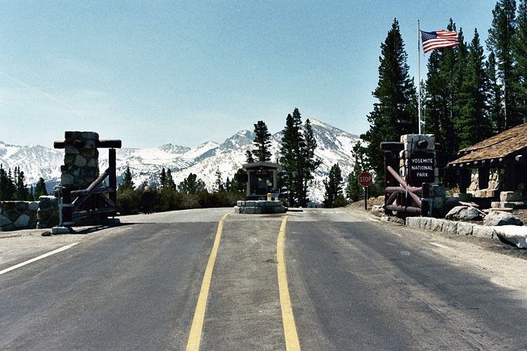
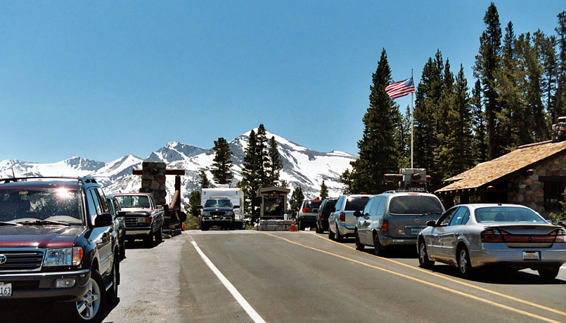
| タイオガ・パス (Tioga Pass) |
|
 |
|
 |
|
 |
|
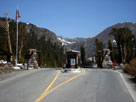
Tioga Pass Entrance
and Tioga Road |
|
Mount Dana
from Tioga Pass |
|
Kuna Crest and Mammoth
Peak from Tioga Pass |
|
|
|
|
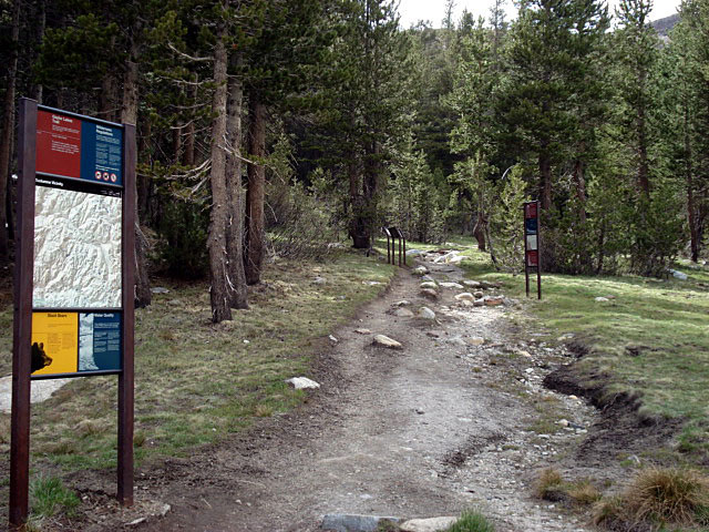
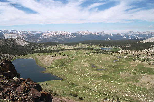
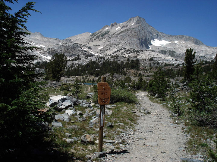
| ゲイラー・レイクス (Gaylor Lakes) - ゲイラー・レイクス・トレイル |
|
 |
|
 |
|
 |
|
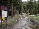
Gaylor Lakes Trailhead
at Tioga Pass |
|
Mammoth Peak, Cathedral
Range, south ridge of Gaylor
Peak and Middle Gaylor Lake |
|
Cathedral Range and
Gaylor Lakes from
Gaylor Peak summit |
|
|
|
|
|
|
|
|
|
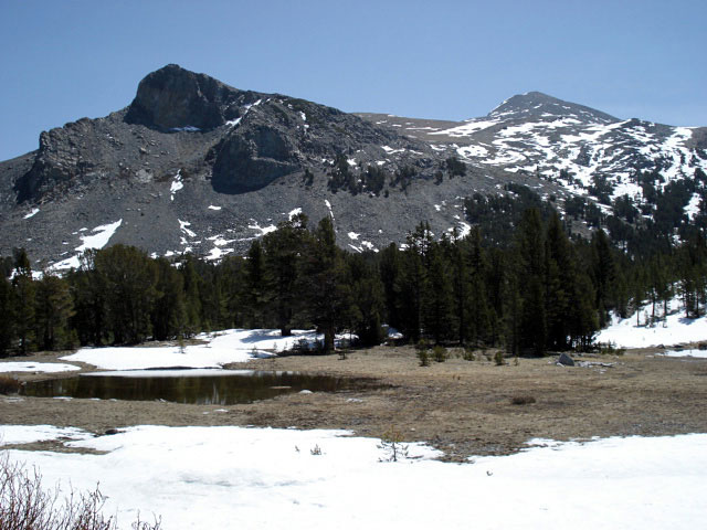
| "ヨセミテの東" ("East of Yosemite") - タイオガ・パスを越えて |
|
 |
|
 |
|
 |
|
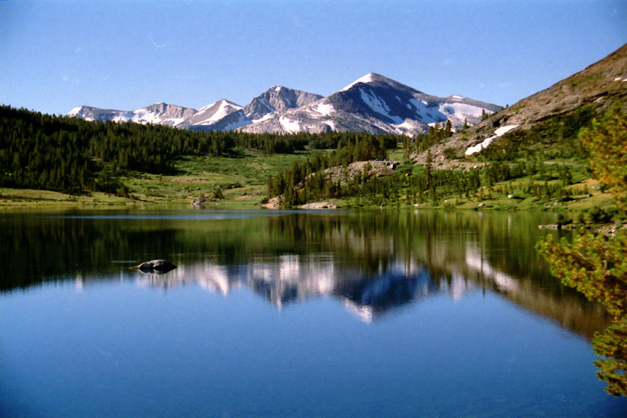
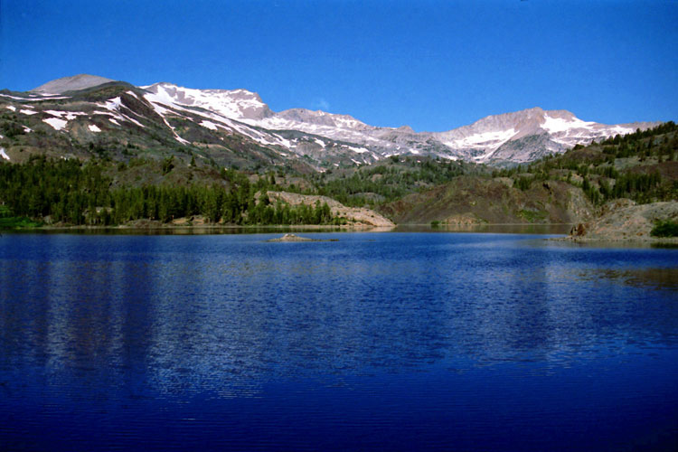
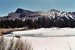
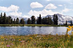
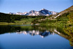
Mammoth Peak, Tioga Pass
and Tioga Lake |
|
White Mountain, Mount
Conness (southeast peak)
and Ellery Lake |
|
North Peak and
20 Lakes Basin Trail
(Hoover Wilderness) |
|
|
|
|
| See also |
|
|
|
|
|
|
|
| ヨセミテ国立公園 (Yosemite National Park) の写真 ON WEB |
|
|
|
|