ITODA.COM イースタン・シエラ フォト・ギャラリー
ミドル・パリセード
 (Middle Palisade)
Original photo collection of sceneries with and around Middle Palisade, a peak on the crest of Sierra Nevada Mountains (Sierra Crest), located on the boundary of John Muir Wilderness in Eastern Sierra and Kings Canyon National Park (Inyo and Fresno Counties, California, USA).

South Fork Big Pine Creek
Forthcoming...

North Fork Trail (North Fork Big Pine Creek Trail, Big Pine Lakes Trail)
Middle Palisade from
North Fork Trail
Middle Palisade and South
Fork Big Pine Creek from
North Fork Trail

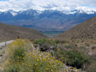
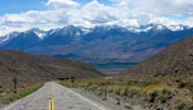
Highway 168 (California State Route 168)
The Palisades (incl. Middle Palisade) from Highway 168

Sierra View - White Mountain Road
Middle Palisade and North Palisade from Sierra View
Middle Palisade
and North Palisade
from Sierra View

White Mountain Road (Cont'd)
Middle Palisade and North Palisade to Mt. Humphreys
from White Mountain Road

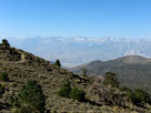
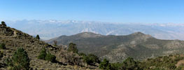
Death Valley Road
Splite Mountain and Middle Palisade from Death Valley Road

ミドル・パリセード (Middle Palisade) の写真 ON WEB
写真
Photo Galleries
Photos
イースタン・シエラ
Areas/Sites
山脈 (Ranges)
山・峰 (Peaks)
ウイリアムソン山
Olancha Peak
カーソン・ピーク
ギブス山
Crown Point
Crystal Crag
ゲイラー・ピーク
コンネス山
Split Mountain
Sawtooth Ridge
Thor Peak
タイオガ・ピーク
Dunderberg Peak
デイナ山
Temple Crag
Tom, Mount
ノース・パリセード
ノース・ピーク
Hurd Peak
Banner Peak
Humphreys, Mount
Bear Creek Spire
Wheeler Ridge
ホイットニー山
ホワイト・マウンテン
White Mountain Peak
マッターホーン・ピーク
Mammoth Crest
マンモス・マウンテン
ミドル・パリセード
Minarets
Morgan, Mount
Morgan, Mount
モリソン山
ラッセル山
ラングレー山
Ritter, Mount
Laurel Mountain
ローン・パイン・ピーク
(Passes)
High Passes
Summits
氷河 (Glaciers)
(Streams)
(Lakes)
High Lakes
峡谷 (Canyons)
渓谷・盆地 (Valleys)
温泉 (Hot Springs)
公園・保護区 (Parks...)
Wilderness Areas
トレイル (Trails)
道路 (Roads)
ハイウェイ (Highways)
Campgrounds
タウン (Towns)

Northern Sierra
Southern Sierra

シエラネバダ山脈

ヨセミテ
Sequoia & Kings Canyon

アメリカの国立公園
カナダの国立公園
[ English | 日本語 ]

ご意見・ご質問は,webmaster@itoda.com 宛にメールをお送りください.
Copyright © 2001-2010, Object Factory, Inc. All rights reserved.