| イースタン・シエラの道路&ハイウェイ |
 |
| (Roads & Highways of Eastern Sierra) |
|
|
|
|
|
|
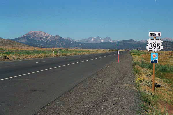
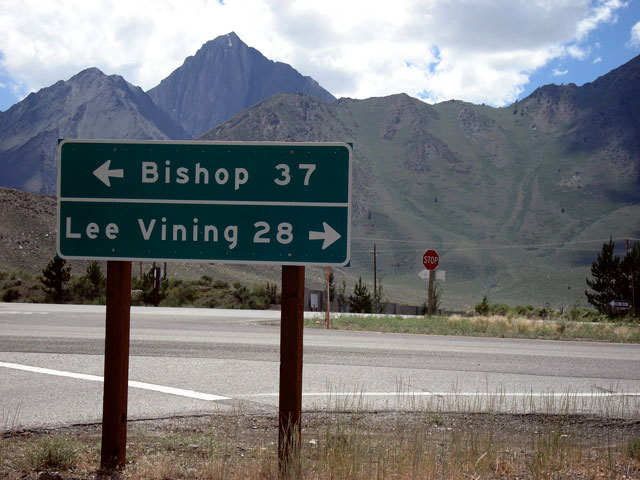
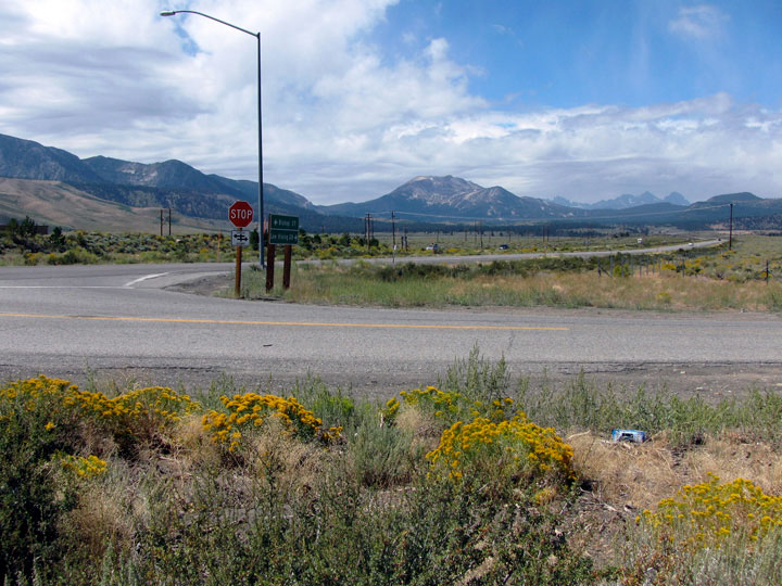
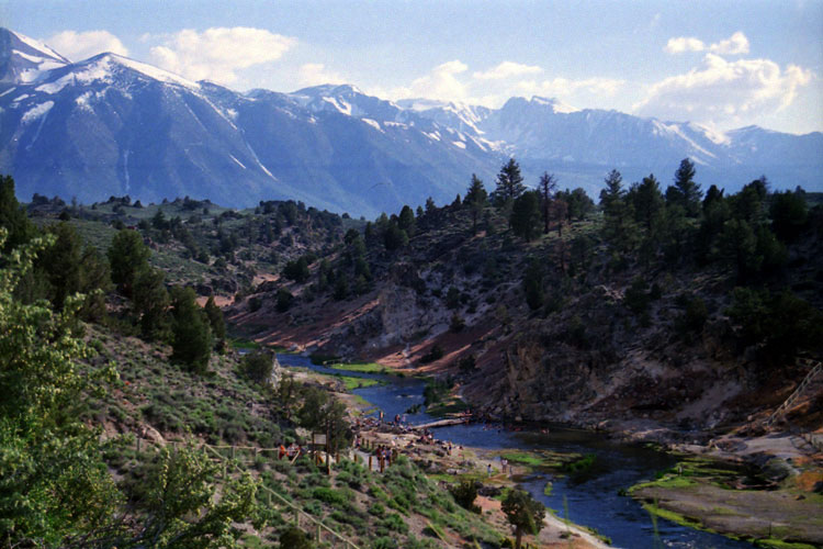
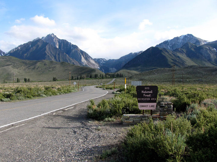
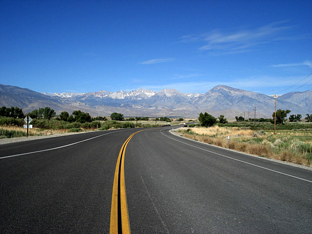
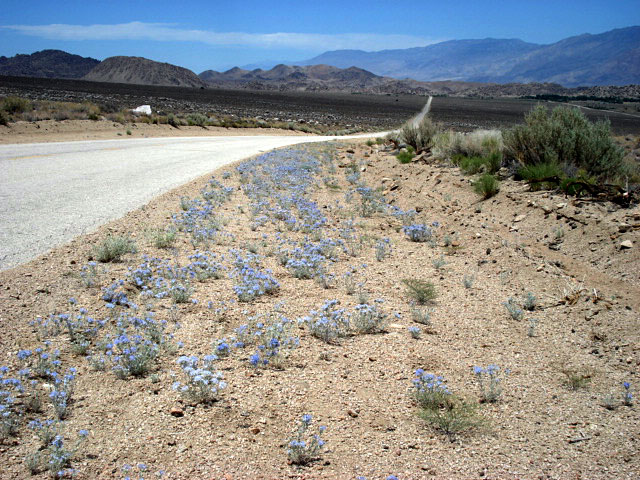
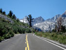
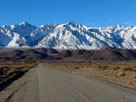
| Highway 395 (U.S. Route 395) |
|
 |
|
 |
|
 |
|
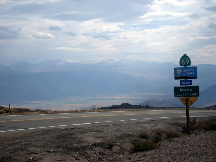
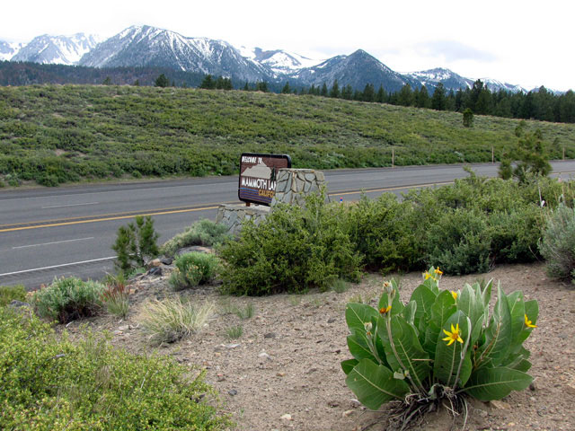
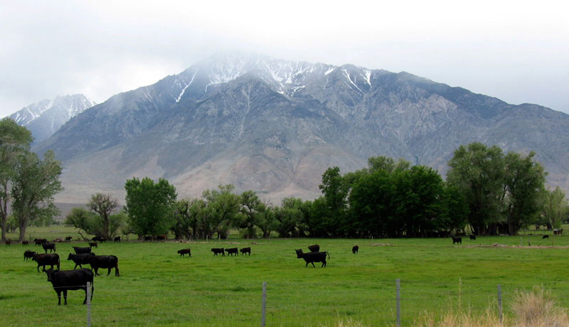
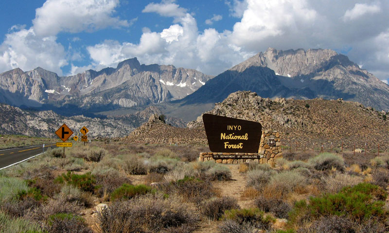
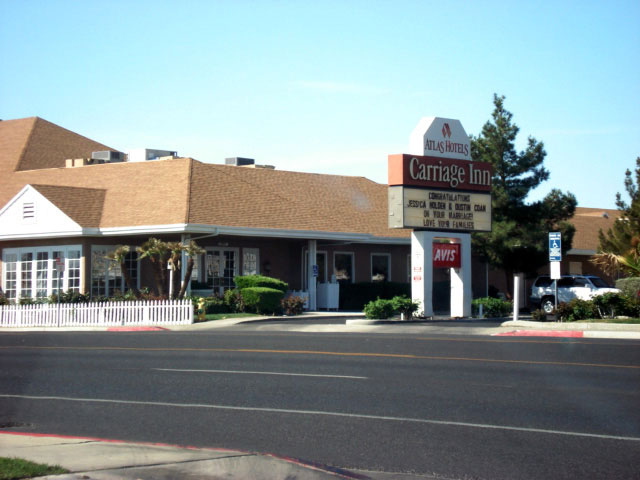
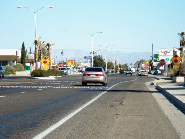
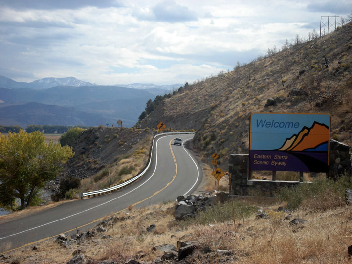
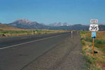
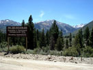
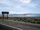
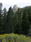
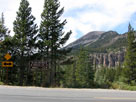
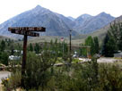
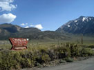
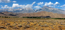
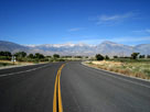
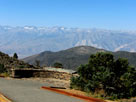
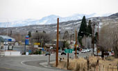
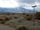
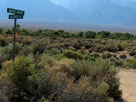
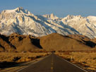
North end of Eastern
Sierra Scenic Byway
near Topaz Lake |
|
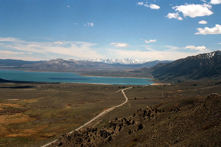
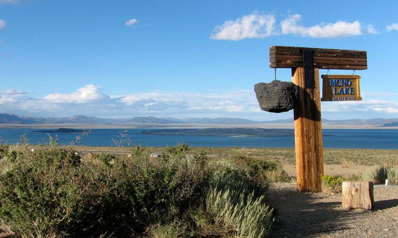
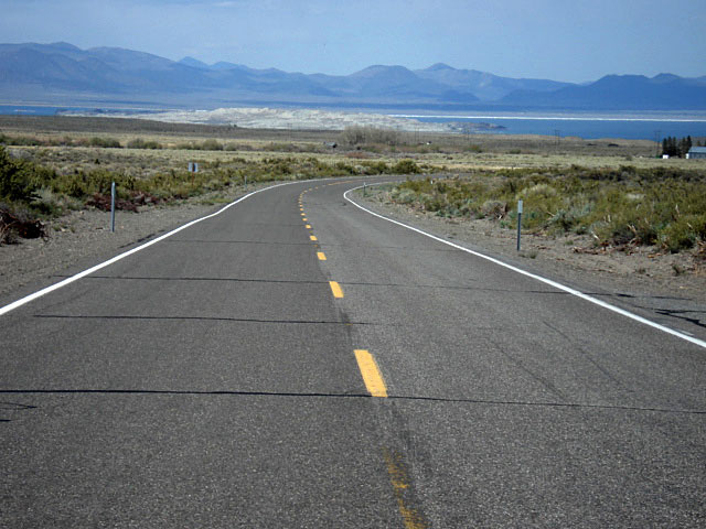
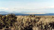
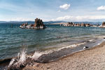
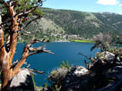
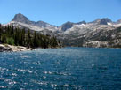
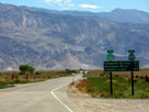
Mono Lake and Highway
395 from Mono Lake Vista
near Conway Summit |
|
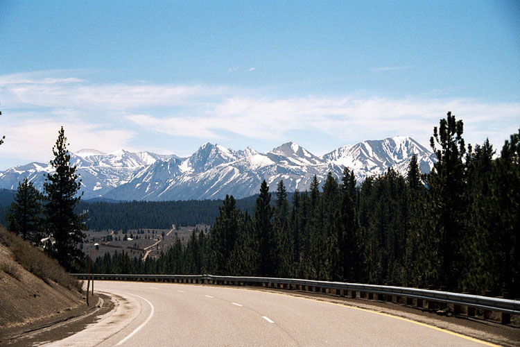
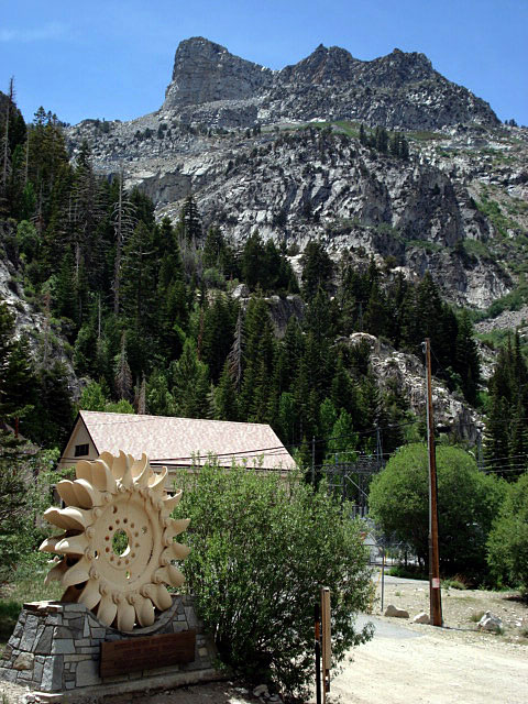
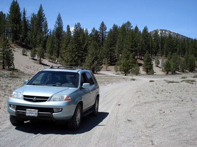
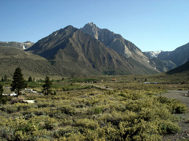
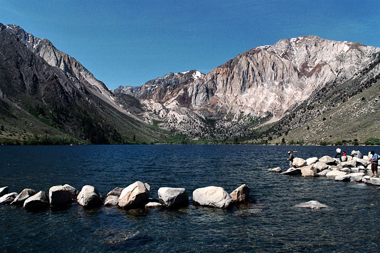
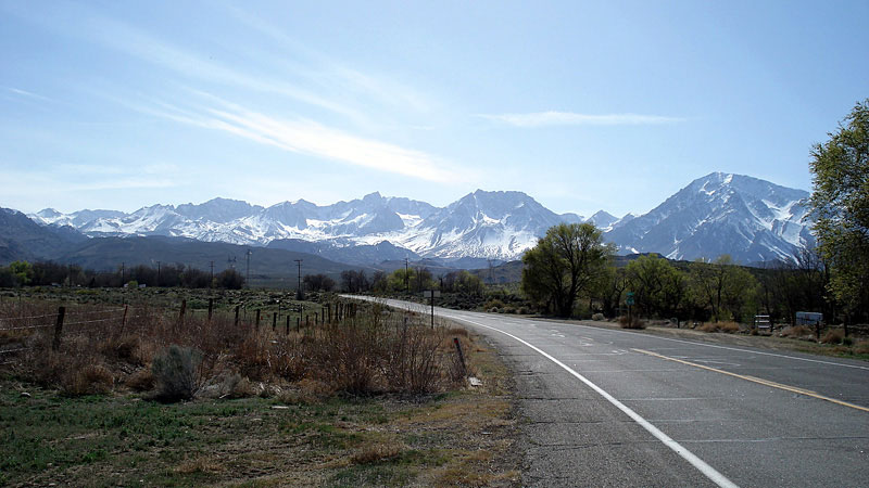
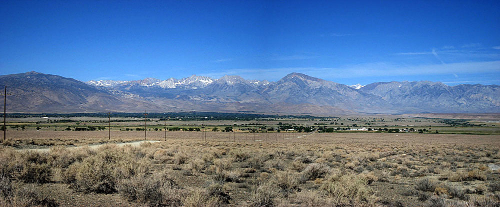
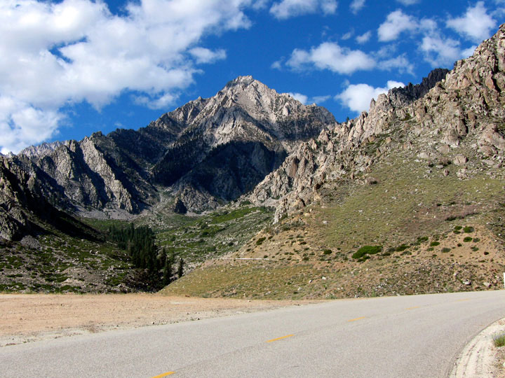
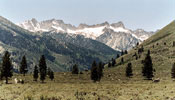
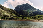
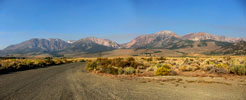
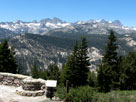
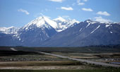
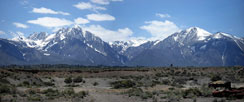
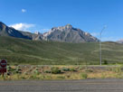
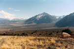
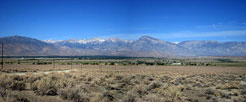
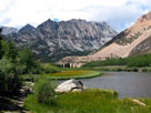
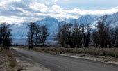
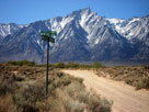
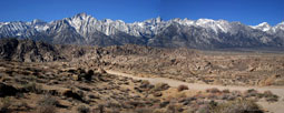
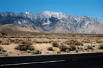
Mount Morrison
and Laurel Mountain |
|
|
 |
|
 |
|
 |
|
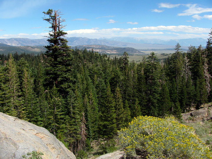
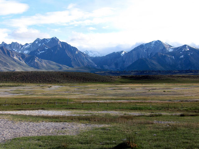
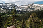
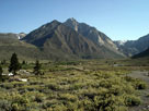
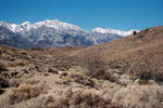
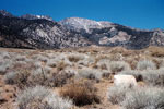
Mammoth Mountain
and Ritter Range |
|
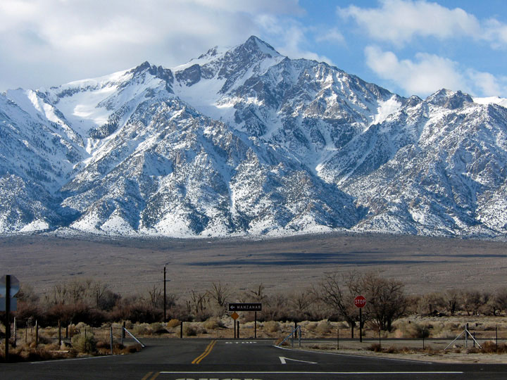
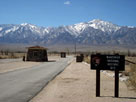
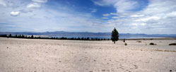
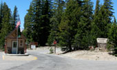
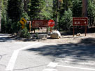
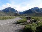
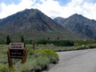
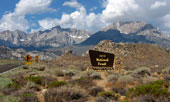
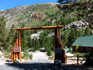
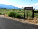
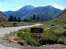
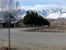
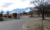
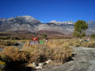
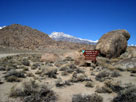
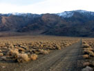
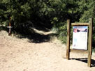
Manzanar National
Historic Site entrance |
|
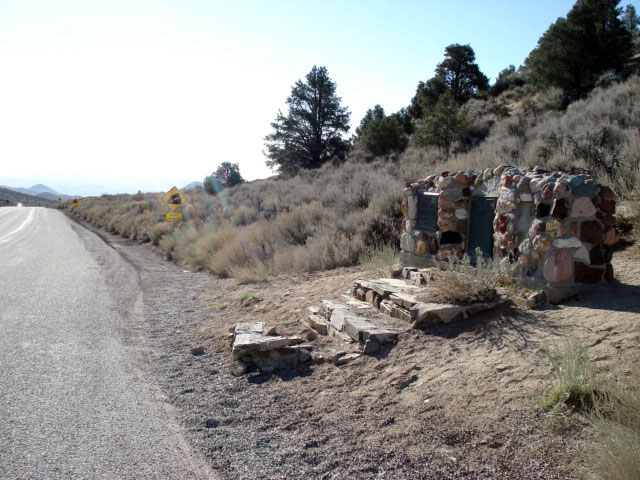
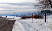
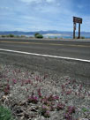
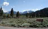
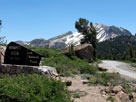
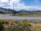
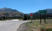
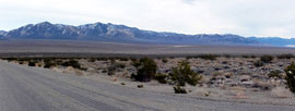
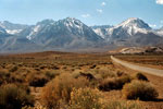
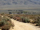
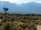
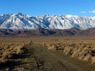
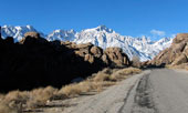
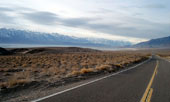
South end of Eastern
Sierra Scenic Byway
near Little Lake |
|
|
|
|
|
|
|
|
|
|
|
|
|
|
|
|
|
|
|
|
|
|
|
|
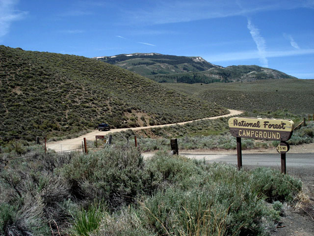
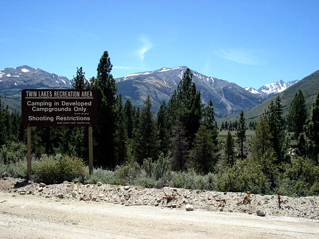
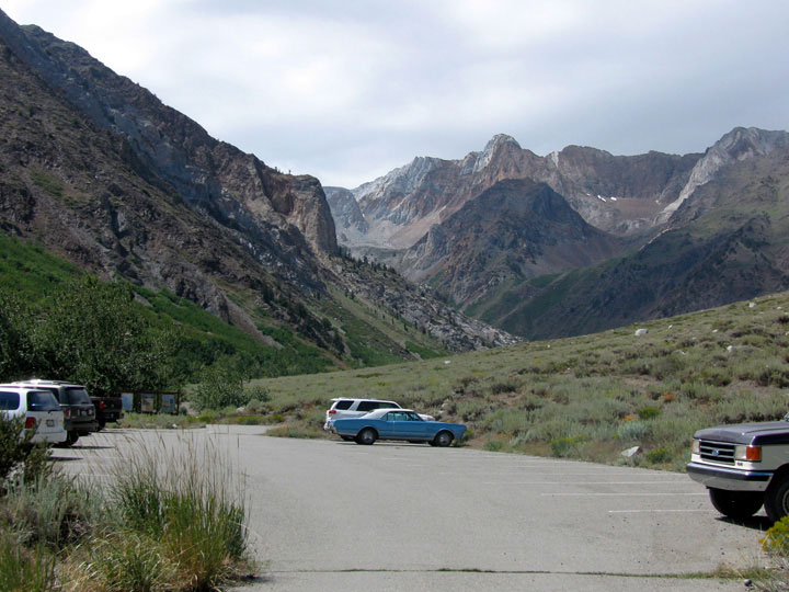
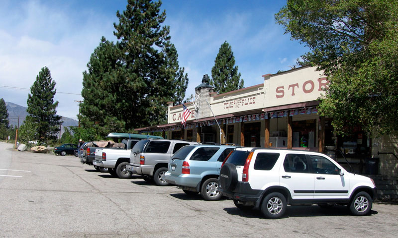
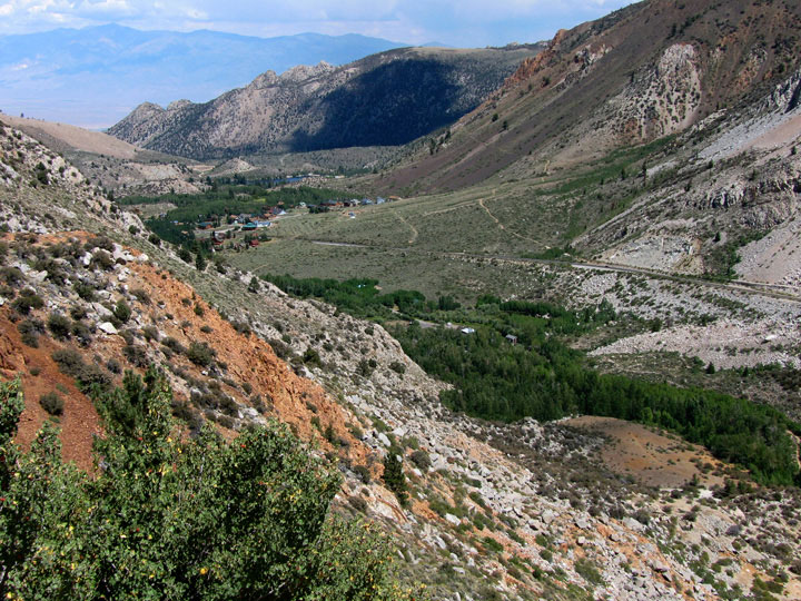
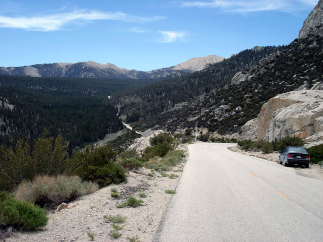
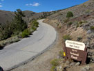
| Twin Lakes Road |
|
 |
|
 |
|
 |
|
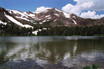
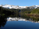
Matterhorn Peak and Sawtooth
Ridge from Twin Lakes Road |
|
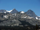
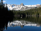
Crater Crest and
Matterhorn Peak |
|
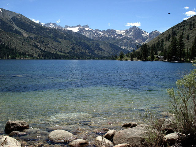
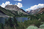
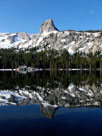
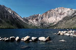
Sawtooth Ridge
and Lower Twin Lake |
|
|
|
|
|
|
|
|
|
|
|
|
|
|
|
|
|
|
|
|
|
|
|
|
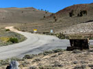
| Virginia Lakes Road |
|
 |
|
 |
|
 |
|
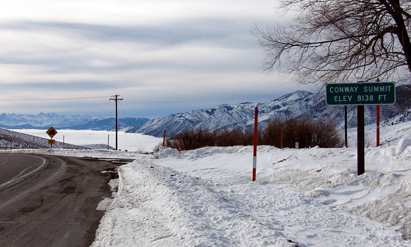
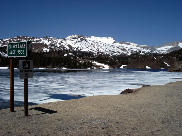
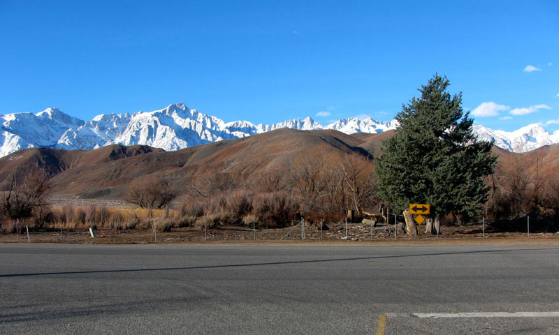
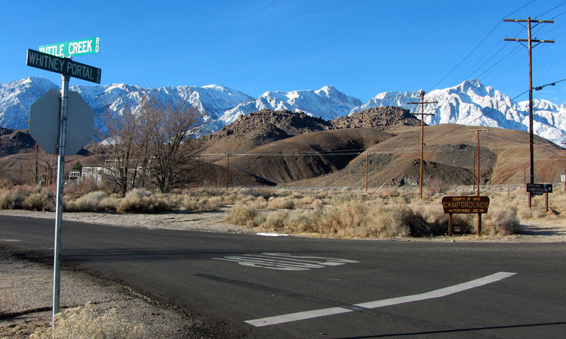
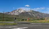
Conway Summit and Highway 395
(Virginia Lakes Road junction) |
|
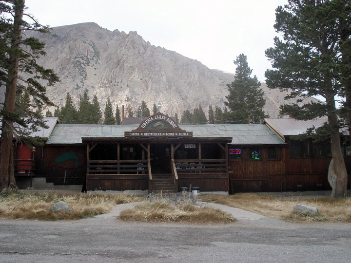
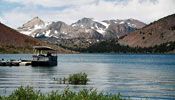
Virginia Lakes Resort
near Little Virginia Lake
off Virginia Lakes Road |
|
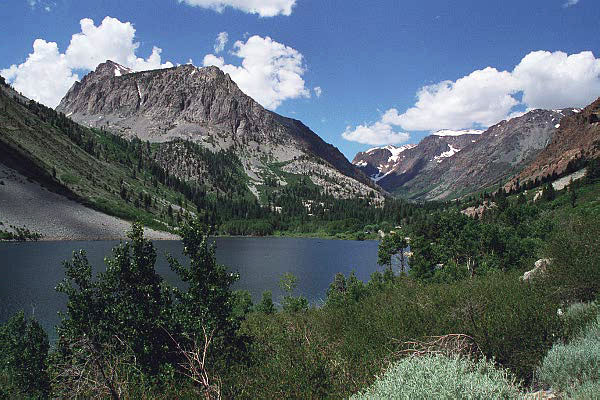
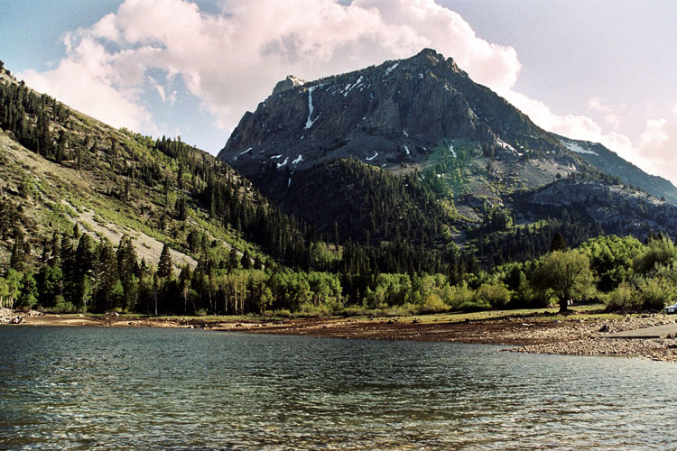
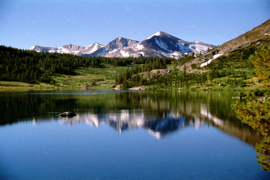
Black Mountain
and Big Virginia Lake
(Big Valley Lake) |
|
|
|
|
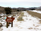
| Lundy Lake Road |
|
 |
|
 |
|
 |
|
Gilcrest Peak and
Lundy Lake (Lundy Canyon) |
|
Gilcrest Peak
and Lundy Lake |
|
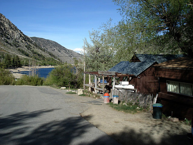
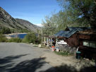
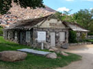
Lundy Lake Resort |
|
|
|
|
|
|
|
|
|
|
|
|
|
|
| Vista Point Drive |
|
 |
|
 |
|
Mono Lake from vista point along Vista Point Drive
off Tioga Pass Road (CA 120) |
|
|
|
|
|
|
|
|
|
| Saddlebag Lake Road |
|
 |
|
 |
|
 |
|
White Mountain,
Lee Vining Creek and
Saddlebag Lake Road |
|
White Mountain and
Mount Conness from
Saddlebag Lake Road |
|
Shepherd Crest,
Excelsior Mountain
and Saddlebag Lake |
|
|
|
|
| Picnic Grounds Road |
|
 |
|
|
|
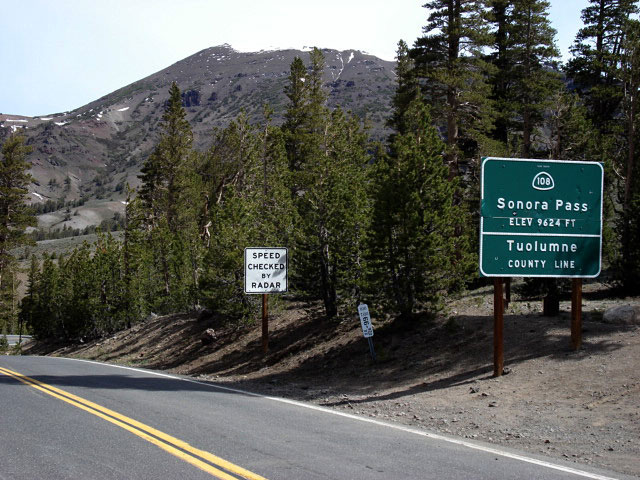
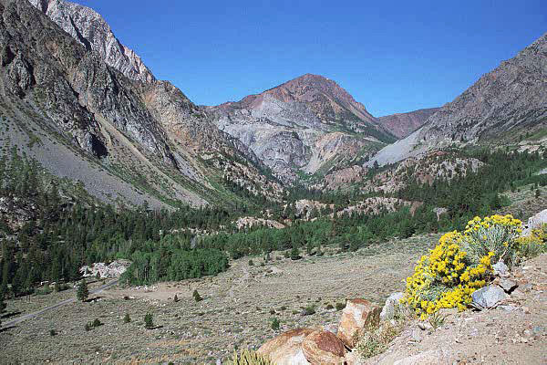
Mt. Wood, Mt. Lewis, Mono Pass, Mt. Gibbs
and Mt. Dana from Picnic Grounds Road |
|
|
|
|
|
|
|
|
|
|
|
|
|
|
|
| Test Station Road |
|
 |
|
 |
|
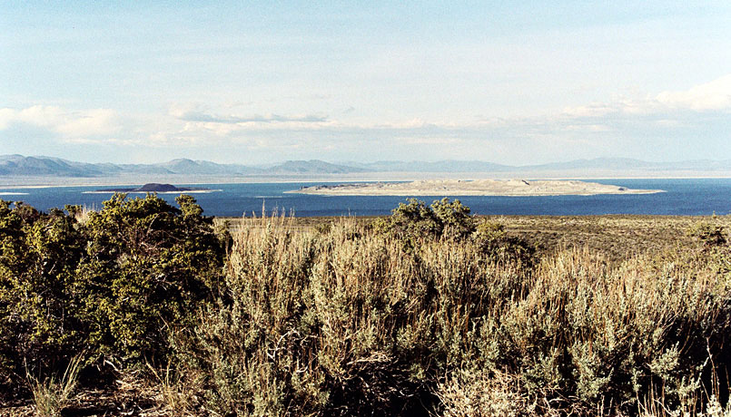
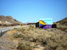
Mono Lake and
Highway 120 (Test
Station Road junction) |
|
Mono Lake Tufa State
Natural Reserve |
|
|
|
|
|
|
|
|
|
|
|
|
|
|
| Highway 120 (California State Route 120) East |
|
 |
|
 |
|
 |
|
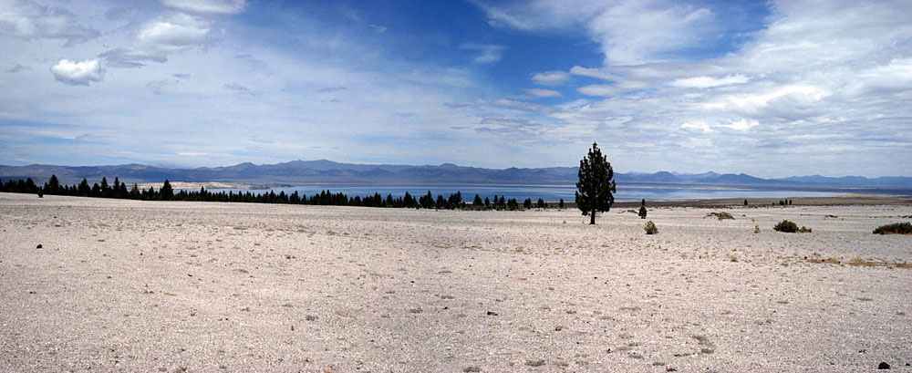
Mono Lake from
Highway 120 |
|
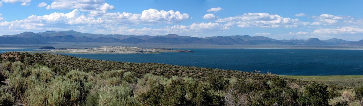
Mono Lake (Mono Basin National
Scenic Area) from Highway 120 |
|
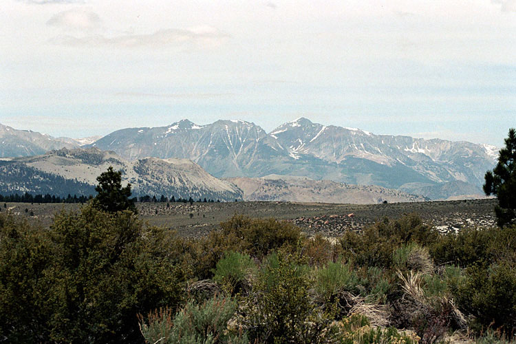
Mt. Gibbs and Mt. Dana
from Sagehen Summit |
|
|
|
|
|
|
|
|
|
| Viewpoint Road |
|
 |
|
Mono Lake from vista point along Viewpoint Road
off Highway 395 north |
|
|
|
|
|
|
|
|
|
| Northshore Drive |
|
 |
|
 |
|
 |
|
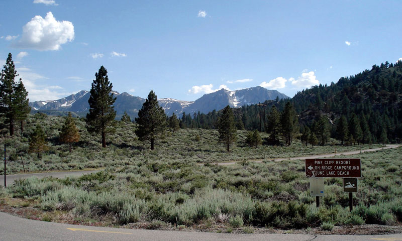
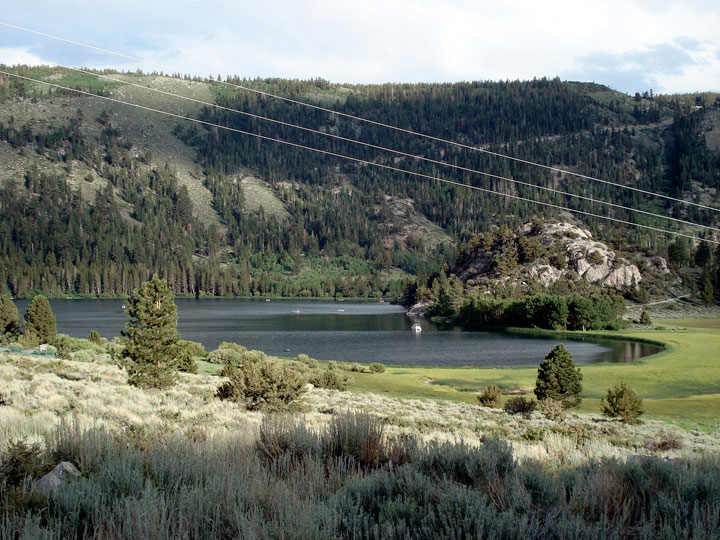
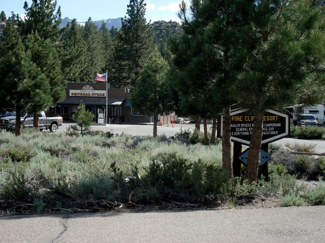
Pine Cliff Road
from Northshore Drive |
|
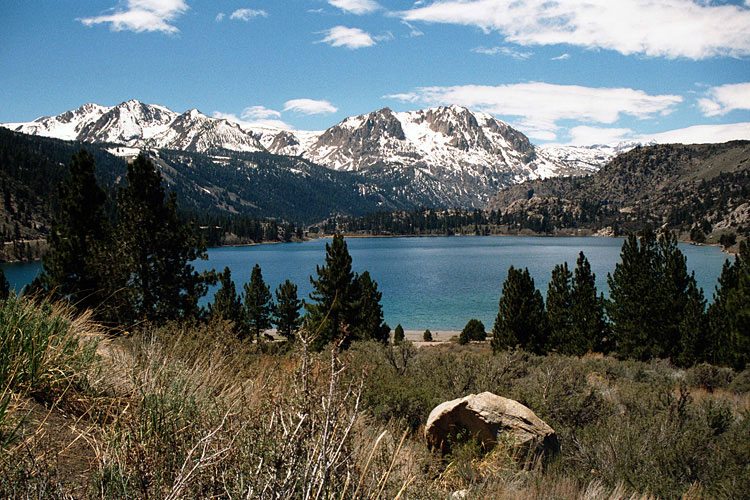
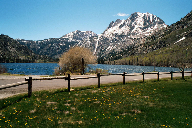
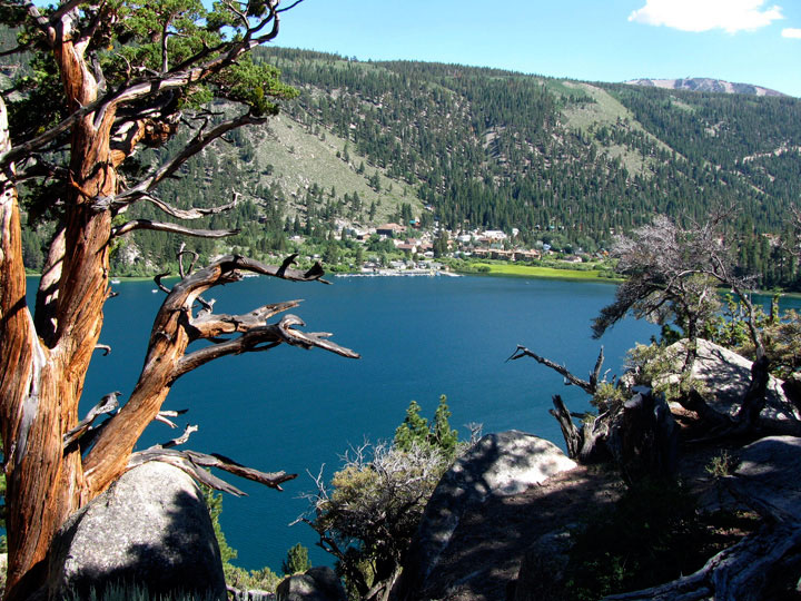
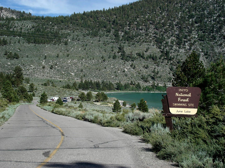
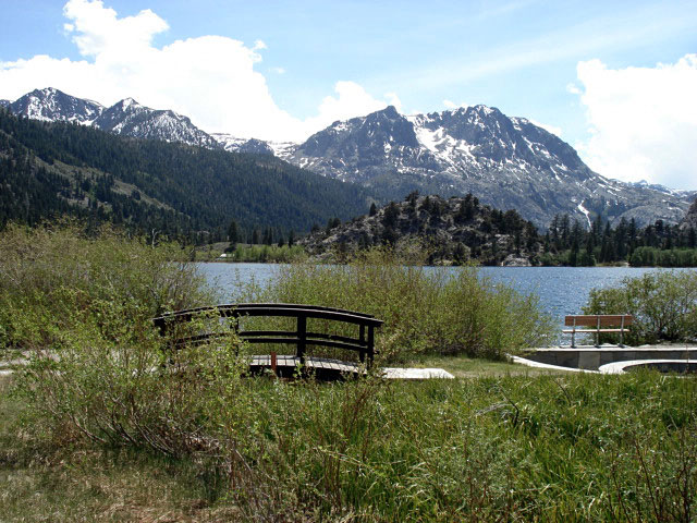
June Lake from
Northshore Drive |
|
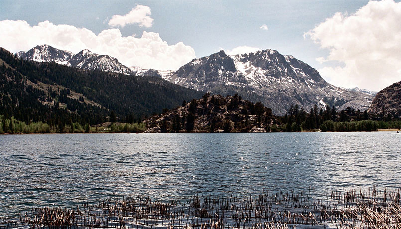
Gull Lake from
Northshore Drive |
|
|
|
|
|
|
|
|
|
|
|
|
|
|
|
|
|
|
|
|
|
|
|
|
|
|
|
|
|
|
|
|
|
|
|
|
|
|
|
| Highway 203 (California State Route 203) |
|
 |
|
 |
|
 |
|
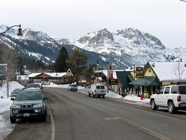
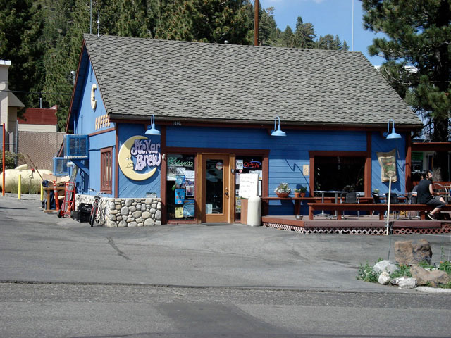
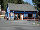
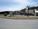
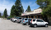
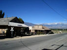
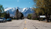
| Highway 203 to Mammoth Lakes |
|
Stellar Brew & Deli
on Main Street (CA 203),
Mammoth Lakes |
|
|
|
|
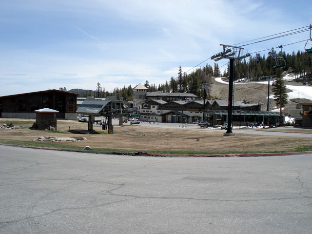
| Minaret Road (California State Route 203) |
|
 |
|
 |
|
 |
|
Minaret Road through
Mammoth Mountain
Ski Area |
|
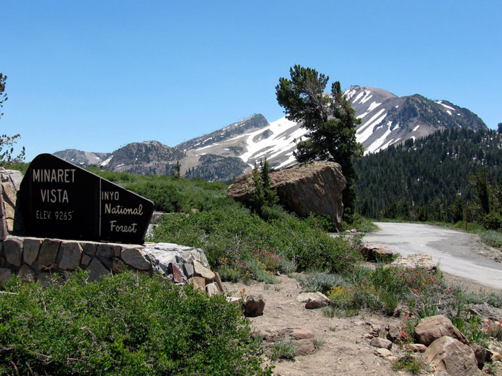
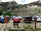
Minaret Vista Station at Minaret
Summit and Minaret Summit
Road from Minaret Road |
|
Mammoth Mountain
and Minaret Road
from Minaret Summit |
|
|
|
|
|
|
|
|
|
| Lookout Point Road |
|
 |
|
 |
|
 |
|
Mammoth Mountain and
Lookout Point Road
from Minaret Vista |
|
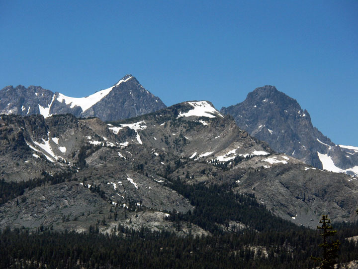
Ritter Range
from Minaret Vista |
|
Mount Ritter
and Banner Peak |
|
|
|
|
| Minaret Summit Road |
|
 |
|
 |
|
 |
|
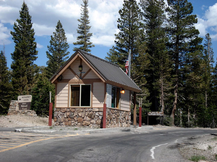
Minaret Vista Station
from Minaret Summit Rd |
|
Minaret Summit Road
and Devils Postpile Road
to Devils Postpile
National Monument |
|
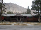
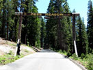
Red's Meadow Resort
entrance (Minaret
Summit Roadend) |
|
|
|
|
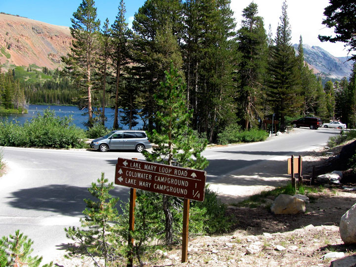
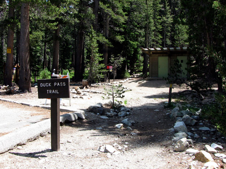
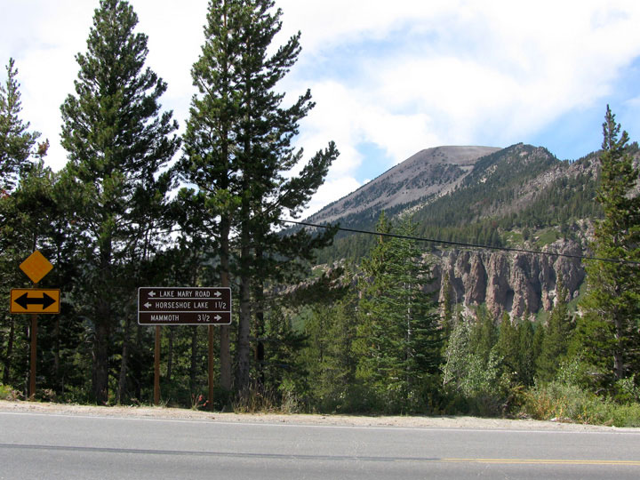
| Lake Mary Road |
|
 |
|
 |
|
 |
|
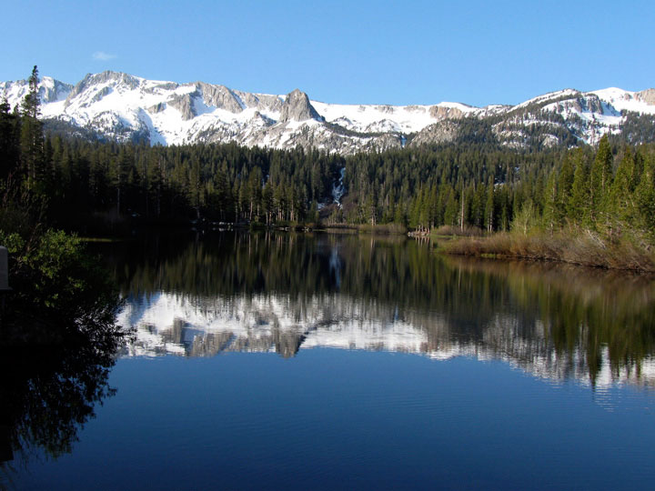
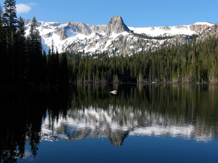
Mammoth Crest and Twin
Lakes from Twin Lakes
Vista off Lake Mary Road |
|
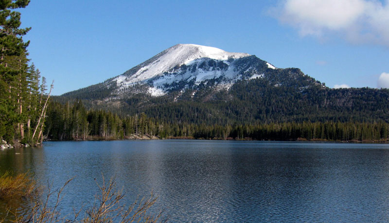
Lake Mamie |
|
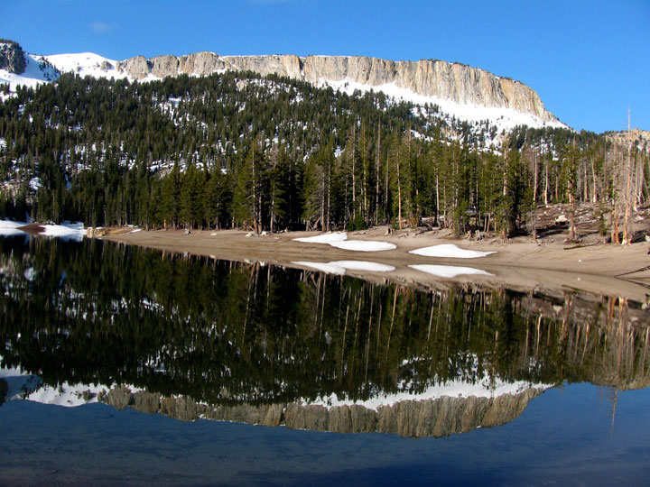
Mammoth Crest
and Horseshoe Lake
(Lake Mary Roadend) |
|
|
|
|
|
|
|
|
|
| Lake George Road |
|
 |
|
 |
|
 |
|
Lake George Road from
Lake Mary Loop Road |
|
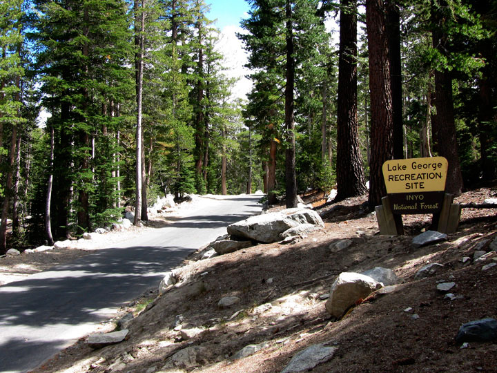
Lake George Road into
Lake George Recreation Site |
|
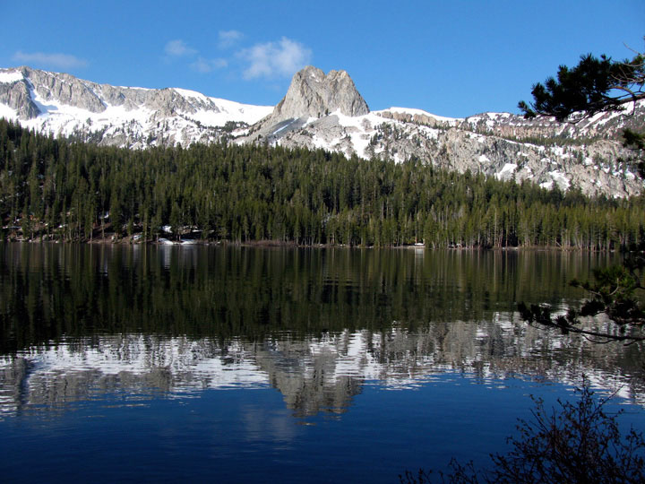
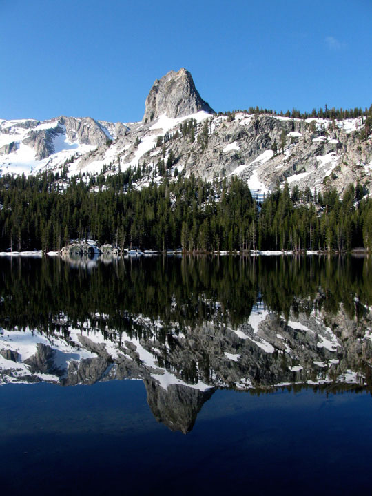
Crystal Crag
and Lake George |
|
|
|
|
|
|
|
|
|
| Old Mammoth Road |
|
 |
|
 |
|
 |
|
|
Mammoth Rock from
Old Mammoth Road |
|
Mammoth Mountain
and Lake Mary Road
from Old Mammoth Road |
|
|
|
|
|
|
|
|
|
|
|
|
|
|
| Hot Creek Hatchery Road |
|
 |
|
 |
|
 |
|
Mount Morrison and
Highway 395 from
Hot Creek Hatchery Road |
|
Mammoth Mountain, Ritter
Range, Highway 395 and
Hot Creek Hatchery Road |
|
Hot Creek |
|
|
|
|
| Owens River Road |
|
 |
|
 |
|
Mount Morgan and
Owens River Road |
|
Mount Morrison and Laurel Mountain
from Owens River Road |
|
|
|
|
| Convict Lake Road |
|
 |
|
 |
|
 |
|
Mount Morrison,
Laurel Mountain and
Convict Lake Road |
|
Mount Morrison,
Convict Lake Campground
and Convict Lake Road |
|
Laurel Mountain
and Convict Lake |
|
|
|
|
| Benton Crossing Road |
|
 |
|
 |
|
 |
|
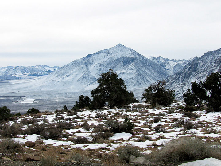
Mount Morrison and
Highway 395 from
Benton Crossing Road |
|
Laurel Mountain
and Highway 395 |
|
Mount Morrison and
Laurel Mountain from
Hilltop Hot Spring
off Benton Crossing Road |
|
|
|
|
| McGee Creek Road |
|
 |
|
 |
|
 |
|
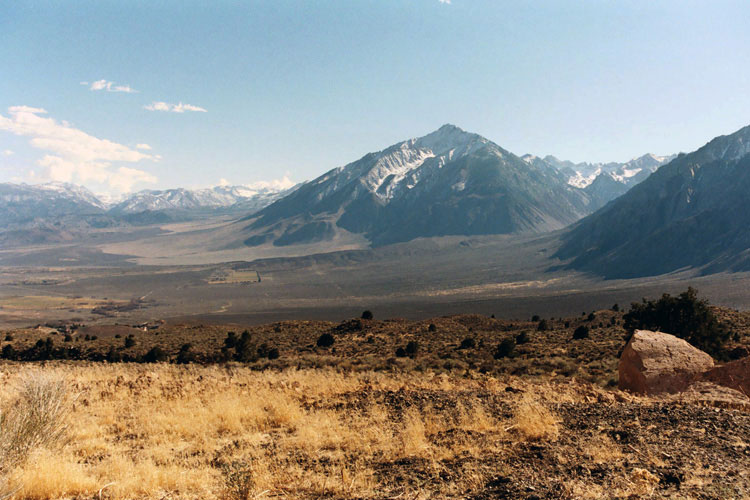
Mount Morgan, Mount
Stanford(?) and McGee
Creek Road from
Crowley Lake Drive |
|
Mount Morgan and McGee
Creek Campground from
McGee Creek Road |
|
Mount Baldwin and
McGee Pass Trailhead
(McGee Creek Roadend) |
|
|
|
|
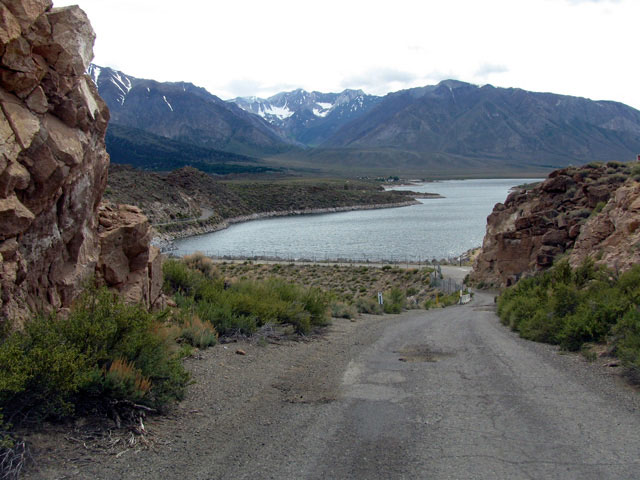
| Crowley Lake Drive |
|
 |
|
 |
|
 |
|
Mt. Morgan and Crowley
Lake Campground from
Crowley Lake Drive |
|
Lake Crowley from
Crowley Lake Drive |
|
Tom's Place and
Crowley Lake Drive |
|
|
|
|
|
|
|
|
|
| Owens Gorge Road |
|
 |
|
 |
|
 |
|
Rock Creek Road and Highway
395 from Owens Gorge Road |
|
Mount Ritter and Banner
Peak from Owens Gorge
Road near Highway 395 |
|
Lake Crowley and
Owens Gorge Road |
|
|
|
|
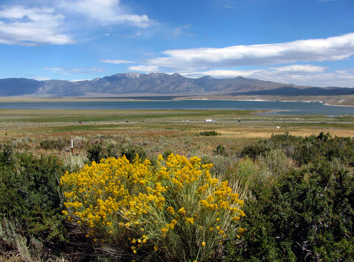
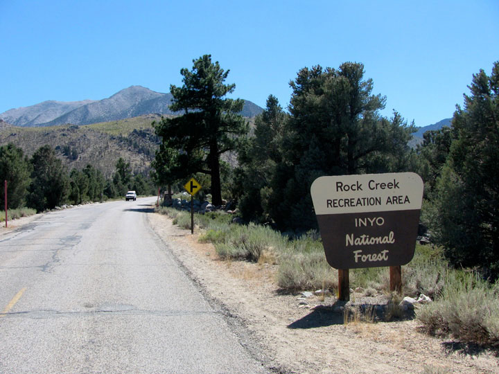
| Rock Creek Road |
|
 |
|
 |
|
 |
|
Rock Creek Road into
Rock Creek Recreation Area |
|
Wheeler Crest and
Rock Creek Lake from
Rock Creek Road |
|
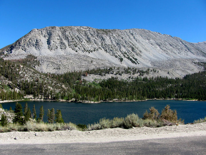
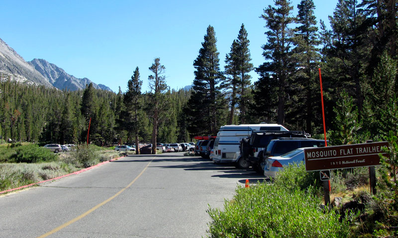
Mosquito Flat
(Rock Creek Roadend) |
|
|
|
|
| Lower Rock Creek Road (Old Sherwin Grade Road) |
|
 |
|
 |
|
 |
|
| Mount Tom from Lower Rock Creek Road |
|
Mount Humphreys, Basin
Mountain, Mount Tom
and Lower Rock Creek Road |
|
|
|
|
|
|
|
|
|
|
|
|
|
|
|
|
|
|
|
|
|
|
|
|
|
|
|
|
|
| Ed Powers Road |
|
 |
|
|
 |
|
Mount Humphreys, Basin
Mountain and Mount Tom from
Ed Powers Road off Highway 395 |
|
|
|
|
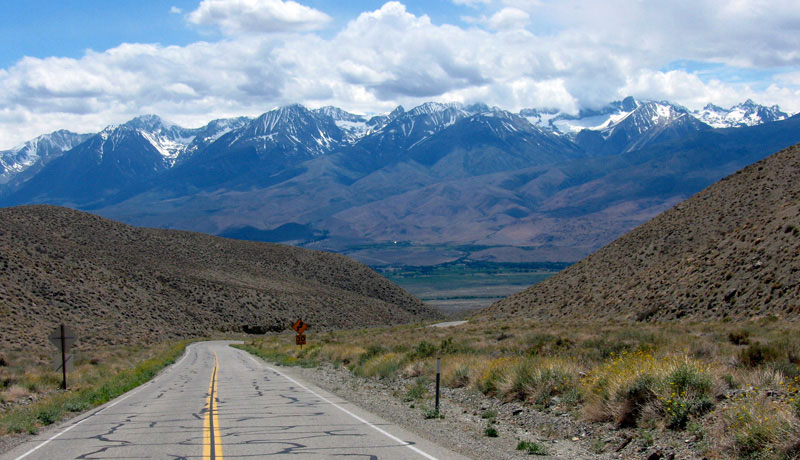
| Highway 6 (U.S. Route 6) |
|
 |
|
 |
|
 |
|
White Mountain Peak and
Highway 6 from Wye Road, Bishop |
|
White Mountains
and Highway 6 |
|
Sierra Nevada Mountains
and Highway 6 |
|
|
|
|
| Silver Canyon Road |
|
 |
|
 |
|
Laws Railroad Museum
and Silver Canyon Road |
|
Sierra Nevada Mountains
from Silver Canyon Road |
|
|
|
|
| Highway 168 (California State Route 168) West |
|
 |
|
 |
|
 |
|
Mount Tom from West Line
Street (CA 168), Bishop |
|
Mount Humphreys and Basin
Mountain from Highway 168 |
|
Highway 168 (west)
above Jawbone Canyon |
|
|
|
|
| Buttermilk Road |
|
 |
|
|
|
Basin Mountain, Mount Tom
and Buttermilk Road
off Highway 168 |
|
|
|
|
|
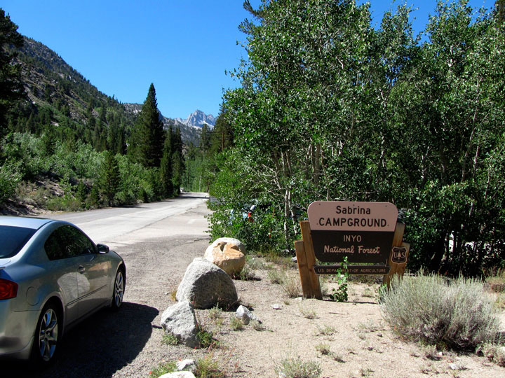
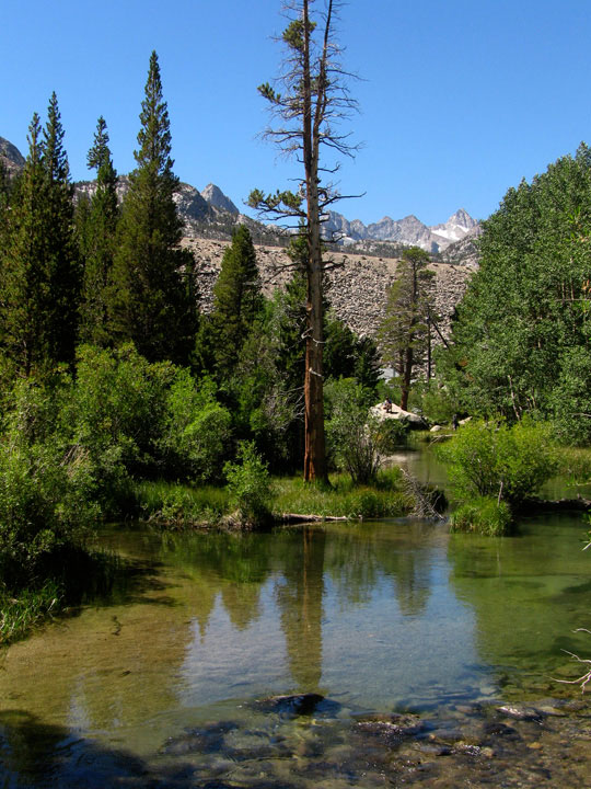
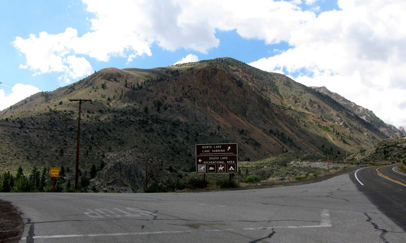
| North Lake Road |
|
 |
|
 |
|
 |
|
Aspendell, Jawbone
Canyon and Highway 168
from North Lake Road |
|
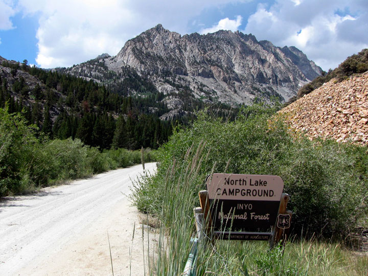
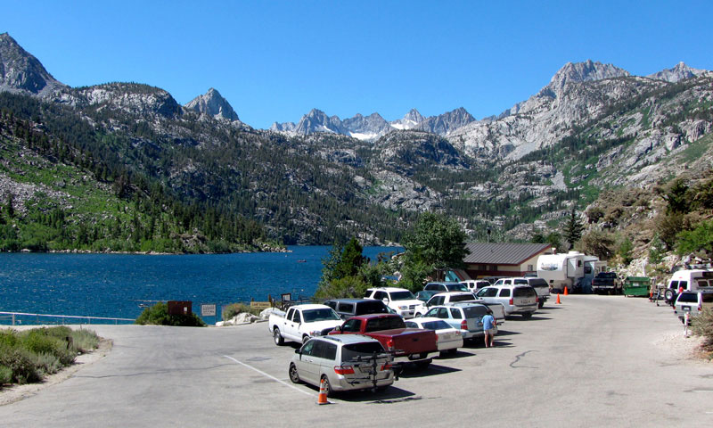
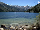
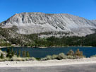
North Lake |
|
North Lake Road into
North Lake Campground |
|
|
|
|
|
|
|
|
|
| South Lake Road |
|
 |
|
 |
|
 |
|
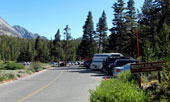
South Lake Road
and Highway 168 |
|
Parchers Resort entrance
from South Lake Road |
|
South Lake from
Bishop Pass Trailhead
(South Lake Roadend) |
|
|
|
|
|
|
|
|
|
|
|
|
|
|
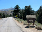
| Keough Hot Springs Road |
|
 |
|
 |
|
 |
|
Keough Hot Springs Road
off Highway 395 |
|
Keough's Hot
Springs |
|
Old bath house,
Keough Hot Springs |
|
|
|
|
|
|
|
|
|
| White Mountain Road |
|
 |
|
 |
|
 |
|
|
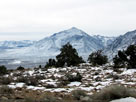
Sierra Nevada Mountains
from Sierra View |
|
Ancient Bristlecone
Scenic Byway |
|
Schulman Grove Visitor
Center entrance |
|
|
|
|
|
|
|
|
|
|
|
|
|
|
|
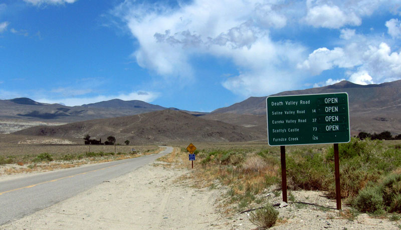
| Death Valley Road (Loretta Mine Road) |
|
|
|
|
 |
|
 |
|
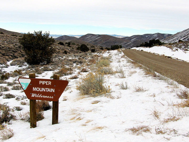
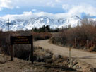
Death Valley Road
and Piper Mountain
Wilderness (left side)
|
|
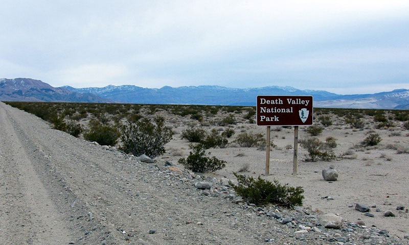
Last Chance Range and Eureka Valley
from Death Valley Road (Loretta Mine Road) |
|
|
|
|
|
|
|
|
|
|
|
|
|
|
| South Eureka Road |
|
|
|
|
 |
|
 |
|
South Eureka Road
off Death Valley Road |
|
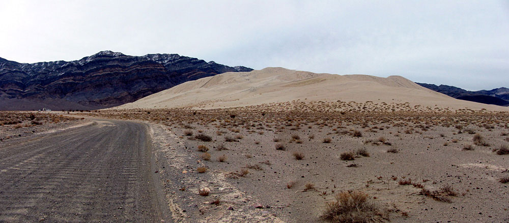
Last Chance Range and
Eureka Sand Dunes (Eureka Dunes)
from South Eureka Road |
|
|
|
|
|
|
|
|
|
| Baker Creek Road |
|
 |
|
 |
|
 |
|
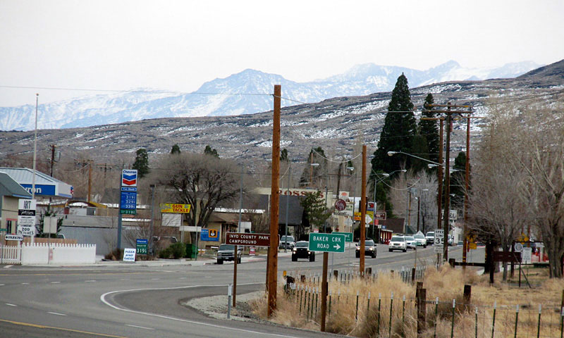
Big Pine and Highway 395 (south)
from Baker Creek Road |
|
Baker Creek Road off
Highway 395, Big Pine |
|
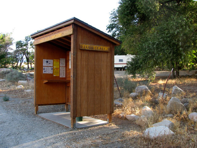
Baker Creek Campground
(Baker Creek
Recreation Site) |
|
|
|
|
| Glacier Lodge Road |
|
 |
|
 |
|
 |
|
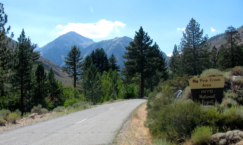
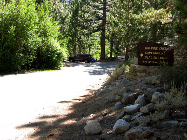
Glacier Lodge Road into Big
Pine Creek Recreation Area |
|
Mt. Gayley(?), Mt. Alice(?)
and Glacier Lodge Road |
|
Glacier Lodge Roadend
(Big Pine Creek Trailhead) |
|
|
|
|
|
|
|
|
|
| Fish Springs Road |
|
|
|
|
 |
|
|
|
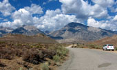
Mount Tinnmaha, Birch
Mountain and Tinnemaha
Road from Fish Springs Road |
|
|
|
|
|
| Birch Creek Road |
|
|
|
|
 |
|
|
|
Mount Tinnmaha, Birch
Mountain and Birch Creek
Road from Tinnemaha Road |
|
|
|
|
|
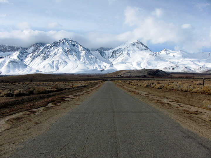
| Tinnemaha Road (Tinemaha Road) |
|
|
|
|
 |
|
 |
|
 |
|
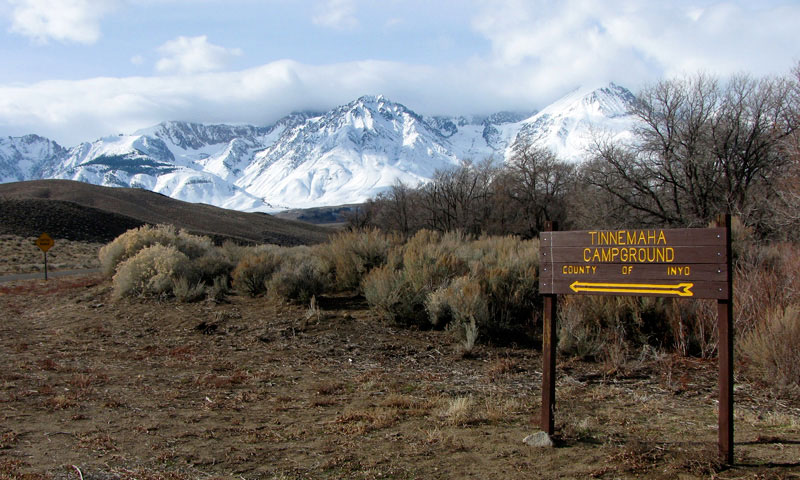
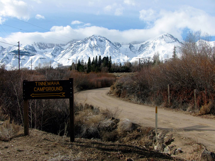
Tinnemaha Campground
(Tinemaha Campground)
from Tinnemaha Road
(Tinemaha Road) |
|
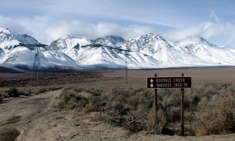
Mount Williamson,
Taboose Campground
and Tinnemaha Road |
|
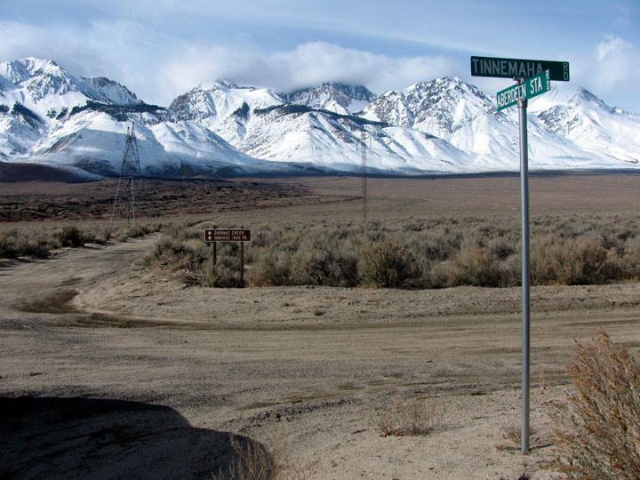
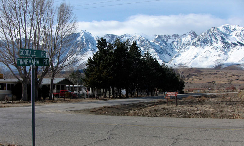
Aberdeen, Goodale Road
and Tinnemaha Road |
|
|
|
|
| Fuller Road |
|
|
|
|
 |
|
 |
|
 |
|
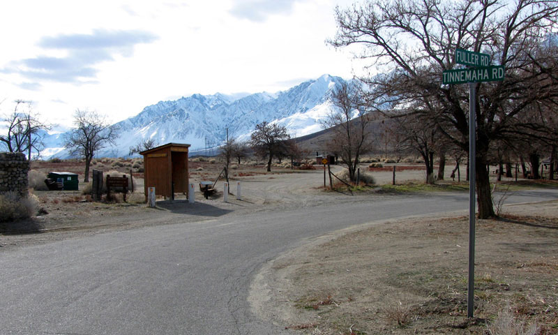
Tinnemaha Campground
and Fuller Road
from Tinnemaha Road |
|
Split Mountain, Mount Tinemaha, Birch Mountain
and Fuller Road |
|
|
|
|
|
|
|
|
|
| Taboose Creek Road |
|
|
|
|
 |
|
|
|
Split Mountain (in clouds),
Mount Tinemaha and Taboose
Creek Road from Tinnemaha Road |
|
|
|
|
|
| Goodale Road |
|
|
|
|
 |
|
 |
|
 |
|
Aberdeen, Goodale Road
and Tinnemaha Road |
|
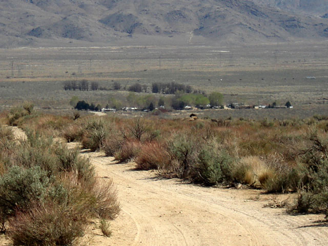
Goodale Mountain and
Goodale Creek Campground |
|
Aberdeen and
Goodale Road |
|
|
|
|
|
|
|
|
|
|
|
|
|
|
| Onion Valley Road |
|
 |
|
 |
|
 |
|
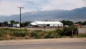
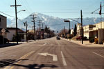
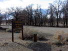
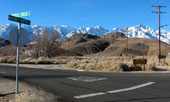
West Market Street (Onion
Valley Road) off Highway 395,
Independence |
|
Independence Peak and
Onion Valley Road |
|
Onion Valley
(Onion Valley Roadend) |
|
|
|
|
|
|
|
|
|
|
|
|
|
|
|
|
|
|
|
| Moffat Ranch Road |
|
|
|
|
 |
|
 |
|
 |
|
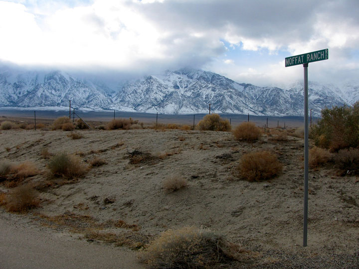
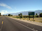
Moffat Ranch Road
off Highway 395 |
|
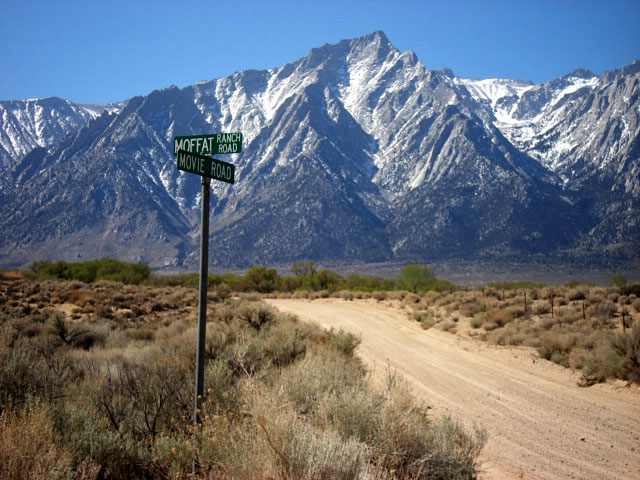
Lone Pine Peak
and Movie Road from
Moffat Ranch Road |
|
Mount Williamson from
Moffat Ranch Roadend |
|
|
|
|
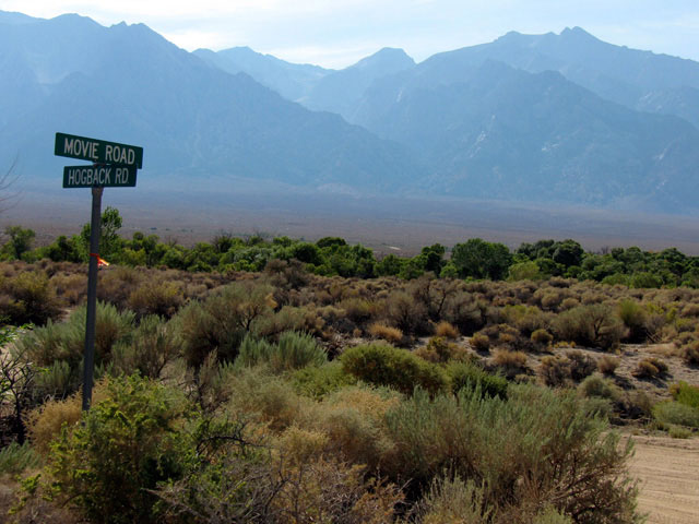
| Hogback Road |
|
|
|
|
 |
|
 |
|
Mount Williamson
from Hogback Road/
Movie Road junction |
|
|
|
|
|
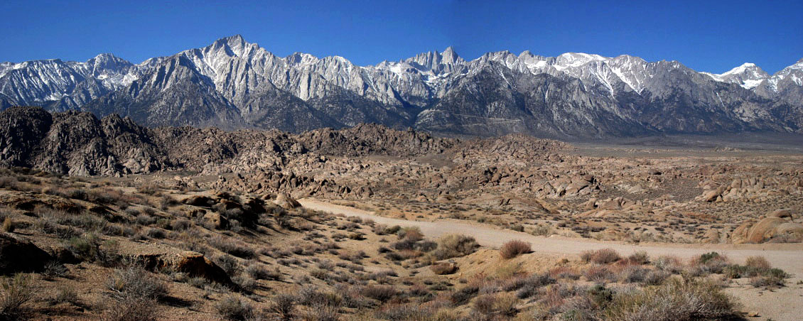
| Movie Road (Movie Flat Road) |
|
 |
|
 |
|
 |
|
Mount Williamson
and Movie Road |
|
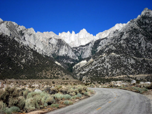
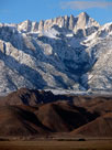
Lone Pine Peak, Mount Whitney and
Alabama Hills from Movie Road |
|
Mount Whitney |
|
|
|
|
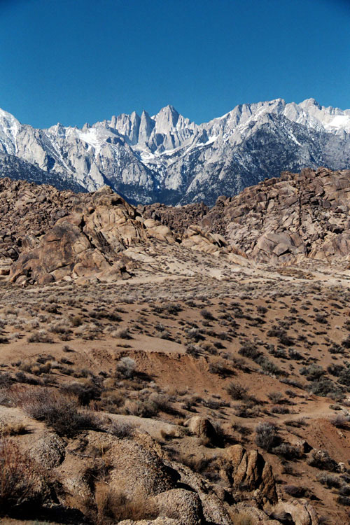
| Lone Pine Narrow Gauge Road |
|
|
|
|
 |
|
 |
|
 |
|
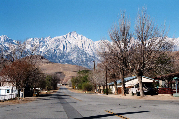
Lone Pine Peak,
Mount Whitney and
U.S. 395
from Lone Pine
Narrow Gauge Road |
|
Mount Whitney and
Mount Williamson from Lone
Pine Narrow Gauge Road |
|
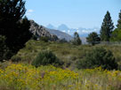
Mount Langley, Lone Pine
Peak and Mount Whitney |
|
|
|
|
| Long John Canyon Road |
|
 |
|
|
 |
|
 |
|
 |
|
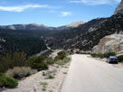
Inyo Mountains and
Long John Canyon Road |
|
Lone Pine Peak and
Mount Whitney from
Long John Canyon Road |
|
Mount Whitney
from Long John
Canyon Road |
|
|
|
|
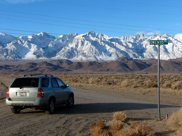
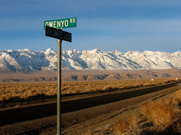
| Owenyo Road (Owenyo Lone Pine Road) |
|
|
|
|
 |
|
 |
|
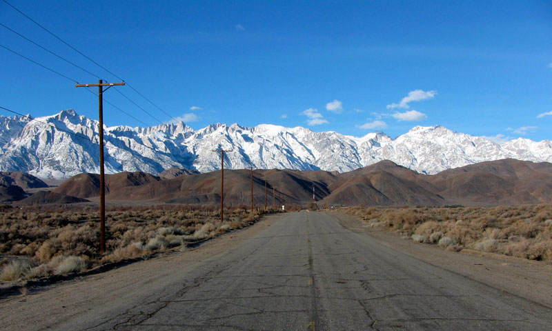
Lone Pine Narrow Gauge
Road and Owenyo Road
(Owenyo Lone Pine Road) |
|
Mount Langley, Lone Pine Peak, Mount
Whitney and Mount Russell from Owenyo Road |
|
|
|
|
|
|
|
|
|
| Tuttle Creek Road |
|
|
|
|
 |
|
 |
|
 |
|
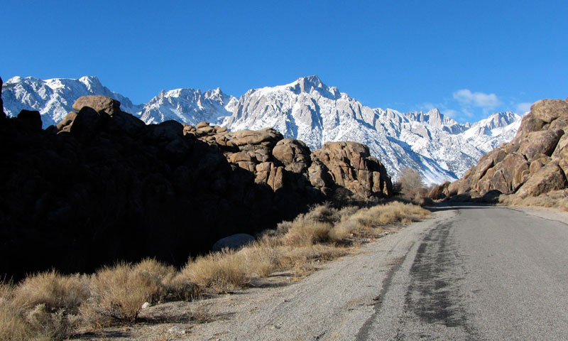
Mount Langley, Lone Pine
Peak and Tuttle Creek Road
from Whitney Portal Road |
|
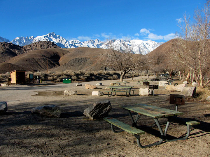
Portegee Joe Campground
off Tuttle Creek Road |
|
Lone Pine Peak and Mount
Whitney and Tuttle Creek
Road along Tuttle Creek |
|
|
|
|
|
|
|
|
|
| Horseshoe Meadows Road |
|
 |
|
 |
|
 |
|
Alabama Hills and
Horseshoe Meadows Road |
|
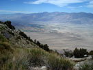
Inyo Mountains, Owens
Valley and Lone Pine |
|
Horseshow Meadow |
|
|
|
|
|
|
|
|
|
|
|
|
|
|
| Highway 136 (California State Route 136) |
|
 |
 |
|
|
 |
|
 |
|
 |
|
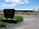
Eastern Sierra Interagency
Visitor Center
off Highway 136 |
|
Inyo Mountains and
Highway 136 (east) |
|
Lone Pine Peak, Mount
Whitney and Mount Russell
from Highway 136 |
|
|
|
|
| Dolomite Loop |
|
|
|
|
 |
|
|
|
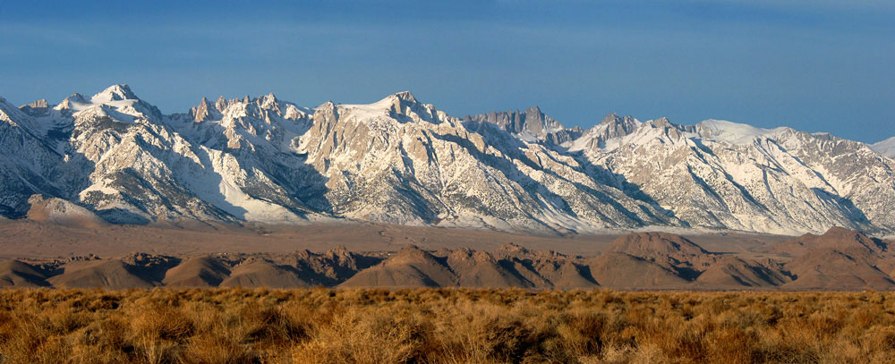
Mount Langley, Lone Pine
Peak, Mount Whitney
and Dolomite Loop
from Owenyo Road |
|
|
|
|
|
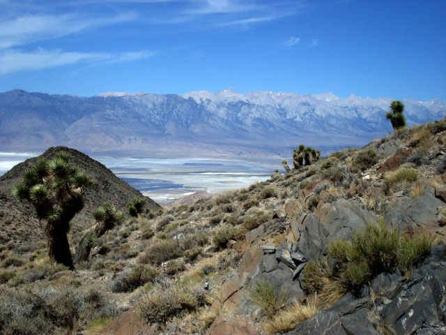
| Cerro Gordo Road |
|
|
|
|
 |
|
 |
|
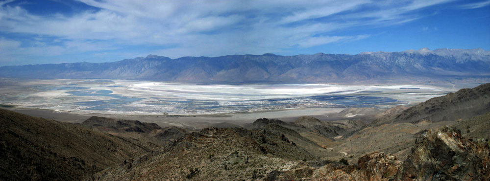
Sierra Nevada (Mount
Langley) and Owens Lake
from Cerro Gordo Road |
|
Sierra Nevada (Olancha Peak to Mount Langley)
and Owens Lake from Cerro Gordo Road |
|
|
|
|
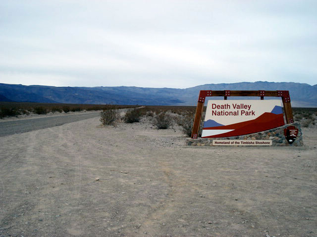
| Highway 190 (California State Route 190) |
|
 |
|
 |
|
 |
|
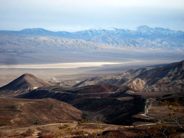
Sierra Nevada Mountains,
Owens Lake and Highway 190 |
|
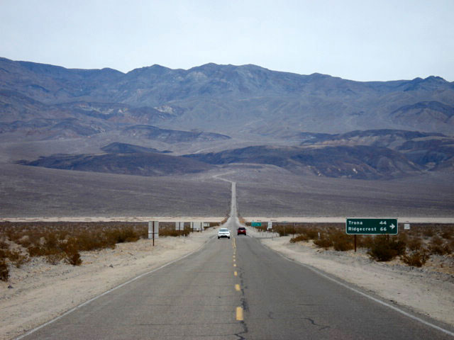
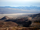
Panamint Valley and
Highway 190 from
Father Crowley Vista |
|
Panamint Range
and Highway 190 |
|
|
|
|
|
|
|
|
|
|
|
|
|
|
|
|
|
|
|
| Sage Flats Road |
|
 |
|
 |
|
 |
|
Olancha Peak
and Highway 395 near
Sage Flats Road junction |
|
Olancha Peak
from Sage Flat |
|
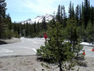
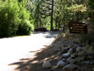
Olancha Pass Trailhead |
|
|
|
|
|
|
|
|
|
|
|
|
|
|
|
|
|
|
|
| Highway 14 (California State Route 14) |
|
| Forthcoming... |
|
|
|
|
|
|
|
|
|
|
|
|
|
|
|
|
|
|
|
|
|
|
|
|
|
|
|
|
|
|
|
|
|
|
|
|
|
|
|
|
|
|
|
|
|
|
|
|
|
|
|
|
|
|
|
|
|
|
|
|
|
|
|
|
| Highway 58 (California State Route 58) |
|
| Forthcoming... |
|
|
|
|
| See also |
|
|
|
|