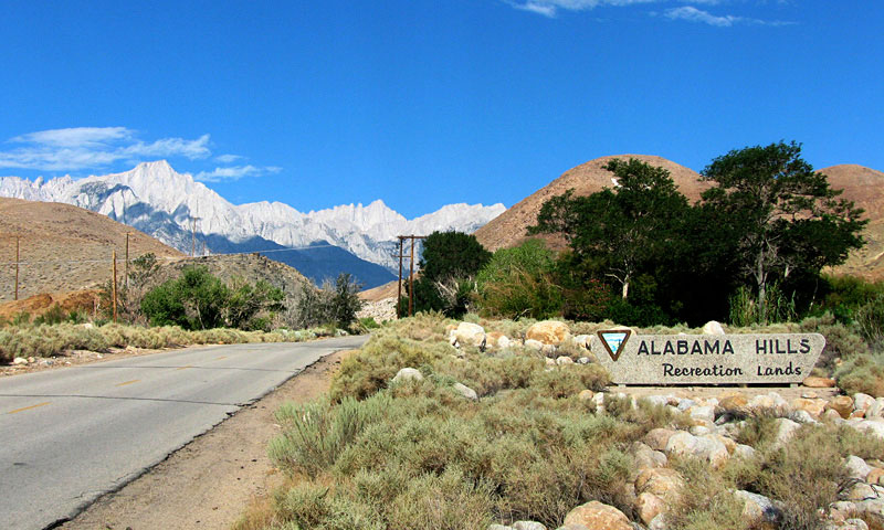
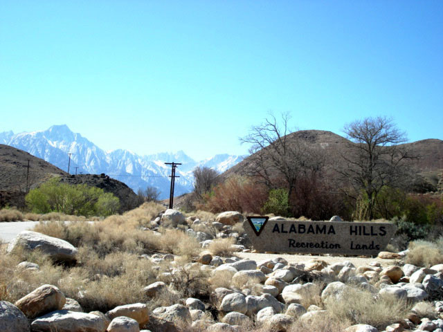
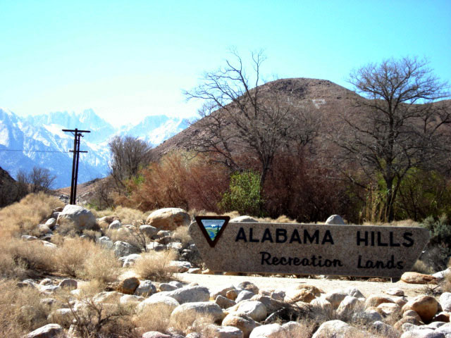
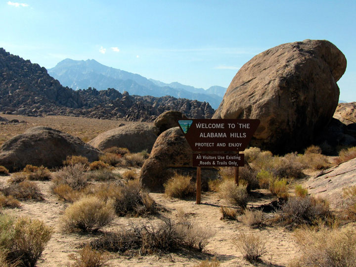
| アラバマ・ヒルズ |
 |
| (Alabama Hills) |
|
|
|
|
|
|
|
|
|
|
|
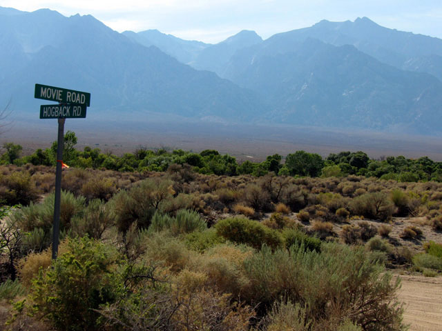
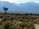
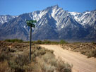
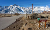
| Moffat Ranch Road |
|
 |
|
|
 |
|
 |
|
 |
|
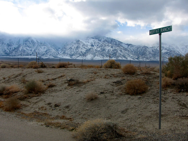
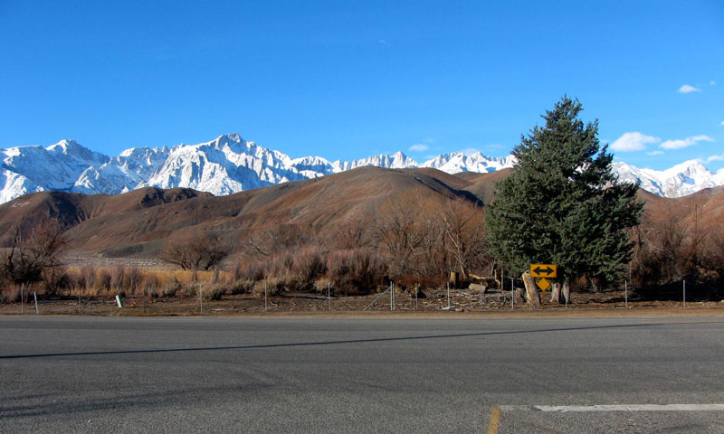
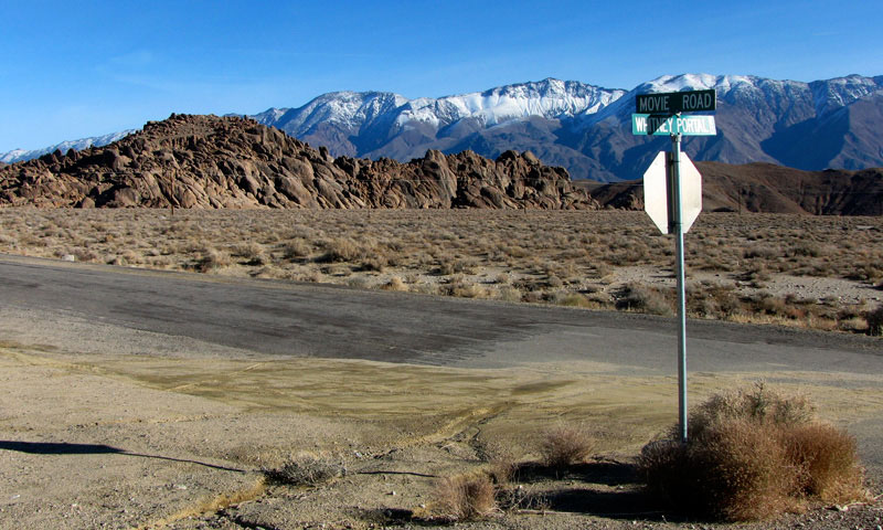
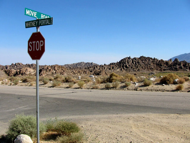
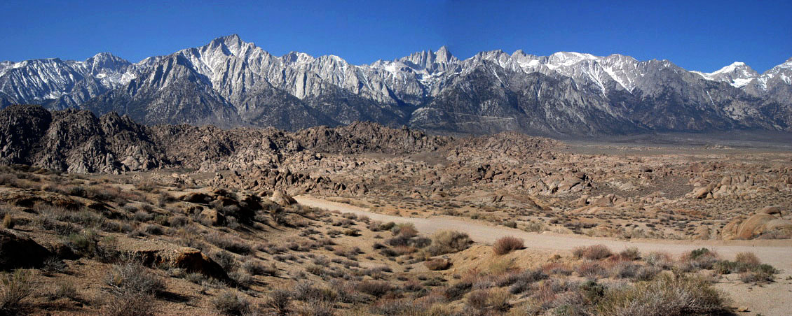
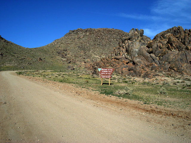
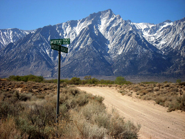
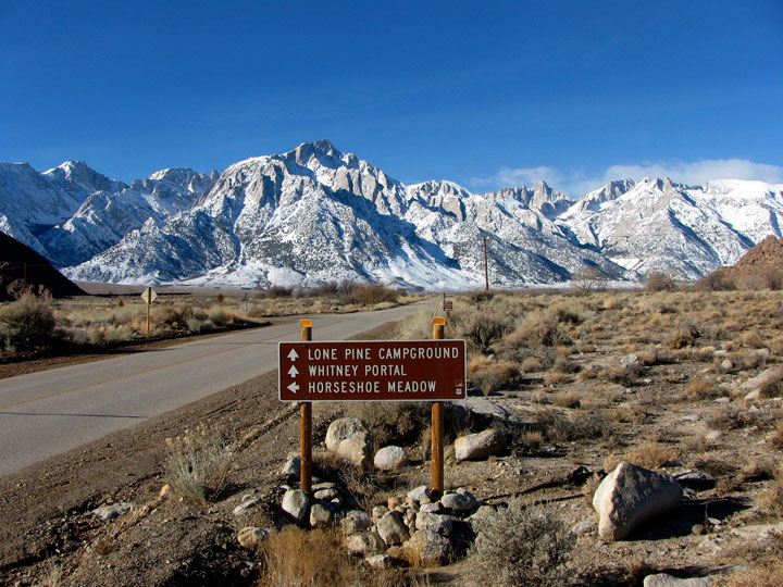
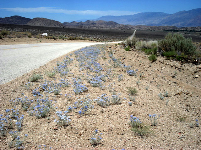
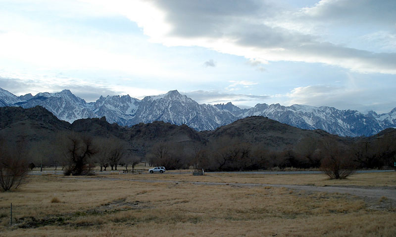
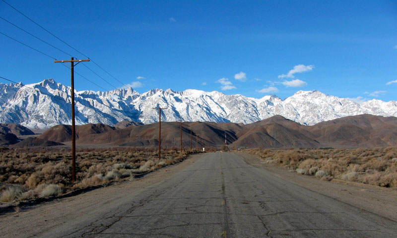
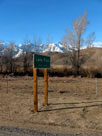
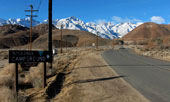
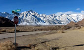
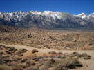
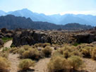
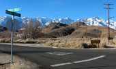
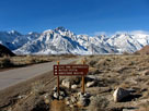
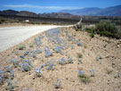
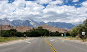
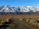
Moffat Ranch Road
off Highway 395 |
|
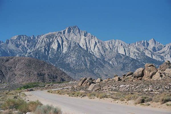
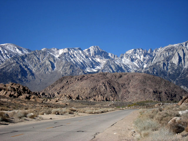
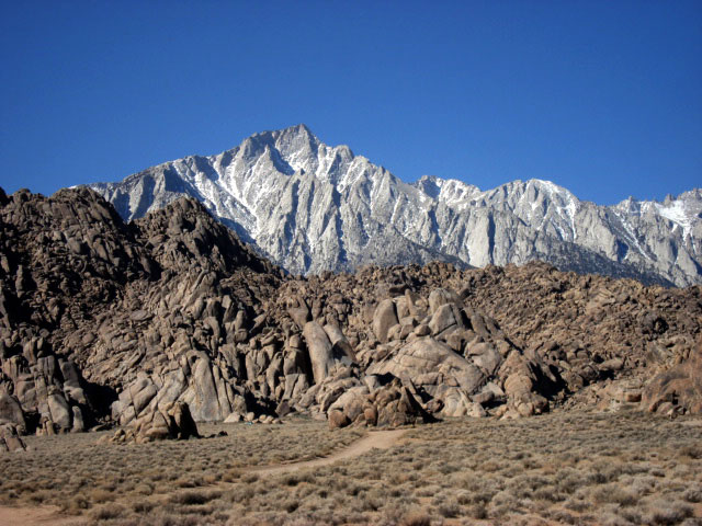
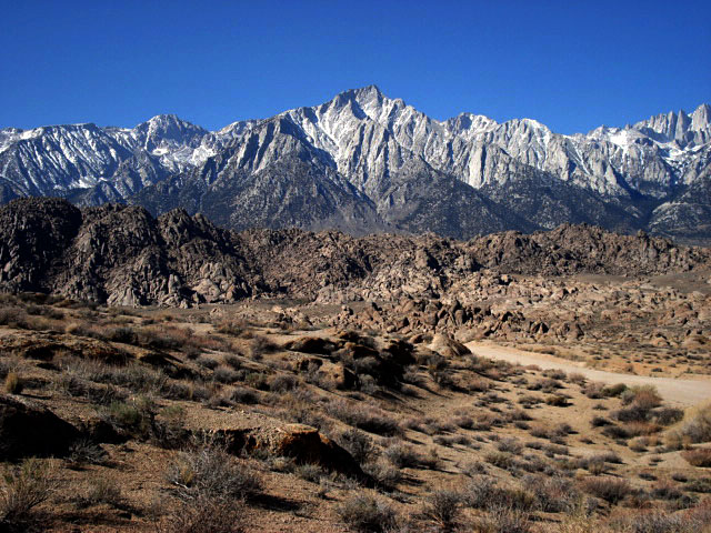
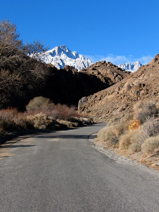
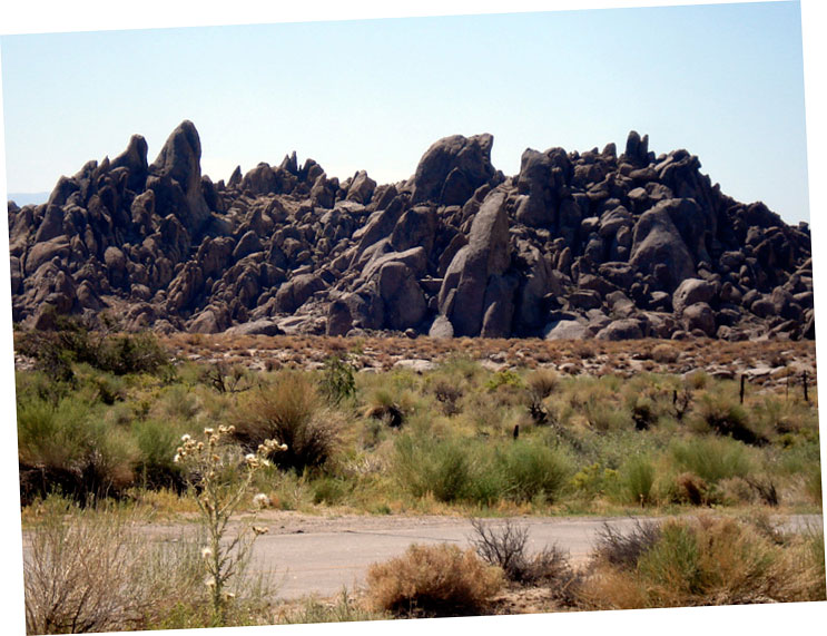
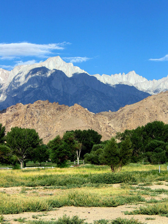
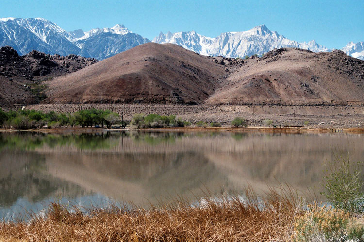
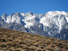
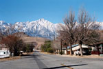
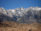
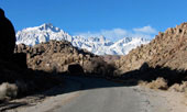
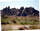
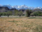
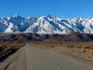
Lone Pine Peak
and Movie Road from
Moffat Ranch Road |
|
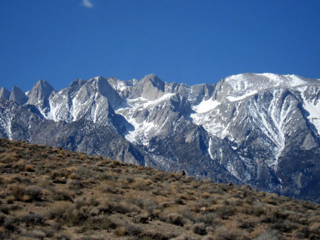
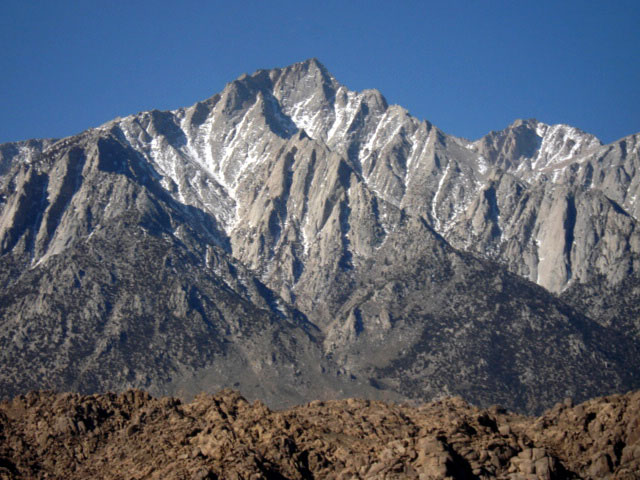
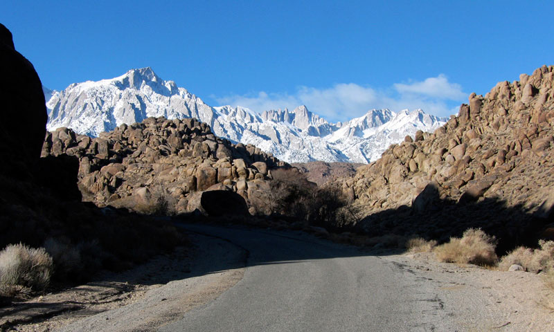
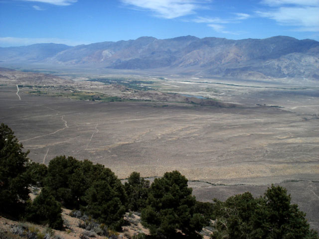
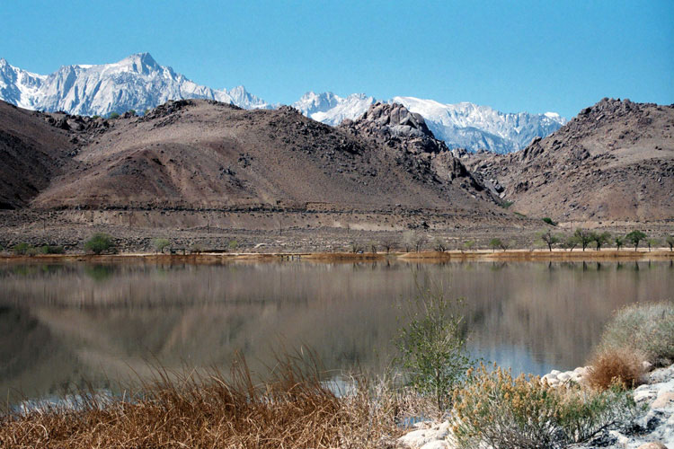
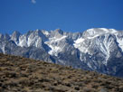
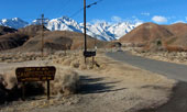
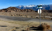
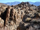
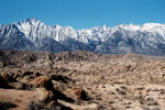
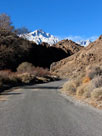
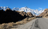
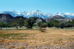
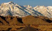
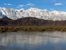
Mount Williamson from
Moffat Ranch Roadend
in Alabama Hills |
|
|
 |
|
 |
|
 |
|
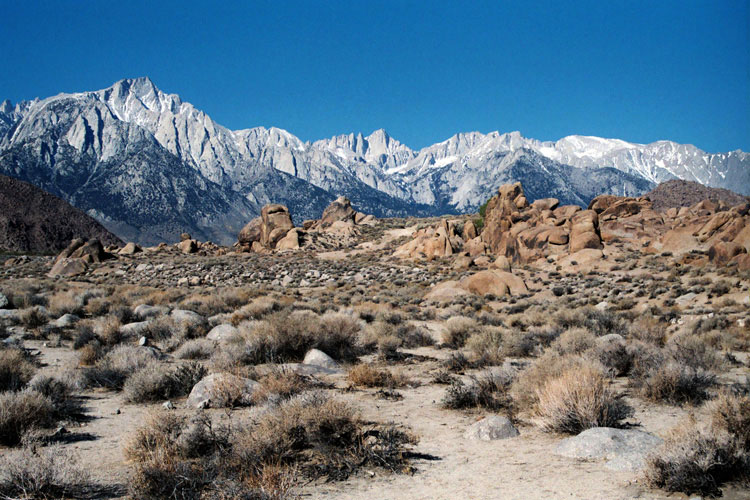
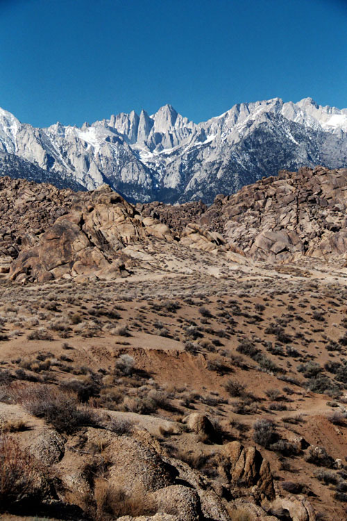
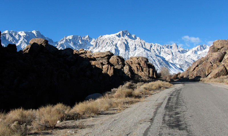
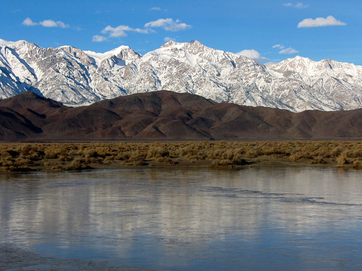
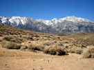
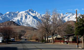
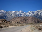
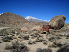
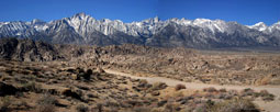
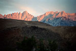
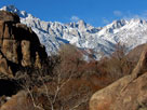
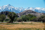
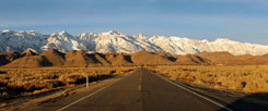
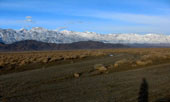
Mount Whitney, The Cleaver and Tunnabora Peak
from Moffat Ranch Roadend in Alabama Hills |
|
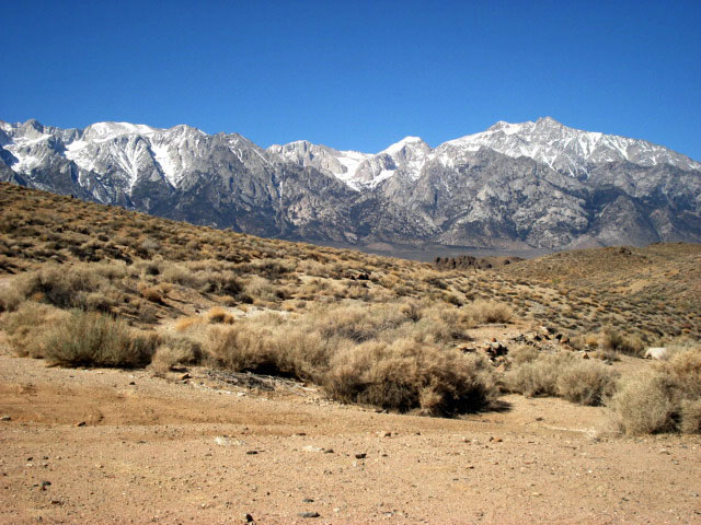
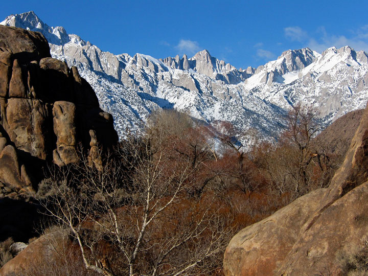
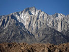
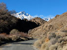
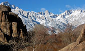
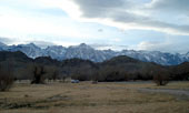
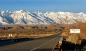
Mount Williamson from
Moffat Ranch Roadend |
|
|
|
|
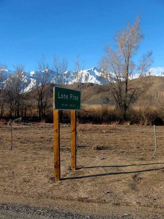
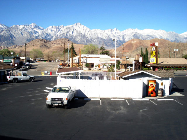
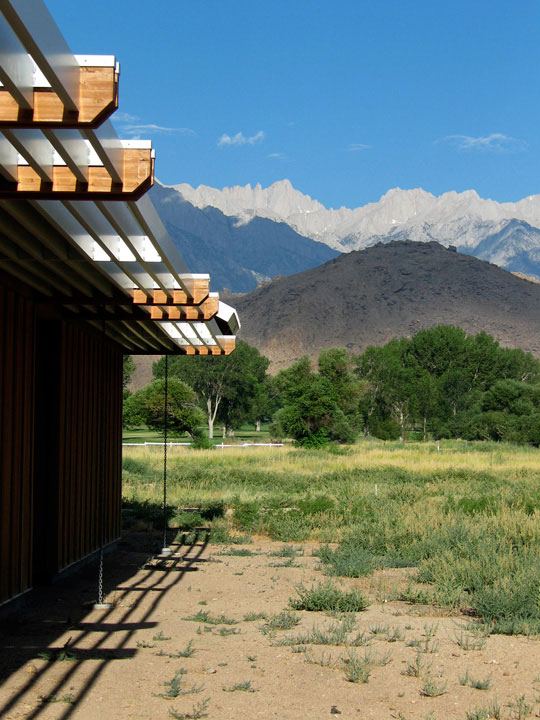
| Lone Pine |
|
 |
|
|
 |
|
 |
|
 |
|
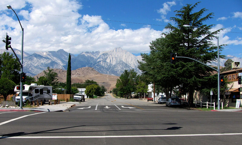
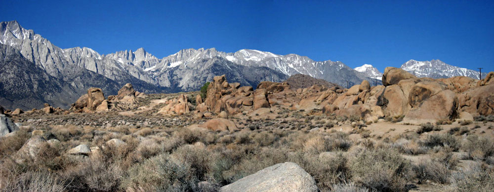
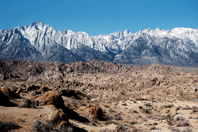
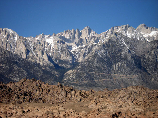
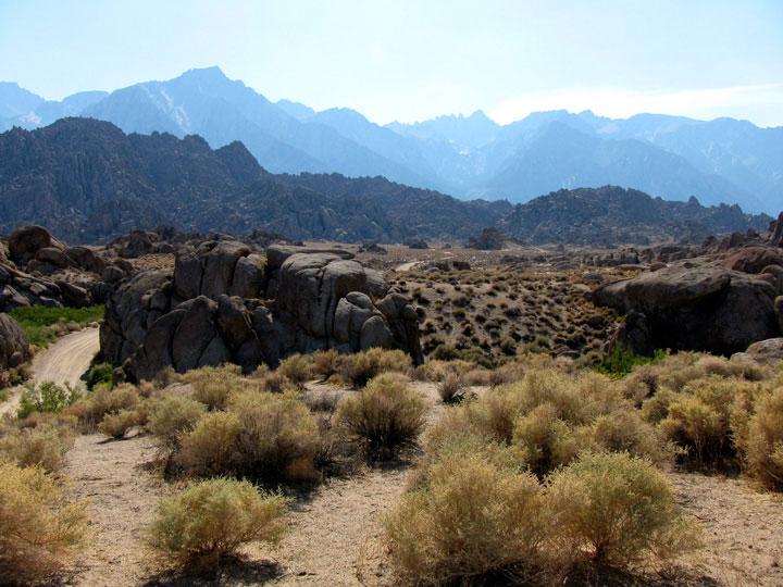
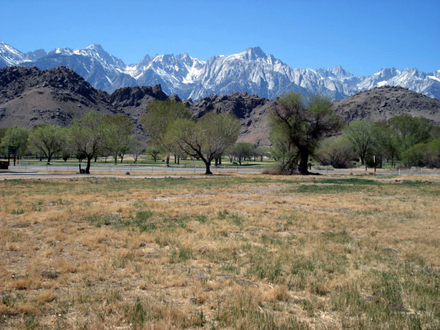
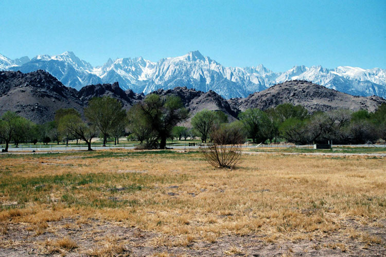
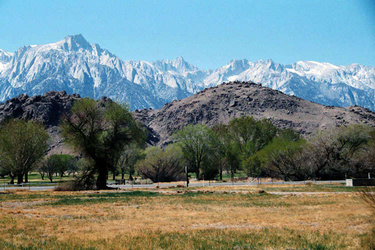
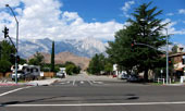
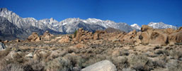
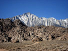
Lone Pine Peak
and Alabama Hills
from U.S. 395 |
|
Lone Pine Peak, Mount Whitney,
Alabama Hills and U.S. 395 from
Lone Pine Narrow Gauge Road |
|
Lone Pine Peak, Alabama
Hills and Whitney Portal Road
from U.S. 395, Lone Pine |
|
|
 |
|
 |
|
Lone Pine Peak and Alabama Hills from
Whitney Portal Road off U.S. 395 |
|
|
 |
|
 |
|
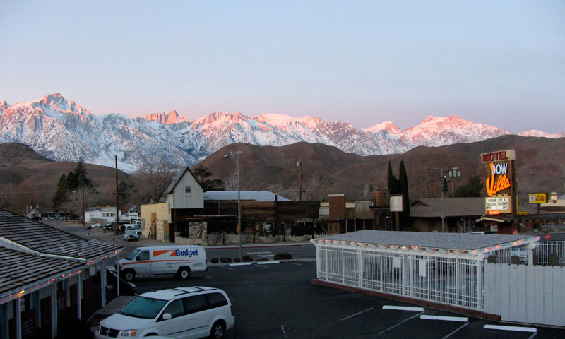
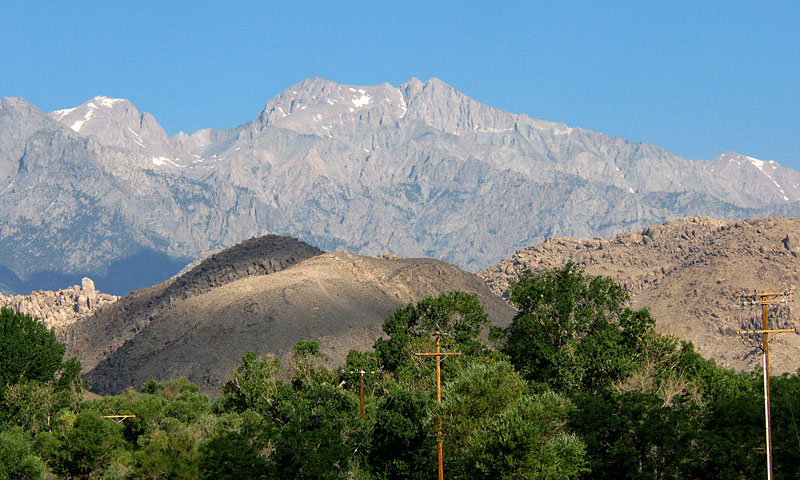
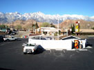
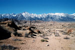
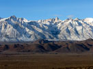
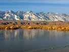
Sierra Nevada Mountains (Mount Whitney) and Alabama
Hills from Dow Villa Motel, Lone Pine |
|
|
|
|
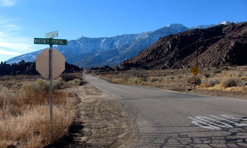
| Whitney Portal Road |
|
|
|
|
 |
|
 |
|
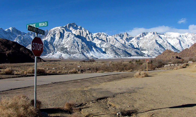
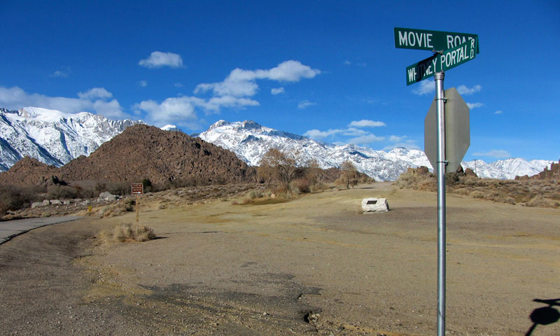
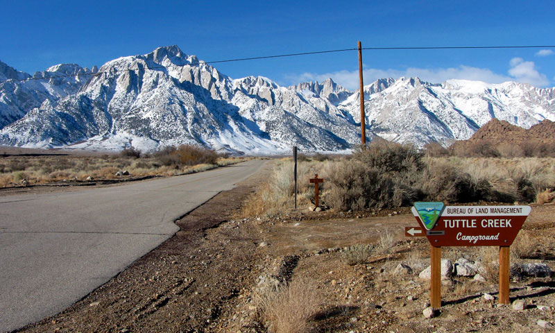
Lone Pine Peak, Mount
Whitney, Alabama Hills
and Whitney Portal Road
from Tuttle Creek Road |
|
Lone Pine Peak, Mount
Whitney, Alabama Hills
and Whitney Portal Road |
|
|
|
|
|
|
|
|
|
|
|
|
 |
|
 |
|
Mount Langley, Lone Pine Peak and Mount Whitney
from Whitney Portal Road |
|
|
 |
|
 |
|
Lone Pine Peak, Mount
Whitney and Whitney Portal
Road from Movie Road |
|
Mount Williamson and Whitney
Portal Road from Movie Road |
|
|
|
|
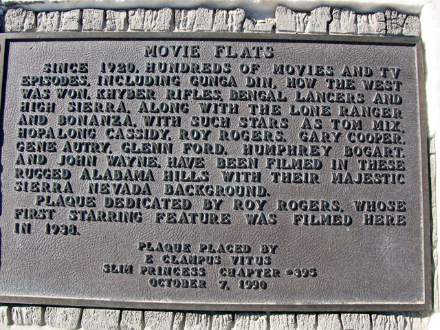
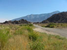
| Movie Road (Movie Flat Road) |
|
|
|
|
 |
|
 |
|
 |
|
Inyo Mountains, Alabama
Hills and Movie Road
from Whitney Portal Road |
|
Alabama Hills and
Whitney Portal Road
from Movie Road |
|
|
|
 |
|
 |
|
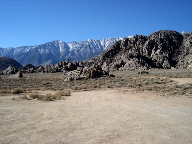
| Mount Williamson and Movie Road |
|
|
 |
|
 |
|
 |
|
|
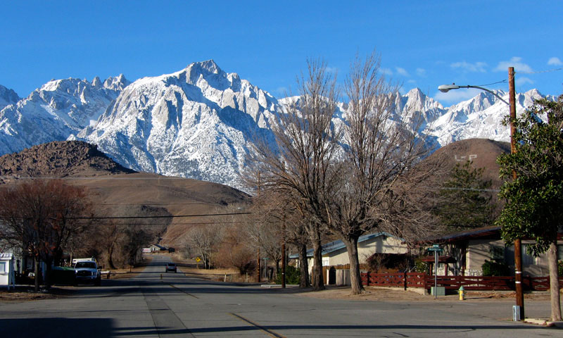
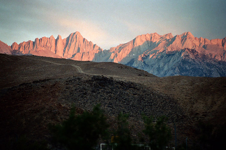
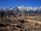
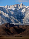
Lone Pine Peak |
|
Mount Whitney |
|
|
|
|
|
|
|
| Movie Road [Cont'd] |
|
 |
|
 |
|
 |
|
|
Lone Pine Peak and Mount Whitney from Alabama Hills |
|
|
 |
|
 |
|
|
Lone Pine Peak and Mount Whitney
from Alabama Hills |
|
|
 |
|
 |
|
 |
|
| Lone Pine Peak |
|
Mount Whitney |
|
|
|
 |
|
 |
|
 |
|
| Movie Road (south) |
|
Mount Williamson from
Hogback Road/Movie
Road junction |
|
Lone Pine Peak
and Movie Road from
Moffat Ranch Road |
|
|
|
|
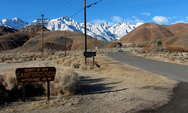
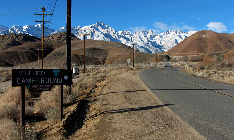
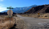
| Tuttle Creek Road |
|
|
|
|
 |
|
 |
|
 |
|
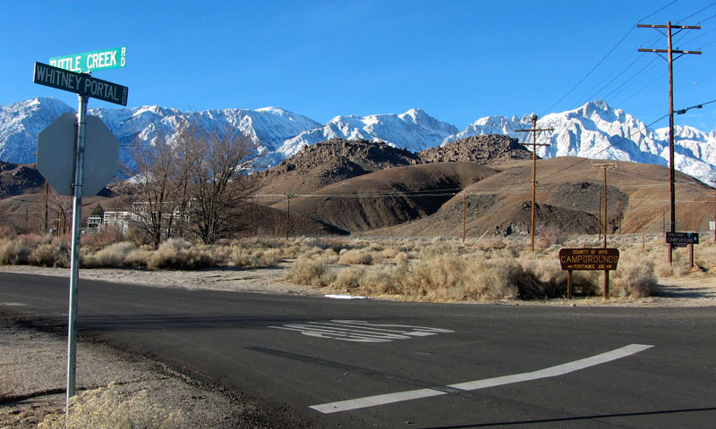
Mount Langley, Alabama Hills
and Tuttle Creek Road
from Whitney Portal Road |
|
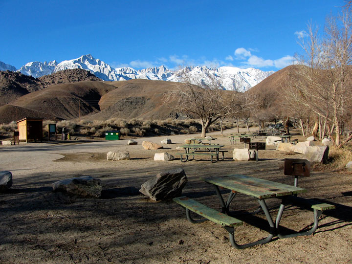
Mount Whitney and
Alabama Hills from
Portagee Joe Campground
off Tuttle Creek Road |
|
Mount Whitney and
Mount Russell above
Alabama Hills from
Portagee Joe Campground |
|
|
 |
|
 |
|
 |
|
Tuttle Creek Road along Tuttle Creek
in Alabama Hills |
|
Lone Pine Peak and
Mount Whitney from
Tuttle Creek Road |
|
|
 |
|
 |
|
 |
|
Lone Pine Peak, Mount
Whitney and Tuttle Creek
Road along Tuttle Creek |
|
Mount Whitney from Tuttle Creek Road |
|
|
|
|
| Horseshoe Meadows Road |
|
|
|
|
 |
|
 |
|
Lone Pine Peak, Mount Whitney and Whitney Portal
Road near Horseshoe Meadows Road junction |
|
|
 |
|
 |
|
 |
|
Alabama Hills and Horseshoe Meadows Road
from Whitney Portal Road |
|
Horseshoe Meadows Road
from Whitney Portal Road |
|
|
 |
|
 |
|
 |
|
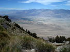
Alabama Hills from
Horseshoe Meadows Road |
|
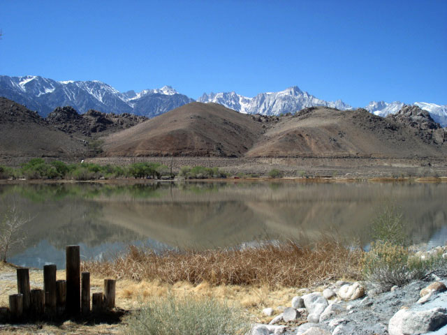
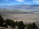
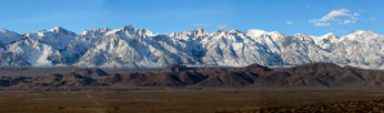
Inyo Mountains, Owens Valley and Alabama Hills
from Horseshoe Meadows Road |
|
|
|
|
|
|
|
 |
|
 |
|
 |
|
Mount Langley, Lone Pine Peak, Mount Whitney and Alabama Hills
from Eastern Sierra Interagency Visitor |
|
|
 |
|
 |
|
Lone Pine Peak, Mount Whitney
and Alabama Hills from Eastern
Sierra Interagency Visitor Center |
|
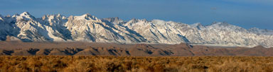
Mount Williamson and Alabama
Hills from Eastern Sierra
Interagency Visitor Center |
|
|
|
|
| Highway 136 (California State Route 136) |
|
 |
 |
|
|
|
 |
|
 |
|
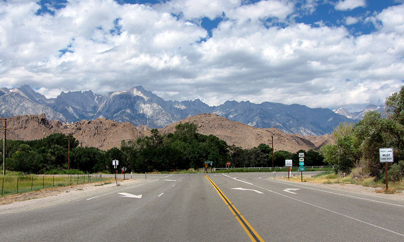
Mt. Whitney, Alabama Hills
and U.S. 395 from CA 136 |
|
Mount Whitney, Alabama
Hills and CA 136 |
|
|
 |
|
 |
|
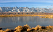
Sierra Nevada Mountains (Mount Whitney)
and Alabama Hills from Highway 136 |
|
|
|
|
|
|
|
|
|
| Lone Pine Narrow Gauge Road |
|
|
|
|
 |
|
 |
|
 |
|
Mt. Whitney, Mt. Williamson
and Alabama Hills from Lone
Pine Narrow Gauge Road |
|
Lone Pine Peak and
Alabama Hills from Lone
Pine Narrow Gauge Road |
|
Mount Williamson and
Alabama Hills from Lone
Pine Narrow Gauge Road |
|
|
 |
|
 |
|
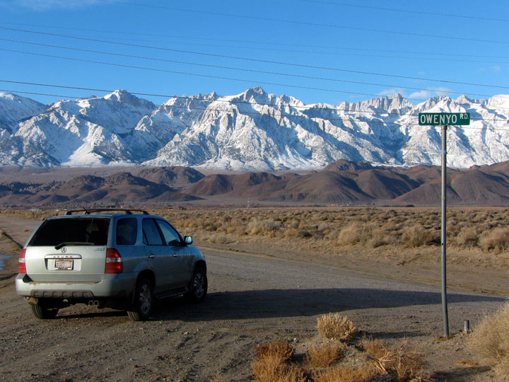
Lone Pine Narrow Gauge
Road and Owenyo Road
(Owenyo Lone Pine Road) |
|
Sierra Nevada Mountains (Mount
Williamson), Alabama Hills
and Lone Pine Narrow Gauge
Road from Owenyo Road |
|
|
|
|
| Long John Canyon Road |
|
 |
|
|
 |
|
 |
|
 |
|
Mount Whitney, Alabama
Hills and Long John
Canyon Road |
|
Mount Whitney and
Alabama Hills from
Long John Canyon Road |
|
Mount Whitney
and Alabama Hills
from Long John
Canyon Road |
|
|
 |
|
Mount Langley, Mount Corcoran, Lone Pine Peak,
Mount Whitney, Mount Russell, Mount Carillon, Tunnabora
Peak, Mount Barnard, Trojan Peak, Mount Williamson
and Alabama Hills from Long John Canyon Road |
|
|
|
|
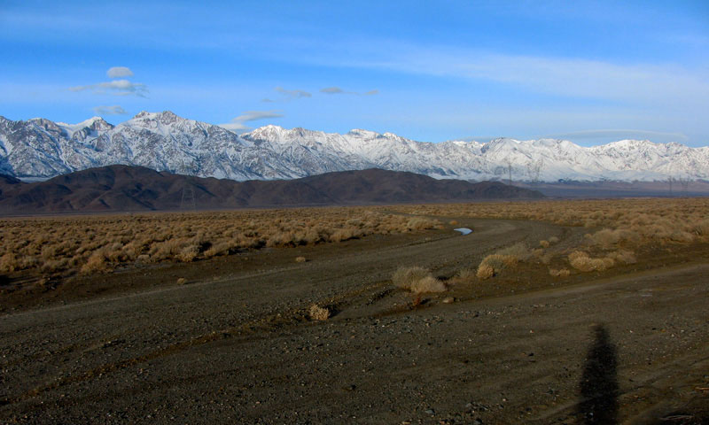
| Owenyo Road (Owenyo Lone Pine Road) |
|
|
|
|
 |
|
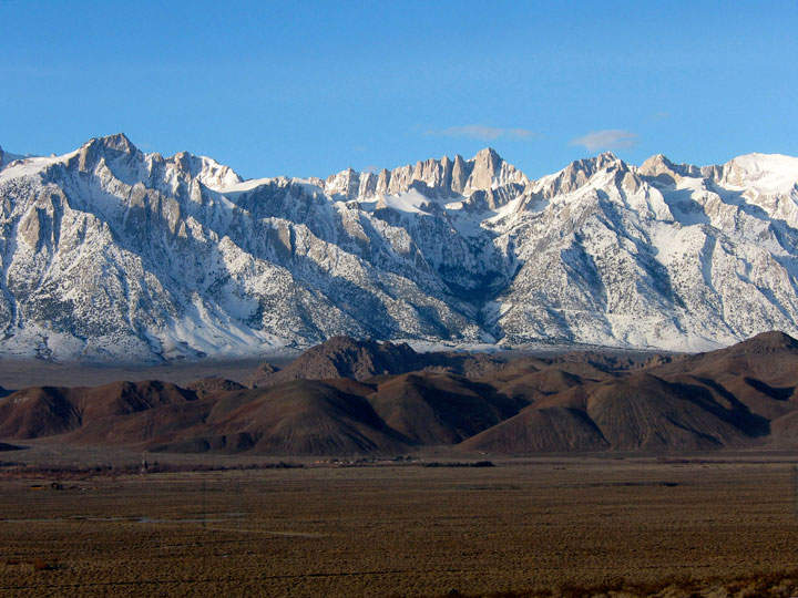
Mount Langley, Mount Corcoran, Lone Pine Peak, Mount
Whitney, Mount Russell, Mount Carillon, Mount Barnard,
Mount Williamson and Alabama Hills from Owenyo Road |
|
|
 |
|
 |
|
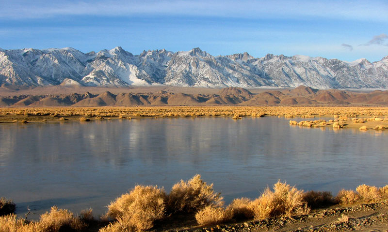
Mount Langley, Lone Pine Peak Mount Whitney
and Alabama Hills from Owenyo Road |
|
|
|
|
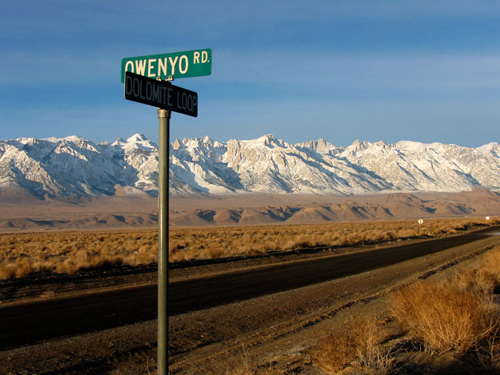
| Dolomite Loop |
|
|
|
|
 |
|
|
|
Lone Pine Peak, Alabama
Hills and Dolomite
Loop from Owenyo Road |
|
|
|
|
|
| アラバマ・ヒルズ (Alabama Hills) の写真 ON WEB |
|
| 写真 |
|
 |
|
|
|
| Photo Galleries |
 |
 |
 |
|
|
|
|
 |
|
| Photos |
|
 |
 |
 |
 |
 |
 |
 |
 |
 |
 |
|
|
|