イースタン・シエラ フォト・ギャラリー
グレイシャー・ロッジ・ロード
(Glacier Lodge Road)
Original photo collection of sceneries along
Glacier Lodge Road
(Glacier Lodge Rd)
, a road from
U.S. Route 395
to
Glacier Lodge
(
Big Pine Creek Trailhead
)
in
Eastern Sierra
(Inyo County, California, USA)
.
Big Pine
-
Highway 395
(U.S. Route 395)
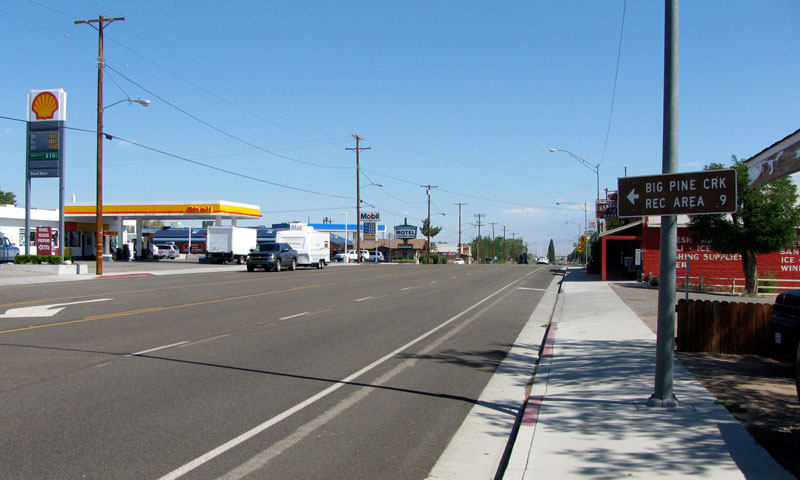
North Main Street (U.S. 395
north), Big Pine
North Main Street (U.S. 395
south), Big Pine
グレイシャー・ロッジ・ロード
(
Glacier Lodge Road
)
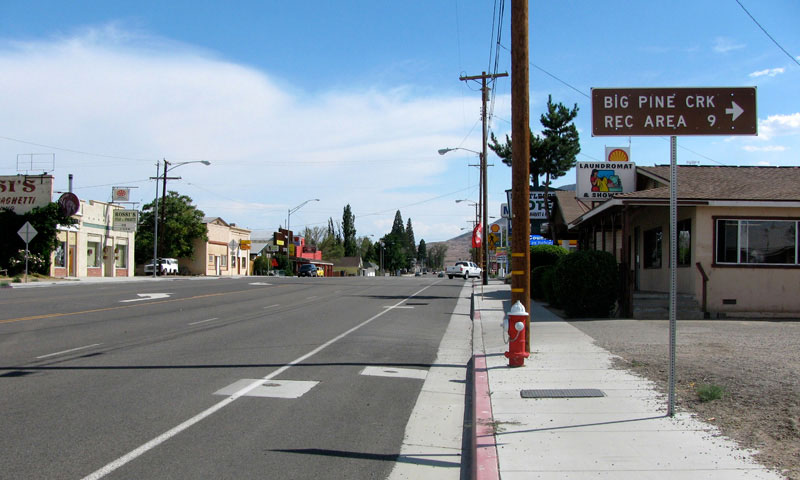
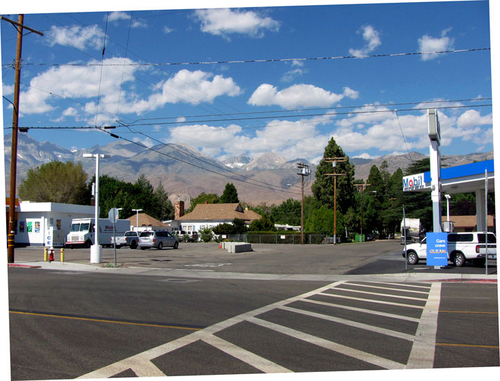
West Croker Street
(Glacier Lodge Road)
and U.S. 395, Big Pine
McMurray Meadows Road
Forthcoming...
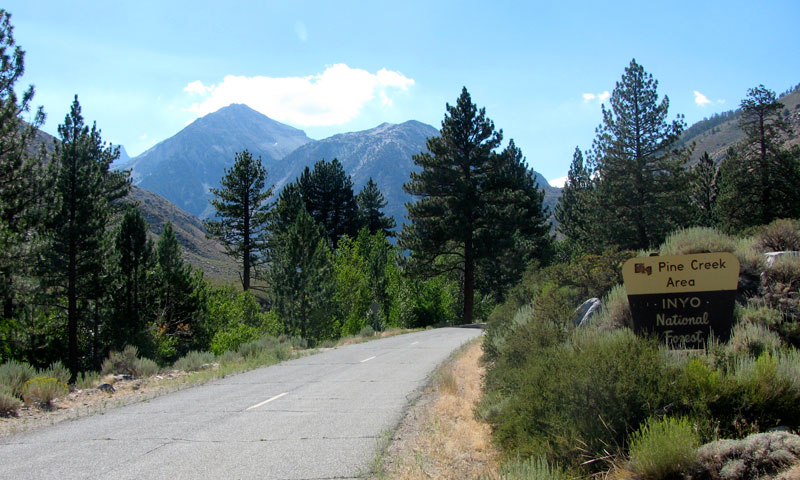
Big Pine Creek Recreation Area
(
Inyo National Forest
)
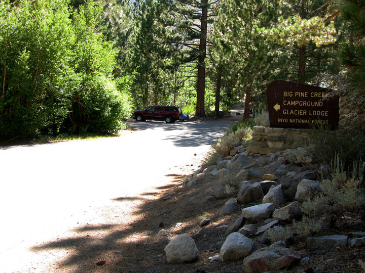
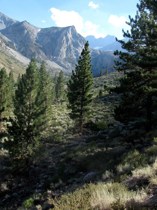
Glacier Lodge Road into Big
Pine Creek Recreation Area
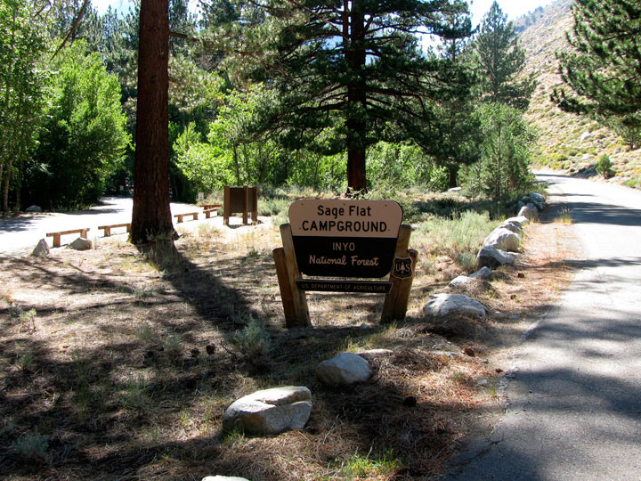
Sage Flat Campground
Sage Flat Campground
entrance and Glacier
Lodge Road
Upper Sage Flat Campground
Upper Sage Flat
Campground entrance
from Glacier Lodge Road
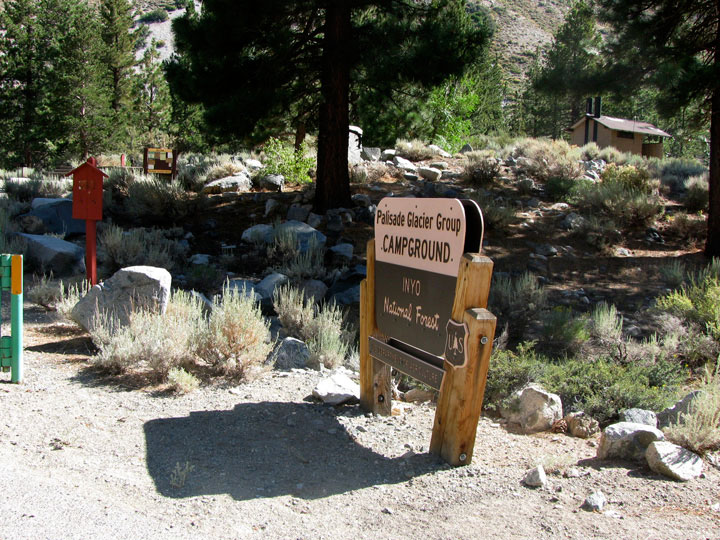
Palisade Glacier Group Campground
Palisade Glacier
Group Campground
from Glacier Lodge Road
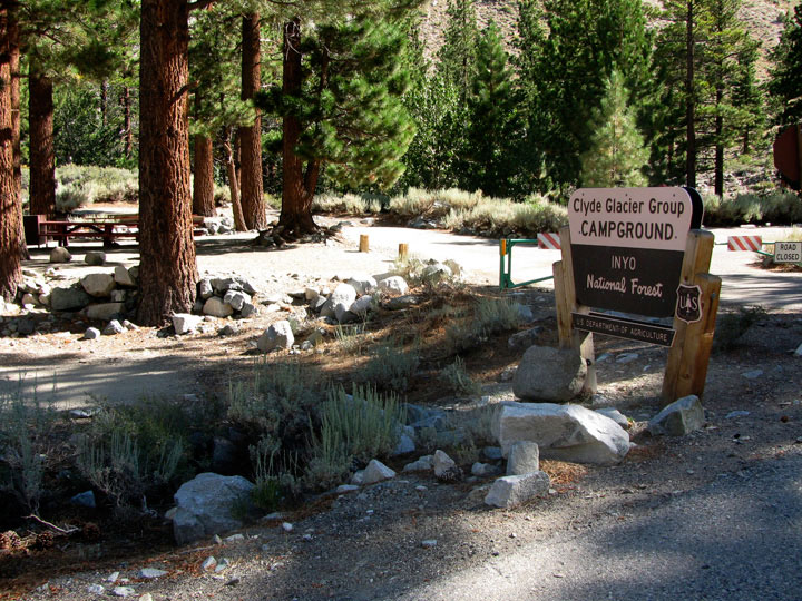
Clyde Glacier Group Campground
Clyde Glacier
Group Campground
from Glacier Lodge Road
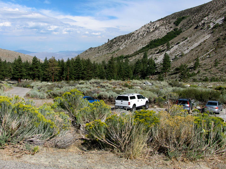
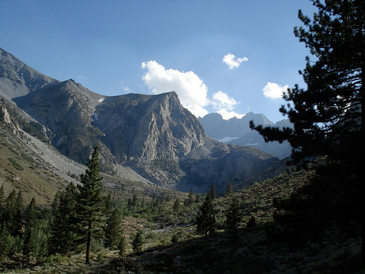
North Fork Big Pine Creek Trailhead
Mt. Gayley(?), Mt. Alice(?)
and Glacier Lodge Road
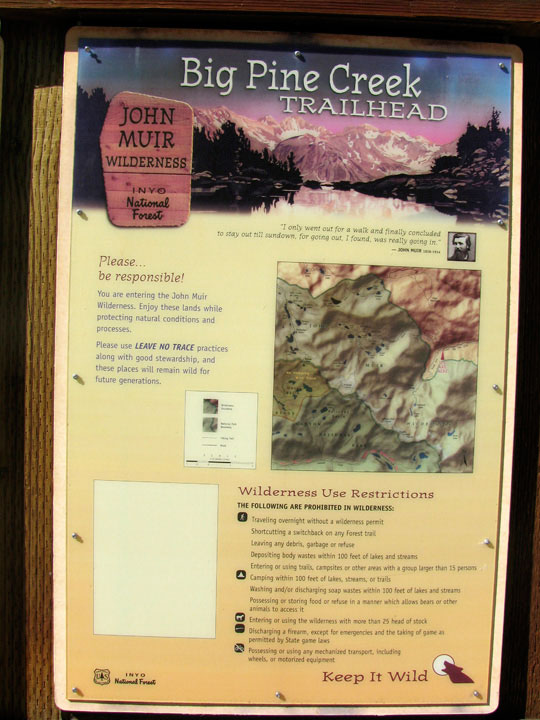
Big Pine Creek Trailhead
(North Fork Big Pine
Creek Trailhead)
Glacier Pack Station
(
Glacier Pack Train
)
Forthcoming...
Big Pine Creek Picnic Site
Glacier Lodge Roadend
(Big Pine Creek Picnic Site)
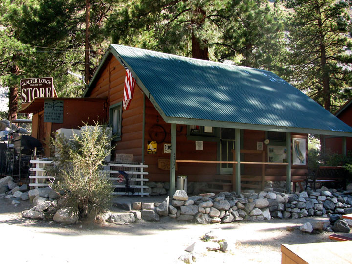
グレイシャー・ロッジ
(
Glacier Lodge
)
Glacier Lodge
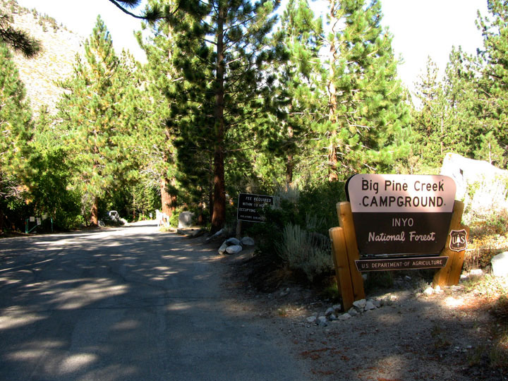
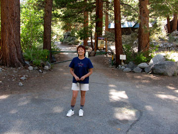
Big Pine Creek Campground
Big Pine Creek
Campground entrance
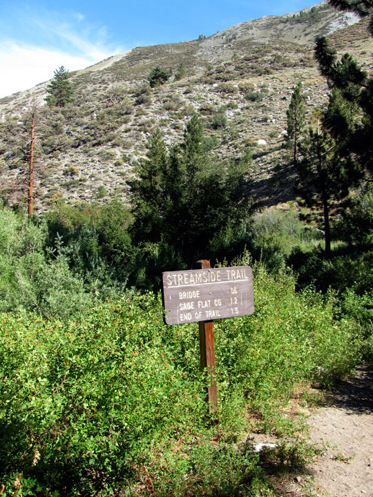
Streamside Trail
from campground
Big Pine Creek Trailhead
(
Big Pine Creek South Fork Trailhead
)
Big Pine Creek Trailhead
(Big Pine Creek South
Fork Trailhead)
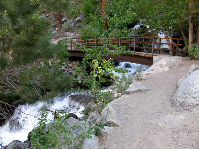
Footbridge over North
Fork Big Pine Creek
South Fork Trail
(
South Fork Big Pine Creek Trail
)
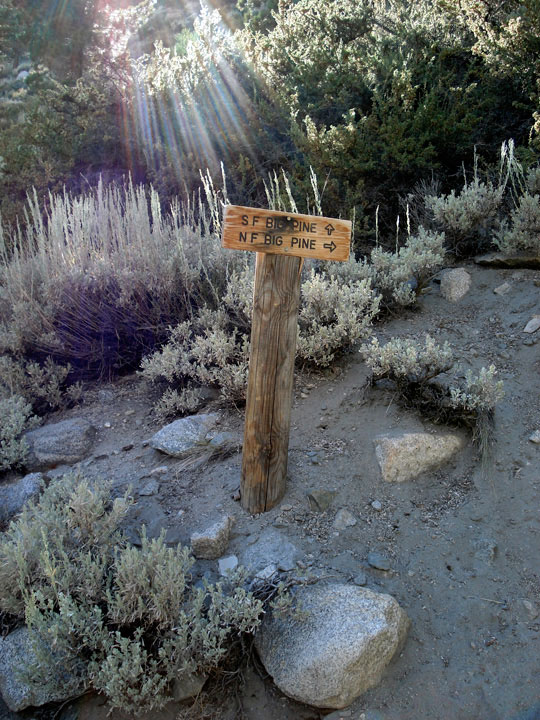
South Fork Trail
and North Fork Trail
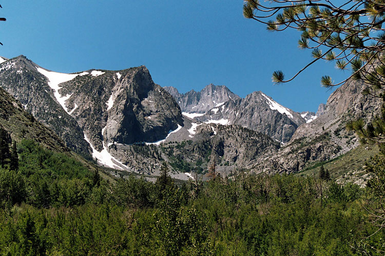
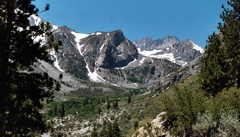
Middle Palisade from South Fork Trail
North Fork Trail
(
North Fork Big Pine Creek Trail
)
Middle Palisade from
North Fork Trail
Middle Palisade and South
Fork Big Pine Creek from
North Fork Trail
グレイシャー・ロッジ・ロード
(Glacier Lodge Road)
の写真 ON WEB
Forthcoming...
イースタン・シエラ
山脈
(
Ranges
)
山・峰
(
Peaks
)
峠
(
Passes
)
High Passes
サミット
(
Summits
)
氷河
(
Glaciers
)
川
(
Streams
)
滝
(
Falls
)
湖
(
Lakes
)
High Lakes
峡谷
(
Canyons
)
渓谷・盆地
(
Valleys...
)
Meadows & Flats
温泉
(
Hot Springs
)
公園・保護区
(
Parks...
)
Wilderness Areas
Recreation Areas
トレイル
(
Trails
)
Trailheads
道路
(
Roads
)
Benton Crossing Rd
Big Pine Rd
Bodie Rd
Buttermilk Rd
Cerro Gordo Rd
Convict Lake Rd
Crowley Lake Dr
Death Valley Rd
Eureka Valley Rd
Glacier Lodge Rd
Goodale Rd
Horseshoe Meadows Rd
Hot Creek Hatchery Rd
Isabella Walker Pass Rd
June Lake Loop
Lake George Rd
Lake Mary Rd
Lake Mary Loop Rd
Lake Sabrina Rd
Lone Pine Narrow
Gauge Rd
Long John Canyon Rd
Lower Rock Creek Rd
Lundy Lake Rd
McGee Creek Rd
Minaret Rd
Moffat Ranch Rd
Monitor Pass Rd
Movie Rd
Ninemile Canyon Rd
North Lake Rd
Northshore Drive
Onion Valley Rd
Owens Gorge Rd
Owens River Rd
Panamint Valley Rd
Pine Creek Rd
Pole Line Rd
Poole Power Plant Rd
Rock Creek Rd
Saddlebag Lake Rd
Sage Flats Rd
Saline Valley Rd
Silver Canyon Rd
Sonora Pass Hwy
South Lake Rd
Sweet Water Rd
Tinemaha Rd
Tioga Pass Rd
Tuttle Creek Rd
Twin Lakes Rd
Twin Lakes Loop Rd
Virginia Lakes Rd
Westgard Pass Rd
White Mountain Rd
Whitney Portal Rd
ハイウェイ
(
Highways
)
Scenic Byways
Vista Points
Campgrounds
Towns & Villages
Northern Sierra
Southern Sierra
シエラネバダ山脈
ヨセミテ
Sequoia & Kings Canyon
アメリカの国立公園
カナダの国立公園
[
English
| 日本語 ]
ご意見・ご質問は,
webmaster@itoda.com
宛にメールをお送りください.
Copyright © 2001-2011, Object Factory, Inc. All rights reserved.