| Inyo National Forest |
 |
| (イニョ・ナショナル・フォレスト) |
 |
|
|
 |
|
|
 |
|
|
 |
|
|
 |
|
 |
|
|
 |
|
 |
|
|
 |
|
 |
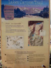
| Lakes Canyon Trail |
 |
 |
 |
 |
 |
 |
 |
 |
 |
 |
 |
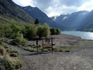
Lakes Canyon Trailhead
and Lundy Lake |
|
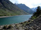
Lakes Canyon Trail
and Lundy Lake
from Lundy Lake Road |
|
 |
|
 |
| Lundy Canyon Trail |
 |
 |
 |
 |
 |
 |
 |
 |
 |
 |
 |
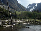
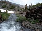
Lundy Canyon and Mill
Creek above Lundy Lake |
|
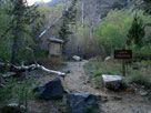
Lundy Canyon Trailhead
(Lundy Trailhead) |
|
Mill Creek (Lake Helen
outlet) and Lundy Canyon
Trail (Hoover Wilderness) |
|
 |
|
 |
|
|
 |
|
 |
|
|
 |
|
 |
|
|
 |
|
 |
| Lower Lee Vining Campground |
 |
 |
 |
 |
 |
 |
 |
 |
 |
 |
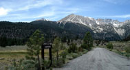
Mount Gibbs and Mount Dana from
Lower Lee Vining Campground
entrance off Tioga Pass Road |
|
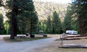
Lower Lee Vining
Campground |
|
 |
|
 |
|
|
 |
|
 |
| Poole Power Plant Road |
 |
 |
 |
 |
 |
 |
 |
 |
 |
 |
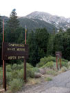
Mt. Dana and Poole
Power Plant Rd off
Tioga Pass Rd |
|
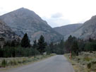
Tioga Peak and Tioga
Pass Road from Poole
Power Plant Road |
|
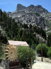
Poole Power Plant |
|
 |
|
 |
| Moraine Campground |
 |
 |
 |
 |
 |
 |
 |
 |
 |
 |
 |
 |
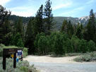
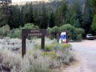
Moraine Campground entrance
from Poole Power Plant Road |
|
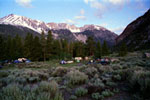
Mount Dana and Dana Crest
from Moraine Campground |
|
 |
|
 |
|
|
 |
|
 |
| Aspen Campground |
 |
 |
 |
 |
 |
 |
 |
 |
 |
 |
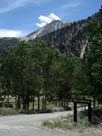
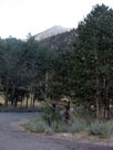
Mount Dana and Aspen Campground
entrance from Poole Power Plant Road |
|
 |
|
 |
|
|
 |
|
 |
| Lee Vining Canyon Scenic Byway |
 |
 |
 |
 |
 |
 |
 |
 |
 |
 |
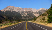
Mount Dana, Dana Crest
and Tioga Pass Road (Lee
Vining Canyon Scenic Byway) |
|
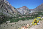
Tioga Peak, Lee Vining
Canyon and Poole Power Plant
Road from Tioga Pass Road |
|
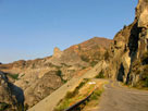
Tioga Peak and
Tioga Pass Road |
|
 |
 |
 |
 |
 |
 |
 |
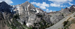
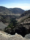
Peak 11,403 (Dana Crest), Lee Vining Canyon and
Lee Vining Canyon Scenic Byway (Tioga Pass Rd) |
|
Tioga Pass
Road and Lee
Vining Canyon |
|
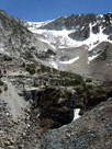
Ellery Lake Falls
(head of Lee
Vining Canyon) |
|
 |
|
 |
|
|
 |
|
 |
| Saddlebag Lake Road |
 |
 |
 |
 |
 |
 |
 |
 |
 |
 |
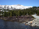
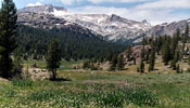
Peak 11,049, Lee Vining
Creek and Saddlebag Lake
Rd from Tioga Pass Rd |
|
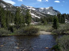
Mount Dana, Tioga Pass
Road and Lee Vining Creek
from Saddlebag Lake Road |
|
Mount Conness (east ridge)
and Lee Vining Creek from
Saddlebag Lake Road |
|
 |
|
 |
|
|
 |
|
 |
| Gardisky Lake Trail |
 |
 |
 |
 |
 |
 |
 |
 |
 |
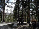
Gardisky Lake Trail and
Saddlebag Lake Road |
|
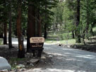
Gardisky Lake Trailhead
off Saddlebag Lake Rd |
|
 |
|
 |
|
|
 |
|
 |
|
|
 |
 |
 |
 |
 |
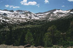
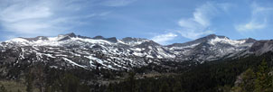
Hall Natural Area (White Mountain, southeast peak of Mount
Conness and Lee Vining Creek) from Saddlebag Lake Road |
|
 |
|
 |
| Saddlebag Lake Trailhead |
 |
 |
 |
 |
 |
 |
 |
 |
 |
 |
 |
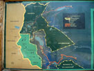
Vicinity map display at
Saddlebag Lake Trailhead |
|
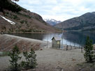
Saddlebag 104-039 Dam
and Saddlebag Lake near
Saddlebag Lake Trailhead |
|
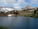
Saddlebag Lake and
Saddlebag Lake Loop Trail |
|
 |
|
 |
|
|
 |
|
 |
|
|
 |
|
 |
| Hoover Wilderness |
 |
 |
 |
 |
 |
 |
 |
 |
 |
 |
 |
 |
Mt. Conness and North
Peak from Hummingbird
Lake off Lundy Pass Trail
(Lundy Canyon Trail) |
|
Odell Lake
off Lundy Pass Trail |
|
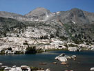
Mount Conness, North
Peak and Lake Helen |
|
 |
 |
 |
 |
 |
 |
 |
North Peak,
Greenstone Lake and
20 Lakes Basin Trail |
|
Noth Peak and
Steelhead Lake |
|
Shepherd Crest
and Cascade Lake |
|
 |
|
 |
|
|
 |
|
 |
| Tioga Lake Campground (Tioga Campground) |
 |
 |
 |
 |
 |
 |
 |
 |
 |
 |
 |
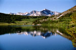
Mammoth Peak, Tioga Pass
and Tioga Lake |
|
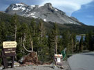
Mount Dana from Tioga
Lake Campground entrance
off Tioga Pass Road |
|
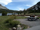
Tioga Pass and Tioga
Lake from Tioga
Lake Campground |
|
 |
|
 |
|
|
 |
|
 |
| Tioga Lake Overlook |
 |
 |
 |
 |
 |
 |
 |
 |
 |
 |
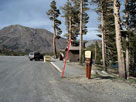
Tioga Peak and
Tioga Lake Overlook
off Highway 120 |
|
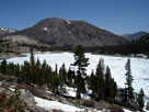
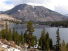
Tioga Peak and Tioga Lake from
Tioga Lake Overlook |
|
 |
|
 |
|
|
 |
|
 |
| Tioga Pass |
 |
 |
 |
 |
 |
 |
 |
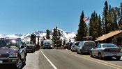
Mammoth Peak and Tioga
Pass from Tioga Pass Road |
|
Tioga Pass Entrance,
Yosemite National Park |
|
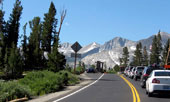
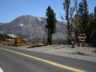
Tioga Peak and Tioga Pass
Road from Tioga Pass |
|
 |
|
 |
| Ansel Adams Wilderness |
 |
 |
 |
 |
 |
 |
 |
 |
 |
 |
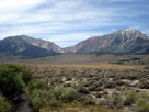
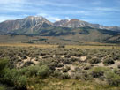
Mount Lewis, Mono Pass, Mount Gibbs and Mount
Dana (Ansel Adams Wilderness) from Highway 395 |
|
 |
|
 |
|
|
 |
 |
 |
 |
 |
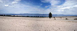
| Mono Lake (Mono Basin) from Highway 120 |
|
 |
 |
 |
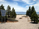
| Mono Lake (Mono Basin) from Viewpoint Road off Highway 395 |
|
 |
|
 |
|
|
 |
|
 |
| June Lake Loop Recreation Area |
 |
 |
 |
 |
 |
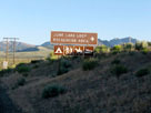
June Lake Loop
North Junction
from Highway 395 |
|
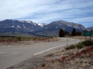
Mount Wood and Mount
Lewis (Ansel Adams
Wilderness) from June Lake
Loop off Highway 395 |
|
 |
|
 |
|
|
 |
|
 |
| Grant Lake Overlook |
 |
 |
 |
 |
 |
 |
 |
 |
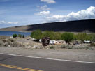
Grant Lake and
Grant Lake Marina
from June Lake Loop |
|
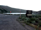
Grant Lake and Grant
Lake Overlook entrance
from June Lake Loop |
|
 |
|
 |
|
|
 |
|
 |
|
|
 |
|
 |
| Rush Creek Trail |
 |
 |
 |
 |
 |
 |
 |
 |
 |
 |
 |
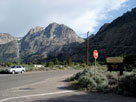
Carson Peak and June
Lake Loop from Rush
Creek Trailhead entrance |
|
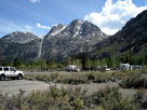
Carson Peak and Rush Creek Trailhead |
|
 |
|
 |
|
|
 |
|
 |
|
|
 |
|
 |
|
|
 |
|
 |
|
|
 |
|
 |
|
|
 |
|
 |
| Oh! Ridge Campground (Oh Ridge Campground) |
 |
 |
 |
 |
 |
 |
 |
 |
 |
 |
 |
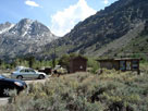
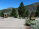
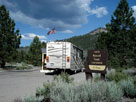
| Oh! Ridge Campground entrance (Pine Cliff Roadend) |
|
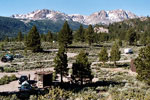
June Mountain and
Carson Peak from
Oh! Ridge Campground |
|
 |
|
 |
| June Lake Beach (June Lake Swimming Site) |
 |
 |
 |
 |
 |
 |
 |
 |
 |
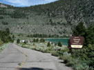
June Lake Beach Road
to June Lake Beach
(June Lake Swimming Site) |
|
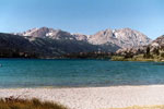
June Mountain and
Carson Peak from
June Lake Beach |
|
|
 |
|
 |
|
|
 |
|
 |
|
|
 |
|
 |
|
|
 |
|
 |
|
|
 |
|
 |
|
|
 |
|
 |
|
|
 |
|
 |
|
|
 |
|
 |
|
|
 |
|
 |
|
|
 |
|
 |
|
|
 |
|
 |
|
|
 |
|
 |
|
|
 |
|
 |
|
|
 |
|
 |
|
|
 |
|
 |
|
|
 |
|
 |
|
|
 |
|
 |
| Minaret Summit |
 |
 |
 |
 |
 |
 |
 |
 |
 |
 |
 |
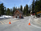
Minaret Vista Station at Minaret Summit
and Minaret Summit Road from Minaret Road |
|
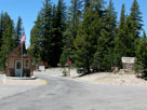
Mammoth Mountain
and Minaret Road
from Minaret Summit |
|
 |
|
 |
| Minaret Vista |
 |
 |
 |
 |
 |
 |
 |
 |
 |
 |
Mammoth Mountain and Lookout Point Road
from Minaret Vista |
|
 |
 |
 |
 |
 |
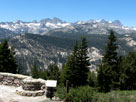
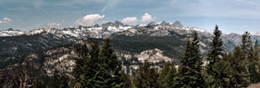
Ritter Range
from Minaret Vista |
|
Ritter Range (Minarets, Mount Ritter and Banner Peak)
and Volcanic Ridge from Minaret Vista |
|
 |
|
 |
|
|
 |
|
 |
|
|
 |
 |
 |
 |
 |
 |
 |
Minaret Falls
Campground entrance |
|
Minaret Summit Road
and Devils Postpile Road |
|
Beck/Fern Lakes Trailhead
from Devils Postpile Road |
|
 |
|
 |
| Reds Meadow (Red's Meadow, Reds Meadow Valley) |
 |
 |
 |
 |
 |
 |
 |
 |
 |
 |
| Sotcher Lake Trailhead |
|
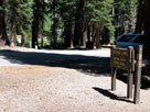
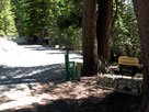
Reds Meadow
Campground entrance |
|
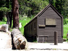
Reds Meadow Bath House
(Reds Meadow Hot
Springs) in Reds
Meadow Campground |
|
 |
 |
 |
 |
 |
 |
 |
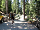
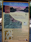
| Rainbow Falls Trailhead off Minaret Summit Road |
|
Red's Meadow Resort |
|
 |
|
 |
| Lake Mary Road |
 |
 |
 |
 |
 |
 |
 |
 |
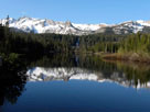
Mammoth Crest, Crystal
Crag and Twin Lakes
from Twin Lakes Vista
off Lake Mary Road |
|
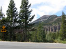
Mammoth Mountain
and Lake Mary Road
from Old Mammoth Road |
|
 |
|
 |
| Twin Lakes Campground |
 |
 |
 |
 |
 |
 |
 |
 |
 |
 |
 |
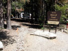
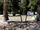
Twin Lakes Campground
from Twin Lakes Loop Road |
|
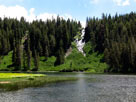
Twin Falls and Twin Lakes
from Twin Lakes
Campground |
|
 |
|
 |
|
|
 |
|
 |
|
|
 |
|
 |
|
|
 |
|
 |
|
|
 |
|
 |
|
|
 |
|
 |
| Lake Mary Campground |
 |
 |
 |
 |
 |
 |
 |
 |
 |
 |
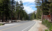
Lake Mary Loop Road
and Lake Mary Road |
|
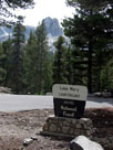
Crystal Crag & Lake
Mary Campground
entrance from Lake
Mary Loop Road |
|
 |
|
 |
|
|
 |
|
 |
|
|
 |
|
 |
| Lake George Campground |
 |
 |
 |
 |
 |
 |
 |
 |
 |
 |
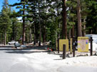
Lake George
Campground entrance |
|
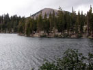
Mammoth Mountain
and Lake George from
T.J.-Barrett Lakes Trail |
|
 |
|
 |
|
|
 |
|
 |
|
|
 |
|
 |
|
|
 |
|
 |
|
|
 |
|
 |
| Duck Pass Trail |
 |
 |
 |
 |
 |
 |
 |
 |
 |
 |
 |
 |
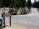
Cold Water Creek
Campground Road and
Lake Mary Loop Road |
|
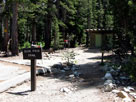
Duck Pass Trailhead in
Cold Water Campground |
|
|
 |
|
 |
| Pine City Campground |
 |
 |
 |
 |
 |
 |
 |
 |
 |
 |
Pine City Campground and
Lake Mary Loop Road |
|
Crystal Crag
and Lake Mary
from near Pine
City Campground |
|
 |
|
 |
|
|
 |
|
 |
|
|
 |
|
 |
|
|
 |
|
 |
|
|
 |
|
 |
|
|
 |
|
 |
|
|
 |
|
 |
|
|
 |
|
 |
|
|
 |
|
 |
| Convict Lake Recreation Area |
 |
 |
 |
 |
 |
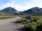
Convict Lake Road
into Convict Lake
Recreation Area |
|
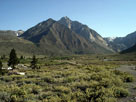
Mount Morrison and
Convict Lake Campground
from Convict Lake Road |
|
 |
|
 |
|
|
 |
|
 |
|
|
 |
|
 |
|
|
 |
|
 |
|
|
 |
|
 |
| John Muir Wilderness |
 |
 |
 |
 |
 |
 |
 |
 |
 |
 |
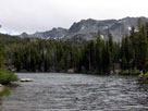
Mammoth Crest
and Lake Barrett |
|
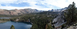
Sherwin Range and Mammoth Crest (John Muir
Wilderness) from Crystal Lake Trail |
|
 |
 |
 |
 |
 |
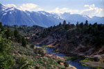
| Sherwin Range and Hot Creek |
|
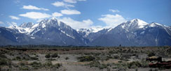
Mount Morrison and Laurel Mountain
from Owens River Road |
|
 |
|
 |
|
|
 |
|
 |
| McGee Creek Campground |
 |
 |
 |
 |
 |
 |
 |
 |
 |
 |
 |
 |
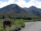
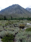
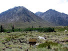
Mount Morgan and McGee
Creek Campground from
McGee Creek Road |
|
Mount Morgan, Nevahbe Ridge and McGee Creek
Campground off McGee Creek Road |
|
 |
|
 |
|
|
 |
|
 |
|
|
 |
|
 |
| Rock Creek Road |
 |
 |
 |
 |
 |
 |
 |
 |
 |
 |
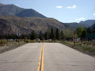
Rock Creek Road
off Highway 395 |
|
Rock Creek Road, Crowley
Lake Drive and Toms Place |
|
Rock Creek Road from
Crowley Lake Drive |
|
 |
|
 |
|
|
 |
|
 |
|
|
 |
|
 |
|
|
 |
|
 |
|
|
 |
|
 |
|
|
 |
|
 |
|
|
 |
|
 |
|
|
 |
|
 |
|
|
 |
|
 |
|
|
 |
|
 |
|
|
 |
|
 |
|
|
 |
|
 |
|
|
 |
|
 |
|
|
 |
|
 |
| Hilton Lakes Trail |
 |
 |
 |
 |
 |
 |
 |
 |
 |
 |
 |
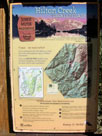
Hilton Lakes Trailhead
(Hilton Creek Trailhead)
and Rock Creek Road |
|
Rock Creek Pack Station
near Hilton Lakes Trailhead |
|
 |
|
 |
|
|
 |
|
 |
|
|
 |
|
 |
|
|
 |
|
 |
| Mono Pass Trail |
 |
 |
 |
 |
 |
 |
 |
 |
 |
 |
 |
Little Lakes Valley Trail
(Morgan Pass Trail)
and Mono Pass Trail |
|
Morgan Pass Trail and
Mono Pass Trail ('00) |
|
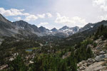
Bear Creek Spire and
Little Lakes Valley
from Mono Pass Trail |
|
 |
|
 |
| John Muir Wilderness [Cont'd] |
 |
 |
 |
 |
 |
 |
 |
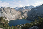
Mount Baldwin from
McGee Pass Trail |
|
Bear Creek Spire
and Ruby Lake from
Mono Pass Trail |
|
Mono Pass |
|
 |
 |
 |
 |
 |
 |
 |
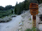
Little Lakes Valley Trail
into John Muir Wilderness |
|
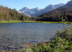
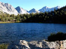
Bear Creek Spire, Pip-squeak
Spire and Marsh Lake |
|
Rosy Finch Peak, Pyramid
Peak, Bear Creek Spire,
Pip-squeak Spire
and Heart Lake |
|
 |
|
 |
| Highway 168 (California State Route 168) |
 |
 |
 |
 |
 |
 |
 |
 |
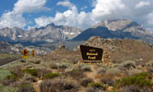
Mount Humphreys and Basin
Mountain from Highway 168 |
|
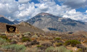
Mount Tom from Highway 168 |
|
 |
|
 |
|
|
 |
|
 |
|
|
 |
|
 |
|
|
 |
|
 |
|
|
 |
|
 |
|
|
 |
|
 |
|
|
 |
|
 |
|
|
 |
|
 |
|
|
 |
|
 |
|
|
 |
|
 |
|
|
 |
|
 |
|
|
 |
|
 |
|
|
 |
|
 |
|
|
 |
|
 |
|
|
 |
|
 |
|
|
 |
|
 |
|
|
 |
|
 |
|
|
 |
|
 |
|
|
 |
|
 |
|
|
 |
|
 |
|
|
 |
|
 |
| Ancient Bristlecone Scenic Byway |
 |
 |
 |
 |
 |
 |
 |
 |
 |
 |
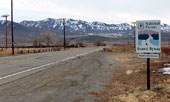
U.S. Route 395 (north)
and CA State Route 168 |
|
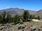
Ancient Bristlecone Scenic
Byway (CA State Route 168) |
|
Ancient Bristlecone
Scenic Byway (White
Mountain Road) |
|
 |
|
 |
|
|
 |
|
 |
|
|
 |
|
 |
|
|
 |
|
 |
|
|
 |
|
 |
| Sierra View (Sierra View Vista Point) |
 |
 |
 |
 |
 |
 |
 |
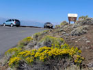
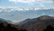
White Mountain Road
and Sierra View
(Sierra View Vista Point) |
|
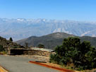
Sierra Nevada Mountains
from Sierra View |
|
The Palisades (Middle
Palisade and North Palisade) |
|
 |
|
 |
| Ancient Bristlecone Pine Forest |
 |
 |
 |
 |
 |
 |
 |
 |
 |
 |
 |
 |
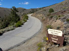
Ancient Bristlecone
Scenic Byway
(White Mountain Road) |
|
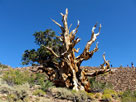
Discovery Trail in
Schulman Grove (Ancient
Bristlecone Pine Forest) |
|
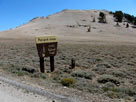
Patriarch Grove
entrance |
|
 |
|
 |
| Schulman Grove Visitor Center |
 |
 |
 |
 |
 |
 |
 |
 |
 |
 |
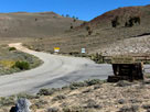
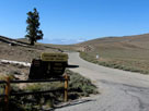
Schulman Grove Visitor Center entrance and White
Mountain Road (Ancient Bristlecone Scenic Byway) |
|
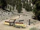
Trailheads for Discovery
Trail and Methuselah
Trail at Schulman Grove |
|
 |
|
 |
| Glacier Lodge Road |
 |
 |
 |
 |
 |
 |
 |
 |
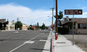
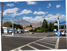
North Main Street (U.S. 395
south) near Glacier Lodge
Road junction, Big Pine |
|
Glacier Lodge Road
(West Croker Street)
and U.S. 395, Big Pine |
|
 |
|
 |
|
|
 |
|
 |
|
|
 |
|
 |
|
|
 |
|
 |
|
|
 |
|
 |
|
|
 |
|
 |
| Big Pine Creek Campground |
 |
 |
 |
 |
 |
 |
 |
 |
 |
 |
 |
 |
| Glacier Lodge Roadend |
|
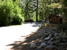
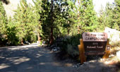
Big Pine Creek
Campground entrance |
|
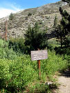
Streamside Trail
from Big Pine
Creek Campground |
|
 |
|
 |
|
|
 |
|
 |
| Onion Valley Road |
 |
 |
 |
 |
 |
 |
 |
 |
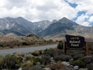
Mount Bradley, University
Peak, Independence Peak
and Onion Valley Road |
|
|
 |
|
 |
|
|
 |
|
 |
|
|
 |
|
 |
| Onion Valley Campground |
 |
 |
 |
 |
 |
 |
 |
 |
 |
 |
 |
 |
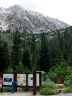
Independence Peak,
Robinson Lake Falls
and Onion Valley
Campground |
|
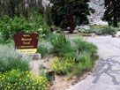
Onion Valley
Campground |
|
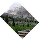
Onion Valley from
Onion Valley Campground |
|
 |
|
 |
| Whitney Portal Road |
 |
 |
 |
 |
 |
 |
 |
 |
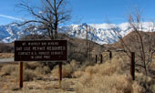
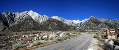
Lone Pine Peak and Mount Whitney
froms Whitney Portal Road |
|
Lone Pine Peak, Mount Whitney
and Whitney Portal Road |
|
 |
|
 |
| Lone Pine Campground |
 |
 |
 |
 |
 |
 |
 |
 |
 |
 |
 |
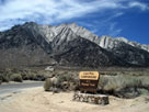
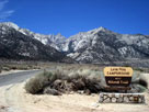
Lone Pine Campground entrance
off Whitney Portal Road |
|
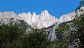
Mount Whitney from
Lone Pine Campground |
|
 |
|
 |
|
|
 |
|
 |
|
|
 |
|
 |
|
|
 |
|
 |
|
|
 |
|
 |
|
|
 |
|
 |
|
|
 |
|
 |
|
|
 |
|
 |
|
|
 |
|
 |
|
|
 |
|
 |
|
|
 |
|
 |
|
|
 |
|
 |
|
|
 |
|
 |
|
|
 |
|
 |
| Ansel Adams Wilderness |
 |
 |
 |
 |
 |
 |
 |
 |
Mount Gibbs and Mount
Dana from Highway 395 |
|
Ritter Range and Ansel Adams Wilderness
from Minaret Vista near Minaret Summit |
|
 |
|
 |
| John Muir Wilderness |
 |
 |
 |
 |
 |
 |
 |
 |
 |
 |
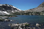
Bear Creek Spire
and Ruby Lake |
|
Piute Pass and Piute Lake |
|
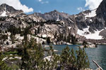
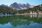
Mount Johnson and
Lowest Treasure Lake |
|
 |
 |
 |
 |
 |
 |
 |
 |
 |
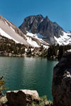
Temple Crag
and First Lake |
|
Nameless Pyramid
and Gilbert Lake |
|
Mount Whitney
Trail |
|
Mount Russell
and Upper Boy
Scout Lake |
|
 |
|
 |
|
|
 |
|
 |
|
|
 |
|
 |
|
|
 |
|
 |
| White Mountains Wilderness |
 |
 |
 |
 |
 |
 |
 |
 |
 |
 |
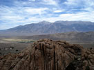
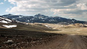
White Mountains
(Montgomery Peak)
from CA State Route 120 |
|
Patriarch Grove from
Cottonwood Basin
Overlook Trail |
|
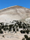
White Mountain Peak
from White Mountain Road |
|
 |
|
 |
|
|
 |
|
 |
| Inyo National Forest の写真 ON WEB |
 |
| 写真 |
|
|
| Photo Galleries |
 |
 |
|
| Photos |
 |
 |
 |
 |
 |
 |
|
 |
 |
 |
 |
 |
 |
 |
 |
 |
|
|